Estimated Value: $100,000 - $160,000
3
Beds
2
Baths
1,112
Sq Ft
$120/Sq Ft
Est. Value
About This Home
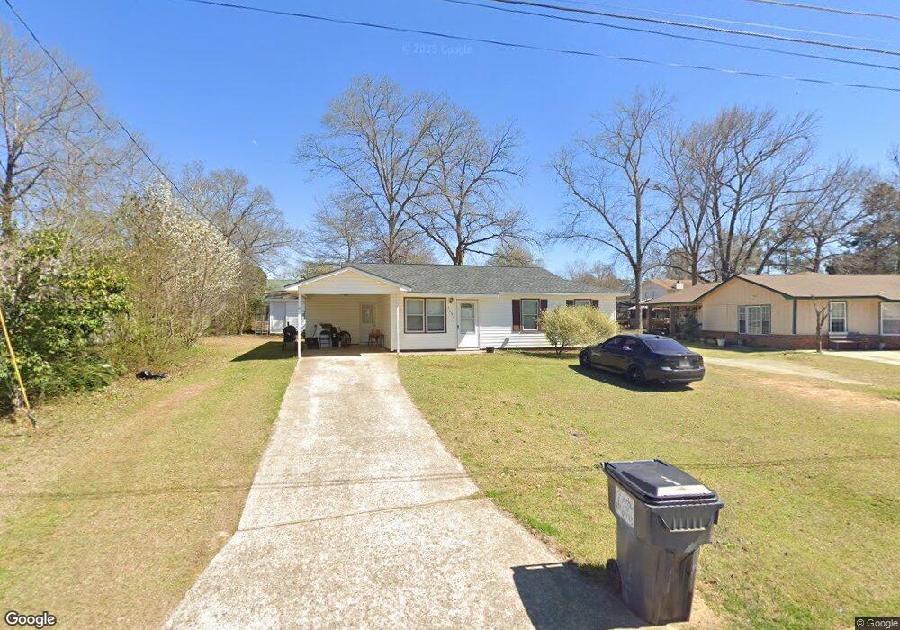
This home is located at 1051 King Cir, Perry, GA 31069 and is currently estimated at $133,859, approximately $120 per square foot. 1051 King Cir is a home located in Houston County with nearby schools including Morningside Elementary School, Perry Middle School, and Perry High School.
Ownership History
Date
Name
Owned For
Owner Type
Purchase Details
Closed on
Nov 7, 2006
Sold by
Holmers Hazel L
Bought by
Layfields Willie
Current Estimated Value
Purchase Details
Closed on
Nov 17, 1981
Sold by
Fickling & Walker Co
Bought by
Holmes Hazel L
Purchase Details
Closed on
Oct 10, 1979
Sold by
Fickling & Walker Inc
Bought by
Fickling & Walker Co
Purchase Details
Closed on
Dec 2, 1974
Sold by
Blm Construction Co Inc
Bought by
Fickling & Walker Inc
Create a Home Valuation Report for This Property
The Home Valuation Report is an in-depth analysis detailing your home's value as well as a comparison with similar homes in the area
Home Values in the Area
Average Home Value in this Area
Purchase History
| Date | Buyer | Sale Price | Title Company |
|---|---|---|---|
| Layfields Willie | $37,000 | None Available | |
| Holmes Hazel L | -- | -- | |
| Fickling & Walker Co | -- | -- | |
| Fickling & Walker Inc | -- | -- | |
| Blm Construction Co Inc | -- | -- |
Source: Public Records
Tax History
| Year | Tax Paid | Tax Assessment Tax Assessment Total Assessment is a certain percentage of the fair market value that is determined by local assessors to be the total taxable value of land and additions on the property. | Land | Improvement |
|---|---|---|---|---|
| 2025 | $1,154 | $35,120 | $4,000 | $31,120 |
| 2024 | $1,166 | $31,720 | $3,520 | $28,200 |
| 2023 | $963 | $26,040 | $3,520 | $22,520 |
| 2022 | $547 | $23,800 | $3,520 | $20,280 |
| 2021 | $499 | $21,600 | $3,520 | $18,080 |
| 2020 | $495 | $21,320 | $3,520 | $17,800 |
| 2019 | $495 | $21,320 | $3,520 | $17,800 |
| 2018 | $495 | $21,320 | $3,520 | $17,800 |
| 2017 | $496 | $21,320 | $3,520 | $17,800 |
| 2016 | $497 | $21,320 | $3,520 | $17,800 |
| 2015 | $498 | $21,320 | $3,520 | $17,800 |
| 2014 | -- | $21,320 | $3,520 | $17,800 |
| 2013 | -- | $21,200 | $3,520 | $17,680 |
Source: Public Records
Map
Nearby Homes
- 129 Kingston Village Dr
- 1703 Sewell Cir
- 1304 Davis Ave
- 1512 State St
- 411 Stonegate Trail
- 415 Stonegate Trail
- 1312 Keith Dr
- 1418 Parkway Dr
- 1432 Duncan Ave
- 0 Carroll Aly
- 1205 Swift St
- 138 Sadie Heights Blvd
- 610 Daisy Dr
- 135 Sadie Heights Blvd
- 137 Sadie Heights Blvd
- 625 Cooper St
- 4 Crossroad Dr
- 100 Constance Ct
- 101 Red Cedar Run
- 1802 Houston Lake Rd
Your Personal Tour Guide
Ask me questions while you tour the home.