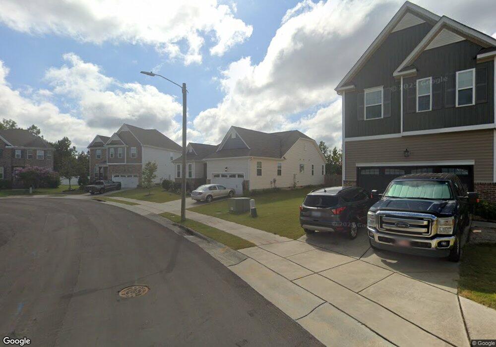
106 Corn Crib Ct Durham, NC 27703
Eastern Durham NeighborhoodEstimated Value: $424,224 - $494,000
3
Beds
2
Baths
1,977
Sq Ft
$233/Sq Ft
Est. Value
About This Home
This home is located at 106 Corn Crib Ct, Durham, NC 27703 and is currently estimated at $461,056, approximately $233 per square foot. 106 Corn Crib Ct is a home located in Durham County with nearby schools including Spring Valley Elementary School, John W Neal Middle School, and Southern School of Energy & Sustainability.
Ownership History
Date
Name
Owned For
Owner Type
Purchase Details
Closed on
Apr 26, 2019
Sold by
Bray Stockman Dawn Gay and Bray Tuck Beverly
Bought by
Dismang Nyika Simbarashe and Dismang Nyika Erica D
Current Estimated Value
Home Financials for this Owner
Home Financials are based on the most recent Mortgage that was taken out on this home.
Original Mortgage
$306,888
Outstanding Balance
$269,269
Interest Rate
4.1%
Mortgage Type
New Conventional
Estimated Equity
$191,787
Purchase Details
Closed on
Sep 6, 2017
Sold by
Lennar Carolinas Llc
Bought by
Stockman Dawn Gay and Tuck Beverly Bray
Home Financials for this Owner
Home Financials are based on the most recent Mortgage that was taken out on this home.
Original Mortgage
$220,000
Interest Rate
3.78%
Mortgage Type
New Conventional
Create a Home Valuation Report for This Property
The Home Valuation Report is an in-depth analysis detailing your home's value as well as a comparison with similar homes in the area
Home Values in the Area
Average Home Value in this Area
Purchase History
| Date | Buyer | Sale Price | Title Company |
|---|---|---|---|
| Dismang Nyika Simbarashe | $320,000 | None Available | |
| Stockman Dawn Gay | $328,500 | None Available |
Source: Public Records
Mortgage History
| Date | Status | Borrower | Loan Amount |
|---|---|---|---|
| Open | Dismang Nyika Simbarashe | $306,888 | |
| Previous Owner | Stockman Dawn Gay | $220,000 |
Source: Public Records
Tax History
| Year | Tax Paid | Tax Assessment Tax Assessment Total Assessment is a certain percentage of the fair market value that is determined by local assessors to be the total taxable value of land and additions on the property. | Land | Improvement |
|---|---|---|---|---|
| 2025 | $4,757 | $479,833 | $107,625 | $372,208 |
| 2024 | $3,779 | $270,902 | $55,170 | $215,732 |
| 2023 | $3,549 | $270,902 | $55,170 | $215,732 |
| 2022 | $3,467 | $270,902 | $55,170 | $215,732 |
| 2021 | $3,451 | $270,902 | $55,170 | $215,732 |
| 2020 | $3,370 | $270,902 | $55,170 | $215,732 |
| 2019 | $3,370 | $270,902 | $55,170 | $215,732 |
| 2018 | $3,065 | $225,958 | $59,670 | $166,288 |
| 2017 | $97 | $59,670 | $59,670 | $0 |
Source: Public Records
Map
Nearby Homes
- 631 Ashburn Ln
- 6 Spicewood Ct
- 634 Conover Rd
- 428 Holly Blossom Dr
- 637 Conover Rd Unit B
- 639 Conover Rd Unit A
- 639 Conover Rd Unit B
- 635 Conover Rd Unit A
- 635 Conover Rd Unit B
- 508 Ashburn Ln
- 618 Starry Sky Dr
- 1508 Underbrush Dr
- 626 Starry Sky Dr
- 636 Starry Sky Dr
- 607 Ravenstone Ln
- 1905 Nellora Ln
- 2007 Rockface Way
- 2113 Rockface Way
- 339 Olive Branch Rd
- 2020 Rockface Way
- 104 Corn Crib Ct
- 108 Corn Crib Ct
- 204 Holly Blossom Dr
- 204 Holly Blossom Dr Unit 134
- 403 Wellwater Ave
- 202 Holly Blossom Dr
- 110 Corn Crib Ct
- 206 Holly Blossom Dr
- 200 Holly Blossom Dr
- 107 Corn Crib Ct
- 405 Wellwater Ave
- 103 Corn Crib Ct
- 208 Holly Blossom Dr
- 106 Holly Blossom Dr
- 109 Corn Crib Ct
- 210 Holly Blossom Dr
- 210 Holly Blossom Dr Unit 131
- 407 Wellwater Ave
- 104 Holly Blossom Dr
- 325 Wellwater Ave
Your Personal Tour Guide
Ask me questions while you tour the home.