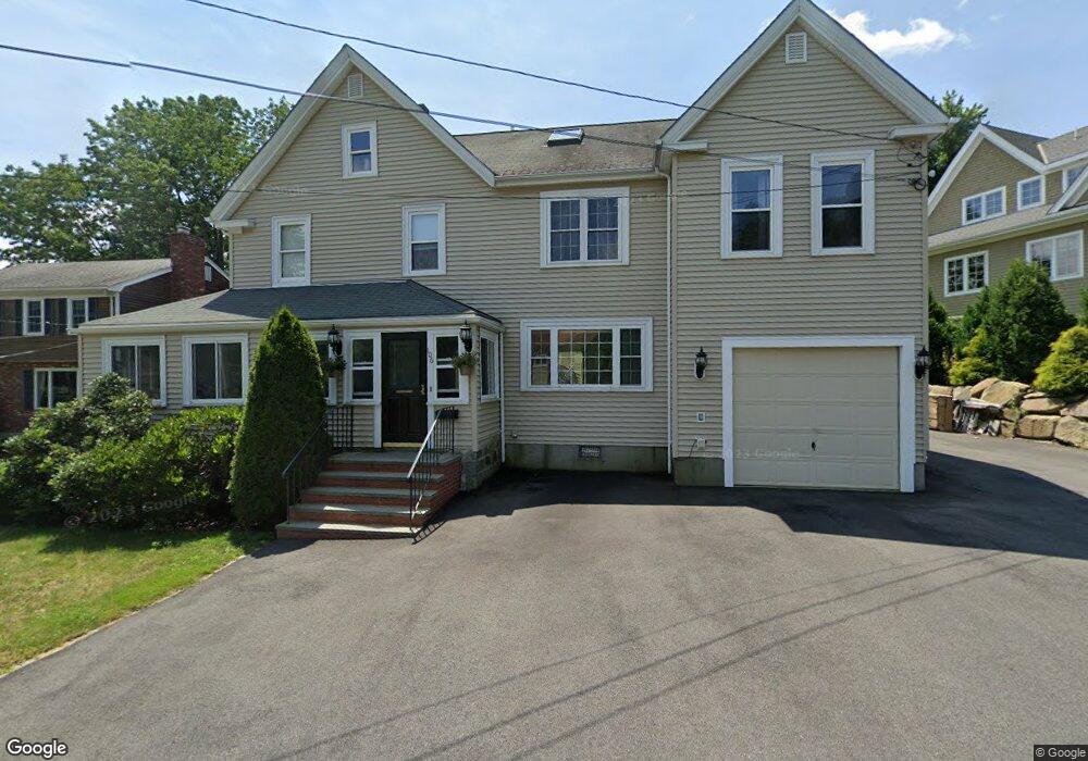
106 Forest Ave Quincy, MA 02169
Estimated Value: $870,668 - $1,133,000
5
Beds
2
Baths
2,674
Sq Ft
$369/Sq Ft
Est. Value
About This Home
This home is located at 106 Forest Ave, Quincy, MA 02169 and is currently estimated at $985,667, approximately $368 per square foot. 106 Forest Ave is a home located in Norfolk County with nearby schools including Montclair Elementary School, Atlantic Middle School, and North Quincy High School.
Ownership History
Date
Name
Owned For
Owner Type
Purchase Details
Closed on
Jan 17, 1992
Sold by
Goldrick Gdn Gertrude
Bought by
Mcgrath Gerard M and Mcgrath Paula P
Current Estimated Value
Home Financials for this Owner
Home Financials are based on the most recent Mortgage that was taken out on this home.
Original Mortgage
$80,000
Interest Rate
8.57%
Mortgage Type
Purchase Money Mortgage
Create a Home Valuation Report for This Property
The Home Valuation Report is an in-depth analysis detailing your home's value as well as a comparison with similar homes in the area
Purchase History
We collect this data history from publicly available records. To have your information removed, we recommend requesting removal directly through your county’s website.
| Date | Buyer | Sale Price | Title Company |
|---|---|---|---|
| Mcgrath Gerard M | $104,000 | -- |
Source: Public Records
Mortgage History
We collect this data history from publicly available records. To have your information removed, we recommend requesting removal directly through your county’s website.
| Date | Status | Borrower | Loan Amount |
|---|---|---|---|
| Open | Mcgrath Gerard M | $150,000 | |
| Closed | Mcgrath Gerard M | $85,000 | |
| Closed | Mcgrath Gerard M | $80,000 |
Source: Public Records
Tax History
| Year | Tax Paid | Tax Assessment Tax Assessment Total Assessment is a certain percentage of the fair market value that is determined by local assessors to be the total taxable value of land and additions on the property. | Land | Improvement |
|---|---|---|---|---|
| 2025 | $9,142 | $792,900 | $310,400 | $482,500 |
| 2024 | $8,563 | $759,800 | $295,600 | $464,200 |
| 2023 | $8,028 | $721,300 | $281,500 | $439,800 |
| 2022 | $8,200 | $684,500 | $225,200 | $459,300 |
| 2021 | $7,700 | $634,300 | $225,200 | $409,100 |
| 2020 | $7,837 | $630,500 | $225,200 | $405,300 |
| 2019 | $7,657 | $610,100 | $218,700 | $391,400 |
| 2018 | $7,402 | $554,900 | $202,500 | $352,400 |
| 2017 | $7,358 | $519,300 | $192,800 | $326,500 |
Source: Public Records
Map
Nearby Homes
- 76 Shawmut St
- 141 Gardiner Rd
- 159 Willard St Unit 7
- 580 Quarry St Unit 18
- 230 Willard St Unit 602
- 94 Grafton Ave
- 7 Phyllis Ln
- 440 Granite Ave Unit 201
- 25 Waldeck Rd
- 18 Jenness St
- 115 Bunker Hill Ln
- 211 Copeland St
- 20 Miller St Unit 2
- 211 West St Unit 11B
- 211 West St Unit 4B
- 211 West St Unit 12B
- 33 Bishop Rd Unit 33
- 308 Quarry St Unit 405
- 98 Pleasant St
- 166 Suomi Rd
- 102 Forest Ave
- 52 Holliston St
- 25 Turning Mill Ln
- 105 Forest Ave
- 105 Forest Ave Unit 1
- Lot 4 Holliston St
- 31 Turning Mill Ln
- 33 Turning Mill Ln
- 94 Forest Ave
- 149 Forest Ave
- 45 Holliston St
- 39 Holliston St
- 58 Holliston St
- 39 Turning Mill Ln
- 97 Forest Ave
- 84 Forest Ave
- 32 Turning Mill Ln
- 61 Holliston St
- 3 Holliston St
- 14 Turning Mill Ln
Your Personal Tour Guide
Ask me questions while you tour the home.