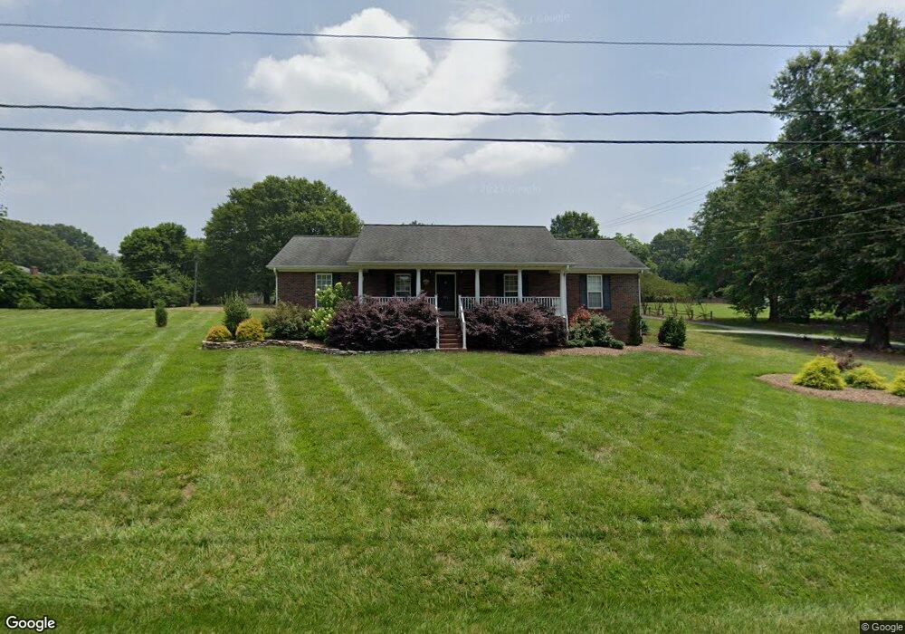
106 Garrison Dr Kings Mountain, NC 28086
Estimated Value: $397,351 - $440,000
About This Home
This home is located at 106 Garrison Dr, Kings Mountain, NC 28086 and is currently estimated at $418,088, approximately $202 per square foot. 106 Garrison Dr is a home located in Cleveland County with nearby schools including North Elementary School, Kings Mountain Intermediate School, and Kings Mountain Middle.
Ownership History
We collect this data history from publicly available records. To have your information removed, we recommend requesting removal directly through your county’s website.
Purchase Details
Purchase Details
Home Financials for this Owner
Home Financials are based on the most recent Mortgage that was taken out on this home.Home Values in the Area
Average Home Value in this Area
Purchase History
We collect this data history from publicly available records. To have your information removed, we recommend requesting removal directly through your county’s website.
| Date | Buyer | Sale Price | Title Company |
|---|---|---|---|
| -- | None Available | ||
| $125,000 | None Available |
Mortgage History
We collect this data history from publicly available records. To have your information removed, we recommend requesting removal directly through your county’s website.
| Date | Status | Borrower | Loan Amount |
|---|---|---|---|
| Open | $58,200 |
Tax History
We collect this data history from publicly available records. To have your information removed, we recommend requesting removal directly through your county’s website.
| Year | Tax Paid | Tax Assessment Tax Assessment Total Assessment is a certain percentage of the fair market value that is determined by local assessors to be the total taxable value of land and additions on the property. | Land | Improvement |
|---|---|---|---|---|
| 2025 | $3,478 | $339,327 | $52,659 | $286,668 |
| 2024 | $2,715 | $230,411 | $62,472 | $167,939 |
| 2023 | $2,600 | $230,411 | $62,472 | $167,939 |
| 2022 | $2,587 | $230,411 | $62,472 | $167,939 |
| 2021 | $2,600 | $230,411 | $62,472 | $167,939 |
| 2020 | $2,113 | $181,786 | $41,230 | $140,556 |
| 2019 | $2,113 | $181,786 | $41,230 | $140,556 |
| 2018 | $2,111 | $181,786 | $41,230 | $140,556 |
| 2017 | $2,101 | $181,786 | $41,230 | $140,556 |
| 2016 | $2,109 | $181,786 | $41,230 | $140,556 |
| 2015 | $2,243 | $198,592 | $39,981 | $158,611 |
| 2014 | $2,243 | $198,592 | $39,981 | $158,611 |
Map
- 266 Colton Ct
- 254 Colton Ct
- 242 Colton Ct
- Parcel 68907 Garrison Dr
- Parcel 68909 Garrison Dr
- Parcel 47244 Garrison Dr
- Parcel 68906 Garrison Dr
- 1301 Shelby Rd
- 1203 W Gold Street Extension
- 208 Victoria Cir
- 205 Churchill Dr
- 1.1 Ac. (+-) Afton Dr
- 209 S Roxford Rd
- 1500 Shelby Rd
- 813 W Mountain St
- 1427 Merrimont Ave
- 817 Landing St
- 1708 Shelby Rd
- 155 Patterson Rd
- 1717 Shelby Rd
- 110 Independence Ct
- 108 Independence Ct
- 112 Independence Ct
- 111 Independence Ct
- 109 Independence Ct
- 107 Independence Ct
- 1209 Suzanne St
- 299 Garrison Dr
- 105 Independence Ct
- 106 Garrison Dr
- 110 Liberty Ct
- 112 Liberty Ct
- 302 Liberty Ct
- 1207 Suzanne St
- 304 Liberty Ct
- 301 Garrison Dr
- 306 Liberty Ct
- 300 Garrison Dr
- 109 Liberty Ct
- 111 Liberty Ct
Ask me questions while you tour the home.