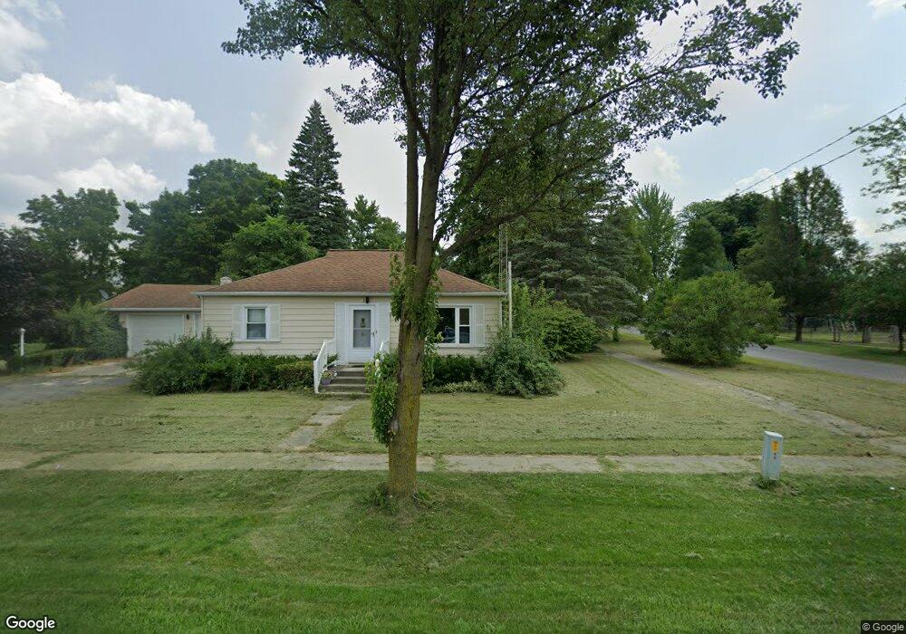
106 Mill St Waldron, MI 49288
Estimated Value: $93,345 - $113,000
3
Beds
1
Bath
1,236
Sq Ft
$84/Sq Ft
Est. Value
About This Home
This home is located at 106 Mill St, Waldron, MI 49288 and is currently estimated at $103,836, approximately $84 per square foot. 106 Mill St is a home located in Hillsdale County with nearby schools including Waldron High School and Waldron Elementary School.
Ownership History
Date
Name
Owned For
Owner Type
Purchase Details
Closed on
Sep 19, 2024
Sold by
Hall Mickael R and Hall Randy L
Bought by
Krueger Jaime
Current Estimated Value
Home Financials for this Owner
Home Financials are based on the most recent Mortgage that was taken out on this home.
Original Mortgage
$76,500
Outstanding Balance
$75,640
Interest Rate
6.47%
Mortgage Type
New Conventional
Estimated Equity
$28,196
Purchase Details
Closed on
Jun 15, 2020
Sold by
Hall Fern L
Bought by
Hall Mickeal R and Hall Randy L
Create a Home Valuation Report for This Property
The Home Valuation Report is an in-depth analysis detailing your home's value as well as a comparison with similar homes in the area
Purchase History
| Date | Buyer | Sale Price | Title Company |
|---|---|---|---|
| Krueger Jaime | $85,000 | Midstate Title | |
| Hall Mickeal R | -- | None Available |
Source: Public Records
Mortgage History
| Date | Status | Borrower | Loan Amount |
|---|---|---|---|
| Open | Krueger Jaime | $76,500 |
Source: Public Records
Tax History
| Year | Tax Paid | Tax Assessment Tax Assessment Total Assessment is a certain percentage of the fair market value that is determined by local assessors to be the total taxable value of land and additions on the property. | Land | Improvement |
|---|---|---|---|---|
| 2025 | $827 | $39,100 | $0 | $0 |
| 2024 | $4 | $35,800 | $0 | $0 |
| 2023 | $350 | $27,600 | $0 | $0 |
| 2022 | $637 | $22,600 | $0 | $0 |
| 2021 | $627 | $20,900 | $0 | $0 |
| 2020 | $584 | $14,600 | $0 | $0 |
| 2019 | $591 | $15,400 | $0 | $0 |
| 2018 | $568 | $16,500 | $0 | $0 |
| 2017 | $550 | $17,300 | $0 | $0 |
| 2016 | $546 | $16,100 | $0 | $0 |
| 2015 | $156 | $16,100 | $0 | $0 |
| 2013 | $151 | $15,060 | $0 | $0 |
| 2012 | $147 | $13,430 | $0 | $0 |
Source: Public Records
Map
Nearby Homes
- 126 S Main St
- 400 S Main St
- 413 W Center St
- 10800 South Rd
- 14191 Lickley Rd
- 17916 County Road R
- 13854 Emens Dr
- 13764 Emens Dr
- 0 Willow Trace Dr Unit 26008895
- 203 College St
- 310 Irene Ct
- 301 E Spring St
- 404 S Fayette St
- 35 Rehn Dr
- Lot 35 of Rehn Dr
- 7100 S Waldron Rd
- 14857 U S 20
- 909 High Point Dr
- 14620 E Merry Dr
- 500 Briarwood Ln
Your Personal Tour Guide
Ask me questions while you tour the home.