106 Range E Rd Limerick, ME 04048
Estimated Value: $531,000 - $1,070,935
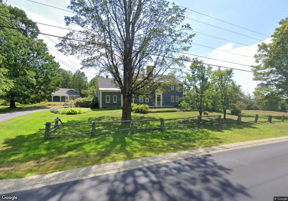
About This Home
This home is located at 106 Range E Rd, Limerick, ME 04048 and is currently estimated at $805,984, approximately $179 per square foot. 106 Range E Rd is a home located in York County with nearby schools including Massabesic High School and Ossipee Valley Christian School.
Ownership History
We collect this data history from publicly available records. To have your information removed, we recommend requesting removal directly through your county’s website.
Purchase Details
Home Values in the Area
Average Home Value in this Area
Purchase History
We collect this data history from publicly available records. To have your information removed, we recommend requesting removal directly through your county’s website.
| Date | Buyer | Sale Price | Title Company |
|---|---|---|---|
| -- | -- |
Mortgage History
We collect this data history from publicly available records. To have your information removed, we recommend requesting removal directly through your county’s website.
| Date | Status | Borrower | Loan Amount |
|---|---|---|---|
| Open | $60,000 |
Tax History
We collect this data history from publicly available records. To have your information removed, we recommend requesting removal directly through your county’s website.
| Year | Tax Paid | Tax Assessment Tax Assessment Total Assessment is a certain percentage of the fair market value that is determined by local assessors to be the total taxable value of land and additions on the property. | Land | Improvement |
|---|---|---|---|---|
| 2025 | $8,957 | $942,836 | $353,100 | $589,736 |
| 2024 | $8,957 | $942,836 | $353,100 | $589,736 |
| 2023 | $11,114 | $731,212 | $270,938 | $460,274 |
| 2022 | $10,383 | $731,212 | $270,938 | $460,274 |
| 2021 | $9,710 | $584,969 | $216,750 | $368,219 |
| 2020 | $3,553 | $584,969 | $216,750 | $368,219 |
| 2019 | $9,213 | $584,969 | $216,750 | $368,219 |
| 2018 | $9,447 | $584,969 | $216,750 | $368,219 |
| 2017 | $1,773 | $584,969 | $216,750 | $368,219 |
| 2016 | $10,939 | $726,867 | $166,750 | $560,117 |
| 2015 | $10,612 | $726,867 | $166,750 | $560,117 |
| 2014 | $10,285 | $726,866 | $166,750 | $560,116 |
Map
- 11 Sokokis Trail S
- 2 Parsonsfield Rd
- Lot 6J Range East Rd
- 337 Elm St
- 56 Burnham Rd
- TBD 0 Foss Rd
- 266 Sokokis Trail S
- 0 Stone Hill Rd
- 17 Home Field Dr
- 148 Washington St Unit A
- 54 Raptor Ridge Rd
- 545 Foss Rd
- 28 Hillview Ave
- 392 Foss Rd
- 4 Deer Crossing Rd
- 8 Emery Corner Rd
- LOT# 8 Business Park Rd
- Lot# 11 Business Park Rd
- 48 Leisure Ln
- 46-86 Island Rd
Ask me questions while you tour the home.