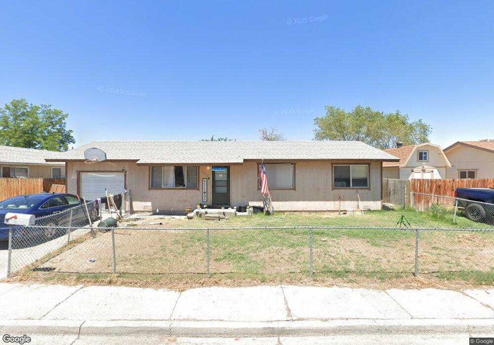
1060 Liberty Ave Unit 1 Fallon, NV 89406
Estimated Value: $267,000 - $289,000
3
Beds
2
Baths
1,296
Sq Ft
$214/Sq Ft
Est. Value
About This Home
This home is located at 1060 Liberty Ave Unit 1, Fallon, NV 89406 and is currently estimated at $277,822, approximately $214 per square foot. 1060 Liberty Ave Unit 1 is a home located in Churchill County with nearby schools including Lahontan Elementary School, E.C. Best Elementary School, and Numa Elementary School.
Ownership History
Date
Name
Owned For
Owner Type
Purchase Details
Closed on
Jul 9, 2015
Sold by
Mccartney Richard D
Bought by
1060 Nv Llc
Current Estimated Value
Purchase Details
Closed on
Nov 5, 2010
Sold by
Federal Home Loan Mortgage Corporation
Bought by
Wells Fargo Bank Na
Purchase Details
Closed on
Nov 1, 2010
Sold by
Wells Fargo Bank Na
Bought by
Mccartney Richard D
Purchase Details
Closed on
Jun 15, 2010
Sold by
Hilyer Joseph E and Hilyer Irene J
Bought by
Federal Home Loan Mortgage Corporation
Create a Home Valuation Report for This Property
The Home Valuation Report is an in-depth analysis detailing your home's value as well as a comparison with similar homes in the area
Home Values in the Area
Average Home Value in this Area
Purchase History
We collect this data history from publicly available records. To have your information removed, we recommend requesting removal directly through your county’s website.
| Date | Buyer | Sale Price | Title Company |
|---|---|---|---|
| 1060 Nv Llc | -- | None Available | |
| 1060 Nv Llc | -- | None Available | |
| Wells Fargo Bank Na | $27,893 | Servicelink | |
| Mccartney Richard D | $50,000 | Servicelink | |
| Federal Home Loan Mortgage Corporation | $133,509 | Accommodation |
Source: Public Records
Tax History
| Year | Tax Paid | Tax Assessment Tax Assessment Total Assessment is a certain percentage of the fair market value that is determined by local assessors to be the total taxable value of land and additions on the property. | Land | Improvement |
|---|---|---|---|---|
| 2025 | $784 | $28,324 | $13,650 | $14,674 |
| 2024 | $784 | $27,405 | $12,950 | $14,455 |
| 2023 | $784 | $25,485 | $12,250 | $13,235 |
| 2022 | $738 | $19,925 | $8,050 | $11,875 |
| 2021 | $739 | $19,961 | $8,050 | $11,911 |
| 2020 | $759 | $20,580 | $8,050 | $12,530 |
| 2019 | $761 | $20,621 | $8,050 | $12,571 |
| 2018 | $729 | $20,648 | $8,050 | $12,598 |
| 2017 | $707 | $19,400 | $6,475 | $12,925 |
| 2016 | $682 | $18,752 | $6,475 | $12,277 |
| 2015 | $669 | $17,603 | $6,475 | $11,128 |
| 2014 | -- | $17,370 | $7,000 | $10,370 |
Source: Public Records
Map
Nearby Homes
- 521 Whitaker Ln
- 831 Sunset Dr
- 1500 Manchester Cir
- 800 W 5th St
- 1009 Deena Way
- 861 W Center St
- 841 W Center St
- 1065 Deena Way
- 745 W Center St
- 400 Burntwood St Unit 3
- 250 S Taylor St
- 1291 S Taylor St
- 210 S Taylor St
- 2210 Christie Cir
- 1040 Tiffany Dr
- 1091 Tiffany Dr
- 15 W Front St
- 1044 Allen Rd
- 345 Lincoln St
- 1.55 Acres on S Maine St
- 1060 Liberty Ave Unit 3A
- 1040 Liberty Ave
- 1080 Liberty Ave
- 1041 Sunset Dr
- 1020 Liberty Ave
- 1081 Sunset Dr
- 1061 Liberty Ave
- 1041 Liberty Ave
- 1081 Liberty Ave
- 1021 Sunset Dr
- 1021 Liberty Ave
- 980 Liberty Ave
- 700 Whitaker Ln
- 991 Sunset Dr
- 981 Liberty Ave
- 580 Anthony Ln
- 581 Whitaker Ln
- 1060 Lee Ave
- 960 Liberty Ave
- 1080 Lee Ave
Your Personal Tour Guide
Ask me questions while you tour the home.