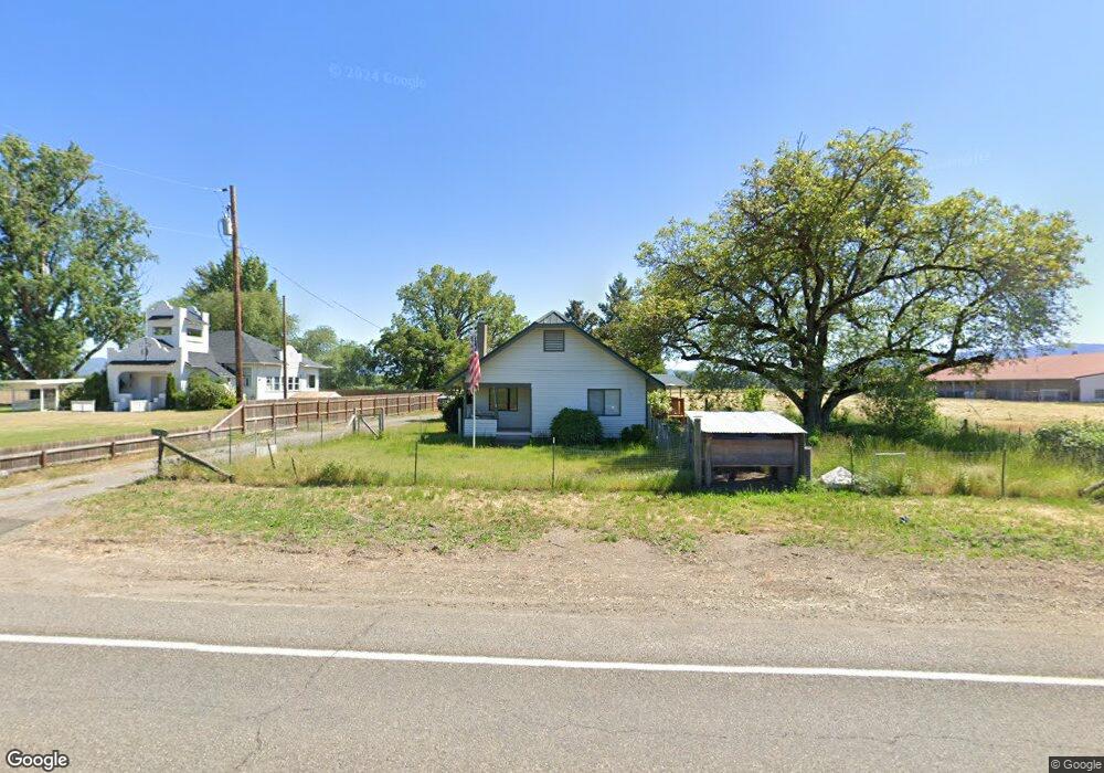
10613 Table Rock Rd Central Point, OR 97502
Estimated Value: $554,000 - $1,146,350
3
Beds
2
Baths
1,454
Sq Ft
$585/Sq Ft
Est. Value
About This Home
This home is located at 10613 Table Rock Rd, Central Point, OR 97502 and is currently estimated at $850,175, approximately $584 per square foot. 10613 Table Rock Rd is a home located in Jackson County with nearby schools including Sams Valley Elementary School, Hanby Middle School, and Crater High School.
Ownership History
Date
Name
Owned For
Owner Type
Purchase Details
Closed on
May 15, 2013
Sold by
Rogue River Ranches Llc
Bought by
K Bar Ranches Corp
Current Estimated Value
Home Financials for this Owner
Home Financials are based on the most recent Mortgage that was taken out on this home.
Original Mortgage
$7,250,000
Interest Rate
3.5%
Mortgage Type
Purchase Money Mortgage
Purchase Details
Closed on
Dec 14, 2012
Sold by
Malcolm Beech Investments Llc
Bought by
Rogue River Ranches Llc
Purchase Details
Closed on
Dec 1, 2008
Sold by
Wood Arlen B
Bought by
Malcolm Beech Investments Llc
Create a Home Valuation Report for This Property
The Home Valuation Report is an in-depth analysis detailing your home's value as well as a comparison with similar homes in the area
Purchase History
| Date | Buyer | Sale Price | Title Company |
|---|---|---|---|
| K Bar Ranches Corp | $14,250,000 | Ticor Title | |
| Rogue River Ranches Llc | $10,080,000 | Ticor Title | |
| Malcolm Beech Investments Llc | -- | None Available |
Source: Public Records
Mortgage History
| Date | Status | Borrower | Loan Amount |
|---|---|---|---|
| Previous Owner | K Bar Ranches Corp | $7,250,000 |
Source: Public Records
Tax History
| Year | Tax Paid | Tax Assessment Tax Assessment Total Assessment is a certain percentage of the fair market value that is determined by local assessors to be the total taxable value of land and additions on the property. | Land | Improvement |
|---|---|---|---|---|
| 2026 | -- | -- | -- | -- |
| 2025 | -- | -- | -- | -- |
| 2024 | -- | $642,983 | $56,153 | $586,830 |
| 2023 | $7,163 | $582,705 | $54,635 | $528,070 |
| 2022 | $7,014 | $582,705 | $54,635 | $528,070 |
| 2021 | $6,819 | $566,131 | $53,441 | $512,690 |
| 2020 | $6,622 | $549,759 | $51,999 | $497,760 |
| 2019 | $6,471 | $518,441 | $49,241 | $469,200 |
| 2018 | $6,272 | $503,462 | $47,932 | $455,530 |
| 2017 | $6,125 | $503,462 | $47,932 | $455,530 |
| 2016 | $5,948 | $474,806 | $45,416 | $429,390 |
| 2015 | $5,731 | $474,806 | $45,416 | $429,390 |
| 2014 | $5,594 | $447,785 | $43,035 | $404,750 |
Source: Public Records
Map
Nearby Homes
- 13290 Table Rock Rd
- 10695 Killdee Ave
- 10695 Kildee Ave
- 11220 Duggan Rd
- 6850 Downing Rd Unit 11
- 6850 Downing Rd Unit SPC 31
- 6850 Downing Rd Unit 7
- 6850 Downing Rd Unit 25
- 6850 Downing Rd Unit SPC 71
- 6850 Downing Rd Unit 65
- 11322 Modoc Rd
- 594 W Gregory Rd
- 380 W Gregory Rd Unit 1
- 380 W Gregory Rd Unit 1
- 0 Perry Rd
- 6251 Ventura Ln
- 10068 SE Pavati Dr Unit 37
- 9674 SE Pavati Dr Unit 41
- 10098 SE Pavati Dr Unit 36
- 9697 SE Pavati Dr Unit 27
- 10705 Table Rock Rd
- 10526 Table Rock Rd
- 10803 Table Rock Rd
- 10916 Table Rock Rd
- 10392 Table Rock Rd
- 10907 Table Rock Rd
- 10351 Table Rock Rd
- 10908 Table Rock Rd
- 10911 Table Rock Rd
- 10857 Table Rock Rd
- 10271 Table Rock Rd
- 10149 Table Rock Rd
- 10105 Table Rock Rd
- 10083 Table Rock Rd
- 10170 Table Rock Rd
- 9305 Pumice Ln
- 9363 Pumice Ln
- 9397 Pumice Ln
- 10004 Table Rock Rd
- 9328 Pumice Ln
Your Personal Tour Guide
Ask me questions while you tour the home.