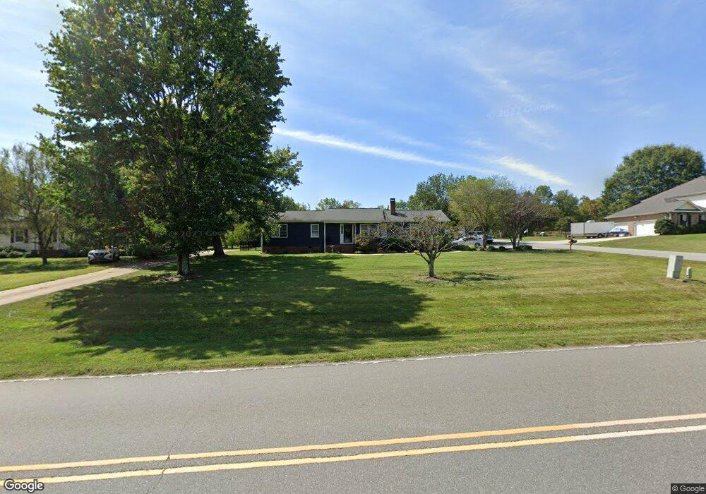
1062 Perth Rd Troutman, NC 28166
Estimated Value: $340,000 - $401,000
3
Beds
3
Baths
1,848
Sq Ft
$199/Sq Ft
Est. Value
About This Home
This home is located at 1062 Perth Rd, Troutman, NC 28166 and is currently estimated at $367,931, approximately $199 per square foot. 1062 Perth Rd is a home located in Iredell County with nearby schools including Troutman Elementary School, Troutman Middle School, and South Iredell High School.
Ownership History
Date
Name
Owned For
Owner Type
Purchase Details
Closed on
Oct 6, 2025
Sold by
Lozano Kara C
Bought by
Lozano Kara C and Lozano Phillip David
Current Estimated Value
Purchase Details
Closed on
Oct 22, 2007
Sold by
Lozano Phillip D and Lozano Kara C
Bought by
Lozano Phillip D and Lozano Kara C
Home Financials for this Owner
Home Financials are based on the most recent Mortgage that was taken out on this home.
Original Mortgage
$131,250
Interest Rate
6.26%
Mortgage Type
Stand Alone Refi Refinance Of Original Loan
Purchase Details
Closed on
Dec 4, 1998
Sold by
Frady Gerald D and Frady Debbie
Bought by
Lozano Phillip D and Whitherspoon Kara C
Home Financials for this Owner
Home Financials are based on the most recent Mortgage that was taken out on this home.
Original Mortgage
$113,900
Interest Rate
6.84%
Mortgage Type
FHA
Purchase Details
Closed on
Nov 1, 1996
Purchase Details
Closed on
Apr 1, 1994
Purchase Details
Closed on
Aug 1, 1990
Create a Home Valuation Report for This Property
The Home Valuation Report is an in-depth analysis detailing your home's value as well as a comparison with similar homes in the area
Home Values in the Area
Average Home Value in this Area
Purchase History
We collect this data history from publicly available records. To have your information removed, we recommend requesting removal directly through your county’s website.
| Date | Buyer | Sale Price | Title Company |
|---|---|---|---|
| Lozano Kara C | -- | None Listed On Document | |
| Lozano Phillip D | -- | The Title Company Of Nc | |
| Lozano Phillip D | $115,000 | -- | |
| -- | $96,500 | -- | |
| -- | $86,900 | -- | |
| -- | $75,500 | -- |
Source: Public Records
Mortgage History
We collect this data history from publicly available records. To have your information removed, we recommend requesting removal directly through your county’s website.
| Date | Status | Borrower | Loan Amount |
|---|---|---|---|
| Previous Owner | Lozano Phillip D | $131,250 | |
| Previous Owner | Lozano Phillip D | $113,900 |
Source: Public Records
Tax History
| Year | Tax Paid | Tax Assessment Tax Assessment Total Assessment is a certain percentage of the fair market value that is determined by local assessors to be the total taxable value of land and additions on the property. | Land | Improvement |
|---|---|---|---|---|
| 2025 | $2,000 | $323,310 | $56,000 | $267,310 |
| 2024 | $2,000 | $323,310 | $56,000 | $267,310 |
| 2023 | $2,000 | $323,310 | $56,000 | $267,310 |
| 2022 | $1,030 | $152,210 | $15,000 | $137,210 |
| 2021 | $1,011 | $152,210 | $15,000 | $137,210 |
| 2020 | $1,011 | $152,210 | $15,000 | $137,210 |
| 2019 | $973 | $152,210 | $15,000 | $137,210 |
| 2018 | $690 | $106,780 | $15,000 | $91,780 |
| 2017 | $690 | $106,780 | $15,000 | $91,780 |
| 2016 | $690 | $106,780 | $15,000 | $91,780 |
| 2015 | $690 | $106,780 | $15,000 | $91,780 |
| 2014 | $850 | $145,180 | $45,000 | $100,180 |
Source: Public Records
Map
Nearby Homes
- 156 Ashmore Cir
- 184 Ashmore Cir
- 169 Winding Creek Dr
- 205 Streamwood Rd
- 141 Winding Creek Dr
- 241 Ashmore Cir
- 132 Chaska Loop
- 202 Streamwood Rd
- 183 Chaska Loop Unit 61
- 179 Chaska Loop Unit 62
- 299 Hamptons Cove Rd
- 133 Crestview Ln Unit 15
- 133 Crestview Ln
- 125 Crestview Ln Unit 14
- 125 Crestview Ln
- 169 Hamptons Cove Rd
- 147 Fernview Trail
- 120 Shady Cove Rd
- 122 Lily Pad Loop
- 159 Fernview Trail
- 1068 Perth Rd
- 1072 Perth Rd
- Lot103 Streamwood Rd
- 109 Perthwood Dr
- 106 Streamwood Rd Unit 13
- 1048 Perth Rd
- 1076 Perth Rd
- 119 Perthwood Dr
- 107 Streamwood Rd
- 107 Streamwood Rd Unit 3
- 103 Streamwood Rd Unit 103
- tbd Streamwood Ln
- 110 Perthwood Dr
- 110 Streamwood Rd
- 1044 Perth Rd
- 129 Perthwood Dr
- 113 Streamwood Rd
- 1081 Perth Rd
- 130 Santana Ln Unit 4
- 130 Santana Ln
Your Personal Tour Guide
Ask me questions while you tour the home.