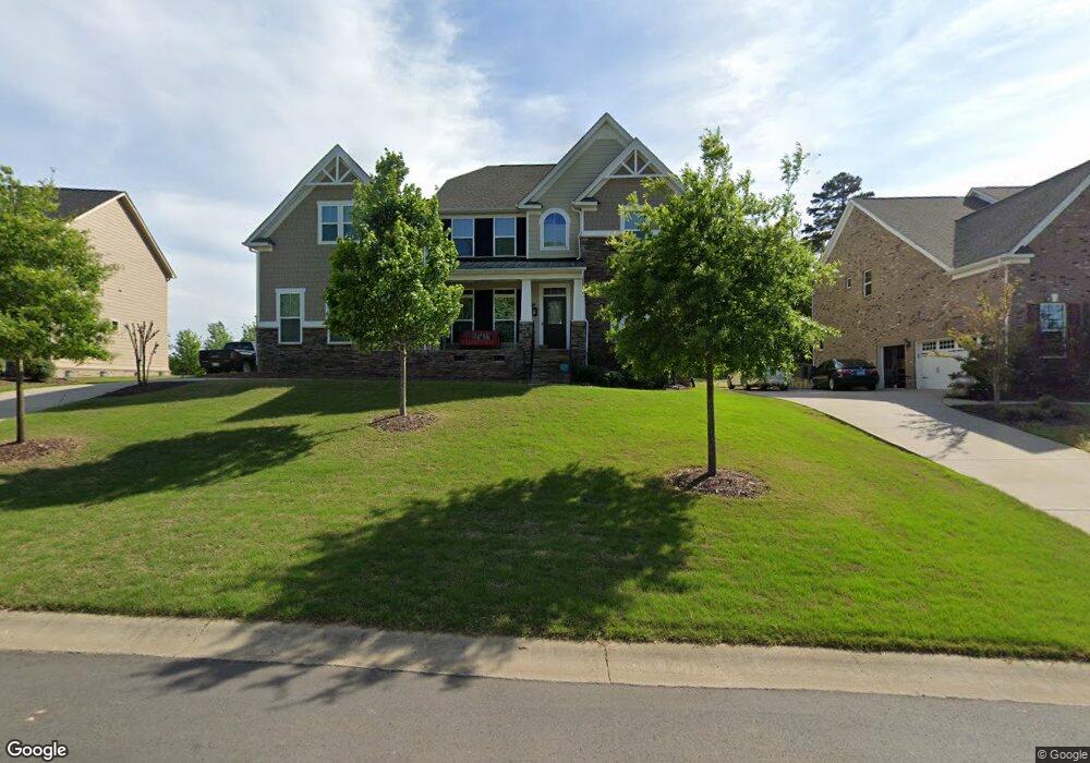
10621 Sable Cap Rd Mint Hill, NC 28227
Estimated Value: $745,000 - $838,000
5
Beds
5
Baths
3,492
Sq Ft
$220/Sq Ft
Est. Value
About This Home
This home is located at 10621 Sable Cap Rd, Mint Hill, NC 28227 and is currently estimated at $769,979, approximately $220 per square foot. 10621 Sable Cap Rd is a home located in Mecklenburg County with nearby schools including Bain Elementary, Mint Hill Middle School, and Independence High.
Ownership History
Date
Name
Owned For
Owner Type
Purchase Details
Closed on
Jan 25, 2016
Sold by
Nvr Inc
Bought by
Doub Kerry Price and Doub Brian T
Current Estimated Value
Home Financials for this Owner
Home Financials are based on the most recent Mortgage that was taken out on this home.
Original Mortgage
$338,887
Outstanding Balance
$270,417
Interest Rate
3.98%
Mortgage Type
New Conventional
Estimated Equity
$499,562
Purchase Details
Closed on
Oct 5, 2015
Sold by
Db Aster Iii Llc
Bought by
Nvr Inc
Create a Home Valuation Report for This Property
The Home Valuation Report is an in-depth analysis detailing your home's value as well as a comparison with similar homes in the area
Home Values in the Area
Average Home Value in this Area
Purchase History
| Date | Buyer | Sale Price | Title Company |
|---|---|---|---|
| Doub Kerry Price | $424,000 | Stewart Title Guaranty Co | |
| Nvr Inc | $63,000 | Attorney |
Source: Public Records
Mortgage History
| Date | Status | Borrower | Loan Amount |
|---|---|---|---|
| Open | Doub Kerry Price | $338,887 |
Source: Public Records
Tax History
| Year | Tax Paid | Tax Assessment Tax Assessment Total Assessment is a certain percentage of the fair market value that is determined by local assessors to be the total taxable value of land and additions on the property. | Land | Improvement |
|---|---|---|---|---|
| 2025 | $4,659 | $650,900 | $140,000 | $510,900 |
| 2024 | $4,659 | $650,900 | $140,000 | $510,900 |
| 2023 | $3,865 | $707,800 | $140,000 | $567,800 |
| 2022 | $3,865 | $438,700 | $70,000 | $368,700 |
| 2021 | $3,865 | $438,700 | $70,000 | $368,700 |
| 2020 | $3,865 | $438,700 | $70,000 | $368,700 |
| 2019 | $3,859 | $438,700 | $70,000 | $368,700 |
| 2018 | $3,040 | $275,600 | $44,800 | $230,800 |
| 2017 | $3,016 | $275,600 | $44,800 | $230,800 |
| 2016 | $1,734 | $44,800 | $44,800 | $0 |
| 2015 | $486 | $44,800 | $44,800 | $0 |
| 2014 | $486 | $44,800 | $44,800 | $0 |
Source: Public Records
Map
Nearby Homes
- 10436 Connell Rd
- 10400 Briarhurst Place
- 10315 Lemington Dr
- 9534 Liberty Hill Dr
- 10628 Connell Rd
- 10542 Blair Rd
- 9515 Liberty Hill Dr
- 9511 Liberty Hill Dr
- 8929 Lauriston Place
- 8120 Arlington Church Rd
- 10810 Connell Rd
- 8907 Euston Ct
- 8810 Scarsdale Dr
- 8917 Dartmoor Place
- 3618 Marchers Trace Dr
- 10138 Truelight Church Rd
- 3606 Marchers Trace Dr
- 14340 Kendalton Meadow Dr
- 3919 Cherrybrook Dr
- 8941 Blair Rd
- 10627 Sable Cap Rd
- 10615 Sable Cap Rd
- 10614 Meg Meadow Dr
- 10635 Sable Cap Rd
- 10622 Meg Meadow Dr
- 8426 Raven Top Dr
- 10605 Sable Cap Rd
- 13711 Pumpkin Way Dr
- 10620 Sable Cap Rd
- 10606 Sable Cap Rd
- 8504 Raven Top Dr
- 13705 Pumpkin Way Dr
- 10628 Meg Meadow Dr
- 10628 Meg Meadow Dr Unit 174
- 8422 Raven Top Dr
- 10530 Sable Cap Rd
- 8510 Raven Top Dr
- 10527 Sable Cap Rd Unit SUM0112
- 8435 Raven Top Dr
- 8429 Raven Top Dr
Your Personal Tour Guide
Ask me questions while you tour the home.