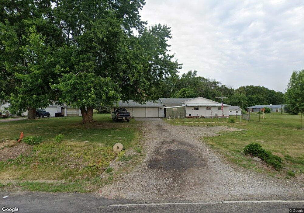
10625 S Kingston Mines Rd Mapleton, IL 61547
Estimated Value: $81,000 - $103,000
2
Beds
1
Bath
1,008
Sq Ft
$91/Sq Ft
Est. Value
About This Home
This home is located at 10625 S Kingston Mines Rd, Mapleton, IL 61547 and is currently estimated at $91,225, approximately $90 per square foot. 10625 S Kingston Mines Rd is a home located in Peoria County with nearby schools including Illini Bluffs Elementary School, Illini Bluffs Middle School, and Illini Bluffs High School.
Ownership History
Date
Name
Owned For
Owner Type
Purchase Details
Closed on
Oct 24, 2025
Sold by
Mcgee Penny L and Burroughs Dale Paul
Bought by
Duley Trista Lea
Current Estimated Value
Home Financials for this Owner
Home Financials are based on the most recent Mortgage that was taken out on this home.
Original Mortgage
$77,450
Outstanding Balance
$77,450
Interest Rate
6.26%
Mortgage Type
New Conventional
Estimated Equity
$13,775
Purchase Details
Closed on
Oct 23, 2002
Bought by
Burroughs Dale E and Burroughs Fairy L
Create a Home Valuation Report for This Property
The Home Valuation Report is an in-depth analysis detailing your home's value as well as a comparison with similar homes in the area
Purchase History
| Date | Buyer | Sale Price | Title Company |
|---|---|---|---|
| Duley Trista Lea | $80,000 | None Listed On Document | |
| Burroughs Dale E | $49,500 | -- |
Source: Public Records
Mortgage History
| Date | Status | Borrower | Loan Amount |
|---|---|---|---|
| Open | Duley Trista Lea | $77,450 |
Source: Public Records
Tax History
| Year | Tax Paid | Tax Assessment Tax Assessment Total Assessment is a certain percentage of the fair market value that is determined by local assessors to be the total taxable value of land and additions on the property. | Land | Improvement |
|---|---|---|---|---|
| 2024 | $1,279 | $32,060 | $6,570 | $25,490 |
| 2023 | $1,294 | $31,430 | $6,440 | $24,990 |
| 2022 | $1,297 | $29,870 | $6,030 | $23,840 |
| 2021 | $1,312 | $29,000 | $5,850 | $23,150 |
| 2020 | $1,304 | $28,440 | $5,740 | $22,700 |
| 2019 | $1,294 | $28,440 | $5,740 | $22,700 |
| 2018 | $1,284 | $28,440 | $5,750 | $22,690 |
| 2017 | $1,277 | $28,440 | $5,750 | $22,690 |
| 2016 | $1,251 | $28,160 | $5,690 | $22,470 |
| 2015 | $1,157 | $27,880 | $5,630 | $22,250 |
| 2014 | $1,145 | $27,390 | $5,490 | $21,900 |
| 2013 | -- | $26,730 | $5,360 | $21,370 |
Source: Public Records
Map
Nearby Homes
- Lot 1 S Hidden Point Dr
- 11109 S Glasford Rd
- 109 E Essex St
- 0 N Deer Trail Unit RMAPA1264360
- 8109 S Mccumber Rd
- 6923 W Wheeler Rd
- Lot 2 S Gerdes Rd
- 0 S Shady Ln Unit South Side
- 12450 Sunset Dr
- 0 S Whittingham Cove
- 9811 W Lake Lancelot Dr
- 9517 W Whittingham Point
- 12245 Sunset Dr
- 9913 W Guinivere Dr
- 9320 W Lake Camelot Dr
- 4606 S Hanna City Glasford Rd
- 5617 W Rt 24 Bypass Rd
- 9522 W Excalibur Ct
- 4304 S Arn Ct
- 409 W Lake Camelot Dr
- 10707 S Kingston Mines Rd
- 10801 S Kingston Mines Rd
- 10727 S Kingston Mines Rd
- 11401 W Wheeler Rd
- 11317 W Wheeler Rd
- 0 Highway 24
- 302 Washington St
- 306 Adams St
- 205 3rd St
- 203 3rd St
- 309 Jefferson St
- 207 3rd St
- 213 Scott St
- 214 Scott St
- 307 Jefferson St
- 301 Washington St
- 301 Adams St
- 11123 W Wheeler Rd
- 305 Jefferson St
- 11123 W Wheeler Rd
Your Personal Tour Guide
Ask me questions while you tour the home.