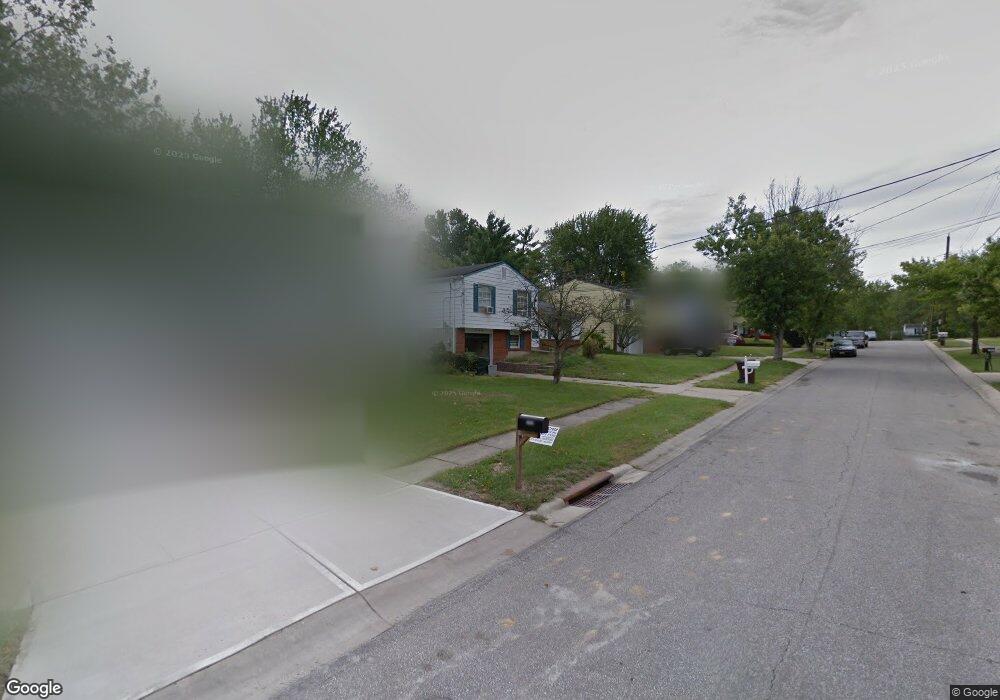
1063 Azure Ct Cincinnati, OH 45230
Salem Heights NeighborhoodEstimated Value: $235,765 - $267,000
3
Beds
2
Baths
1,300
Sq Ft
$196/Sq Ft
Est. Value
About This Home
This home is located at 1063 Azure Ct, Cincinnati, OH 45230 and is currently estimated at $254,691, approximately $195 per square foot. 1063 Azure Ct is a home located in Hamilton County with nearby schools including Maddux Elementary School, Nagel Middle School, and Anderson High School.
Ownership History
Date
Name
Owned For
Owner Type
Purchase Details
Closed on
Mar 3, 2021
Sold by
Wehage Carol M
Bought by
Wehage Gearing Trust and Gearing
Current Estimated Value
Purchase Details
Closed on
Mar 2, 2021
Sold by
Wehage Carol M
Bought by
Gearing Mark L and Wehage Carol M
Purchase Details
Closed on
Nov 24, 2004
Sold by
Robinson Carol M and Wehage Carol M
Bought by
Wehage Carol M
Home Financials for this Owner
Home Financials are based on the most recent Mortgage that was taken out on this home.
Original Mortgage
$74,500
Interest Rate
5.89%
Mortgage Type
New Conventional
Purchase Details
Closed on
Sep 27, 1995
Sold by
Morford Howard A and Morford Dorothy M
Bought by
Robinson Carol M
Home Financials for this Owner
Home Financials are based on the most recent Mortgage that was taken out on this home.
Original Mortgage
$80,000
Interest Rate
7.91%
Create a Home Valuation Report for This Property
The Home Valuation Report is an in-depth analysis detailing your home's value as well as a comparison with similar homes in the area
Home Values in the Area
Average Home Value in this Area
Purchase History
| Date | Buyer | Sale Price | Title Company |
|---|---|---|---|
| Wehage Gearing Trust | -- | None Listed On Document | |
| Gearing Mark L | -- | None Available | |
| Wehage Carol M | -- | None Available | |
| Robinson Carol M | -- | -- |
Source: Public Records
Mortgage History
| Date | Status | Borrower | Loan Amount |
|---|---|---|---|
| Previous Owner | Wehage Carol M | $74,500 | |
| Previous Owner | Robinson Carol M | $80,000 |
Source: Public Records
Tax History
| Year | Tax Paid | Tax Assessment Tax Assessment Total Assessment is a certain percentage of the fair market value that is determined by local assessors to be the total taxable value of land and additions on the property. | Land | Improvement |
|---|---|---|---|---|
| 2025 | $3,981 | $63,673 | $12,191 | $51,482 |
| 2024 | $3,868 | $63,673 | $12,191 | $51,482 |
| 2023 | $3,680 | $63,673 | $12,191 | $51,482 |
| 2022 | $3,087 | $47,555 | $11,960 | $35,595 |
| 2021 | $3,014 | $47,555 | $11,960 | $35,595 |
| 2020 | $3,049 | $47,555 | $11,960 | $35,595 |
| 2019 | $2,971 | $42,084 | $10,584 | $31,500 |
| 2018 | $2,783 | $42,084 | $10,584 | $31,500 |
| 2017 | $2,625 | $42,084 | $10,584 | $31,500 |
| 2016 | $2,491 | $39,015 | $10,602 | $28,413 |
| 2015 | $2,420 | $39,015 | $10,602 | $28,413 |
| 2014 | $2,421 | $39,015 | $10,602 | $28,413 |
| 2013 | $2,246 | $38,252 | $10,395 | $27,857 |
Source: Public Records
Map
Nearby Homes
- 949 Yarger Dr
- 6026 Squirehill Ct
- 1069 Doolittle Ln
- 1 Salem Rd
- 1075 Nimitz Ln
- 777 Cedar Point Dr
- 1059 4 Mile Rd
- 6956 Shadow Ridge Rd
- 6947 Shadow Ridge Rd
- 3 Salem Rd
- 2 Salem Rd
- 4 Salem Rd
- 6637 Wyndwatch Dr
- 1146 Bruce Ave
- 0 Watch Point Dr Unit 1864148
- 1432 Apple Hill Rd
- 1508 Beth Ln
- 1244 Bondick Ct
- 1150 Brooke Ave
- 6193 Dawes Ln
Your Personal Tour Guide
Ask me questions while you tour the home.