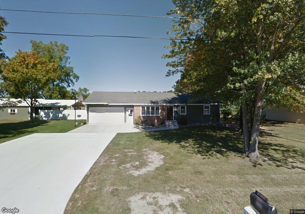
1069 Aster St Wayland, MI 49348
Estimated Value: $296,000 - $328,000
3
Beds
3
Baths
1,408
Sq Ft
$222/Sq Ft
Est. Value
About This Home
This home is located at 1069 Aster St, Wayland, MI 49348 and is currently estimated at $312,812, approximately $222 per square foot. 1069 Aster St is a home located in Allegan County with nearby schools including Wayland High School and St. Therese Catholic School.
Ownership History
Date
Name
Owned For
Owner Type
Purchase Details
Closed on
Sep 28, 2012
Sold by
Button Derrick R and Button Lisa
Bought by
Thede Kenneth and Thede Cheryl
Current Estimated Value
Purchase Details
Closed on
Jun 2, 2006
Sold by
Wolf Thomas G and Wolf Heidi L
Bought by
Button Derrick R and Button Lisa
Home Financials for this Owner
Home Financials are based on the most recent Mortgage that was taken out on this home.
Original Mortgage
$146,300
Interest Rate
6.66%
Mortgage Type
Fannie Mae Freddie Mac
Purchase Details
Closed on
Sep 15, 1998
Sold by
Tarnutzer Thomas J and Tarnutzer Joann
Bought by
Wolf Thomas G and Wolf Heidi L
Create a Home Valuation Report for This Property
The Home Valuation Report is an in-depth analysis detailing your home's value as well as a comparison with similar homes in the area
Home Values in the Area
Average Home Value in this Area
Purchase History
| Date | Buyer | Sale Price | Title Company |
|---|---|---|---|
| Thede Kenneth | $45,000 | Chicago Title | |
| Button Derrick R | $154,000 | Michigan Bankers Title | |
| Wolf Thomas G | $138,000 | -- |
Source: Public Records
Mortgage History
| Date | Status | Borrower | Loan Amount |
|---|---|---|---|
| Previous Owner | Button Derrick R | $146,300 |
Source: Public Records
Tax History
| Year | Tax Paid | Tax Assessment Tax Assessment Total Assessment is a certain percentage of the fair market value that is determined by local assessors to be the total taxable value of land and additions on the property. | Land | Improvement |
|---|---|---|---|---|
| 2025 | $2,405 | $136,800 | $14,700 | $122,100 |
| 2024 | $2,191 | $130,200 | $14,700 | $115,500 |
| 2023 | $2,191 | $117,000 | $14,700 | $102,300 |
| 2022 | $2,191 | $114,300 | $14,000 | $100,300 |
| 2021 | $2,047 | $106,200 | $14,000 | $92,200 |
| 2020 | $2,017 | $102,500 | $14,000 | $88,500 |
| 2019 | $1,958 | $89,600 | $14,000 | $75,600 |
| 2018 | $1,888 | $85,600 | $14,000 | $71,600 |
| 2017 | $0 | $83,200 | $14,000 | $69,200 |
| 2016 | $0 | $68,000 | $14,000 | $54,000 |
| 2015 | -- | $68,000 | $14,000 | $54,000 |
| 2014 | -- | $60,000 | $14,000 | $46,000 |
| 2013 | $2,050 | $58,400 | $14,000 | $44,400 |
Source: Public Records
Map
Nearby Homes
- 1033 Aster St
- 3770 Division Ave S
- 545 N Main St
- 1146 Saskatoon Trail
- 518 Lawrence Ave Unit 5
- 131 Oak St
- 1137 Regina Trail
- 609 W Maple St
- 603 W Maple St
- 1206 Woodland Dr
- 146 Hanlon Ct
- 429 Plum St
- 535 135th Ave
- 826 Meadow Dr
- 329 Lotz Ct
- VL 13th St
- 3382 13th St
- 3905 Sunset View
- 4251 Butternut Dr
- 4255 Cloverfield Ct
- 1067 Aster St
- 1070 Serenity Ridge Dr Unit 10
- 1074 Aster St
- 1066 Serenity Ridge Dr Unit 9
- 1074 Serenity Ridge Dr Unit 11
- 1062 Serenity Ridge Dr Unit 8
- 1058 Aster St
- 1059 Aster St
- 1078 Serenity Ridge Dr Unit 12
- 1058 Serenity Ridge Dr Unit 7
- 3636 Lilac St
- 3645 Urban Depot Ct
- 1079 Serenity Ridge Dr
- 1056 Aster St
- 1067 Serenity Ridge Dr
- 1055 Aster St
- 3633 Lilac St
- 3637 Urban Depot Ct
- 1082 Serenity Ridge Dr
- 3632 Lilac St
Your Personal Tour Guide
Ask me questions while you tour the home.