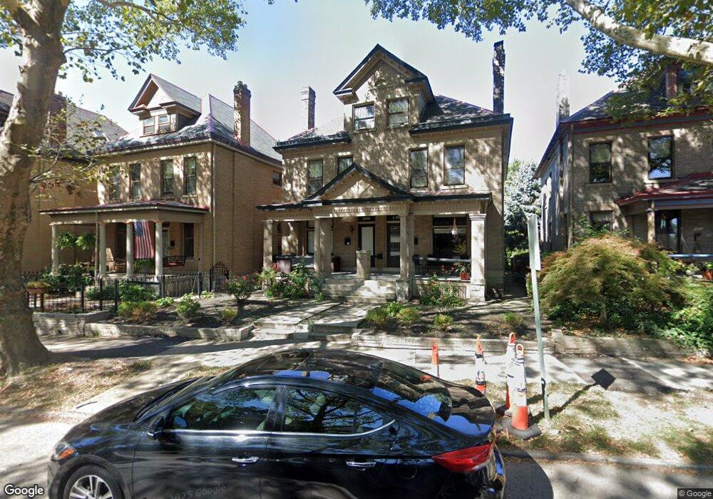
1069 Neil Ave Unit 73 Columbus, OH 43201
Victorian Village NeighborhoodEstimated Value: $599,000 - $875,051
4
Beds
2
Baths
--
Sq Ft
6,578
Sq Ft Lot Lot
About This Home
This home is located at 1069 Neil Ave Unit 73, Columbus, OH 43201 and is currently estimated at $760,263. 1069 Neil Ave Unit 73 is a home located in Franklin County with nearby schools including Hubbard Elementary School, Dominion Middle School, and Whetstone High School.
Ownership History
Date
Name
Owned For
Owner Type
Purchase Details
Closed on
Jul 3, 1972
Bought by
Frye Dan D
Current Estimated Value
Create a Home Valuation Report for This Property
The Home Valuation Report is an in-depth analysis detailing your home's value as well as a comparison with similar homes in the area
Home Values in the Area
Average Home Value in this Area
Purchase History
We collect this data history from publicly available records. To have your information removed, we recommend requesting removal directly through your county’s website.
| Date | Buyer | Sale Price | Title Company |
|---|---|---|---|
| Frye Dan D | -- | -- |
Source: Public Records
Tax History
| Year | Tax Paid | Tax Assessment Tax Assessment Total Assessment is a certain percentage of the fair market value that is determined by local assessors to be the total taxable value of land and additions on the property. | Land | Improvement |
|---|---|---|---|---|
| 2025 | $10,169 | $221,900 | $77,000 | $144,900 |
| 2024 | $10,169 | $221,900 | $77,000 | $144,900 |
| 2023 | $10,042 | $221,900 | $77,000 | $144,900 |
| 2022 | $12,241 | $230,340 | $43,470 | $186,870 |
| 2021 | $12,263 | $230,340 | $43,470 | $186,870 |
| 2020 | $12,281 | $230,340 | $43,470 | $186,870 |
| 2019 | $11,936 | $191,950 | $36,230 | $155,720 |
| 2018 | $11,790 | $191,950 | $36,230 | $155,720 |
| 2017 | $13,143 | $183,270 | $36,230 | $147,040 |
| 2016 | $12,220 | $179,870 | $35,070 | $144,800 |
| 2015 | $11,125 | $179,870 | $35,070 | $144,800 |
| 2014 | $11,153 | $179,870 | $35,070 | $144,800 |
| 2013 | $5,001 | $163,520 | $31,885 | $131,635 |
Source: Public Records
Map
Nearby Homes
- 320 W 3rd Ave
- 1063 Harrison Ave
- 319 W 2nd Ave Unit 319
- 1056 Pennsylvania Ave
- 1029 Hunter Ave
- 1178 Harrison Ave
- 981 Highland St
- 965 Delaware Ave Unit 965
- 387 W 2nd Ave
- 399 W 2nd Ave
- 978 Highland St
- 201 W 2nd Ave Unit 201
- 344 W 4th Ave
- 1214 Neil Ave
- 1001 Dennison Ave
- 313 W 1st Ave
- 1024 Michigan Ave
- 1216 Highland St
- 1163 Michigan Ave Unit 165
- 107 Aston Row Ln
- 1077 Neil Ave
- 1085 Neil Ave
- 1065 Neil Ave
- 301 W 3rd Ave
- 1061 Neil Ave
- 305 W 3rd Ave
- 280 W 3rd Ave Unit 282
- 280 W 3rd Ave Unit 282
- 298 Tappan St
- 296 Tappan St
- 294 Tappan St
- 292 Tappan St
- 310 Tappan St
- 304 Tappan St
- 302 Tappan St
- 309 W 3rd Ave
- 1099 Neil Ave Unit 101
- 288 Tappan St
- 1055 Neil Ave
- 1057 Neil Ave
Your Personal Tour Guide
Ask me questions while you tour the home.