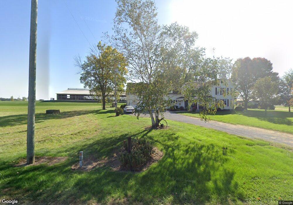
10695 Wolf Rd Versailles, OH 45380
Estimated Value: $341,829 - $399,000
3
Beds
2
Baths
3,768
Sq Ft
$99/Sq Ft
Est. Value
About This Home
This home is located at 10695 Wolf Rd, Versailles, OH 45380 and is currently estimated at $373,957, approximately $99 per square foot. 10695 Wolf Rd is a home located in Darke County with nearby schools including Versailles Elementary School, Versailles Middle School, and Versailles High School.
Ownership History
Date
Name
Owned For
Owner Type
Purchase Details
Closed on
Jan 20, 2025
Sold by
Henry Joseph F and Irrevo Sharon
Bought by
Joseph F Henry And Sharon E Henry Irrevocable and Henry
Current Estimated Value
Purchase Details
Closed on
Sep 8, 2015
Sold by
Henry Joseph F and Henry Sharon E
Bought by
Henry Joseph F and Henry Sharon E
Create a Home Valuation Report for This Property
The Home Valuation Report is an in-depth analysis detailing your home's value as well as a comparison with similar homes in the area
Purchase History
| Date | Buyer | Sale Price | Title Company |
|---|---|---|---|
| Joseph F Henry And Sharon E Henry Irrevocable | -- | Northwest Title | |
| Joseph F Henry And Sharon E Henry Irrevocable | -- | Northwest Title | |
| Henry Joseph F | -- | Attorney |
Source: Public Records
Tax History
| Year | Tax Paid | Tax Assessment Tax Assessment Total Assessment is a certain percentage of the fair market value that is determined by local assessors to be the total taxable value of land and additions on the property. | Land | Improvement |
|---|---|---|---|---|
| 2025 | $3,089 | $93,660 | $6,850 | $86,810 |
| 2024 | $3,089 | $93,660 | $6,850 | $86,810 |
| 2023 | $3,093 | $93,660 | $6,850 | $86,810 |
| 2022 | $2,212 | $69,070 | $5,710 | $63,360 |
| 2021 | $2,316 | $69,070 | $5,710 | $63,360 |
| 2020 | $2,328 | $69,070 | $5,710 | $63,360 |
| 2019 | $1,896 | $56,400 | $5,710 | $50,690 |
| 2018 | $1,905 | $56,400 | $5,710 | $50,690 |
| 2017 | $1,518 | $56,400 | $5,710 | $50,690 |
| 2016 | $1,519 | $47,780 | $5,710 | $42,070 |
| 2015 | $1,519 | $47,780 | $5,710 | $42,070 |
| 2014 | $1,598 | $47,780 | $5,710 | $42,070 |
| 2013 | $1,637 | $45,490 | $5,430 | $40,060 |
Source: Public Records
Map
Nearby Homes
- 0 St Rt 121 Unit 10041143
- 45 Short St
- 00 State Route 121
- 552 Reed Ave
- 546 Reed Ave
- 547 Reed Ave
- 447 Reed Ave
- 435 Reed Ave
- 140 N Center St
- 161 E Main St
- 9072 Stillwater Dr
- 7627 Horatio-Harris Creek Rd
- 311 E Canal St
- 5331 Tamarack Trail
- 231 N Main St
- 5177 Warvel Rd
- 420 W Canal St
- 414 W High St
- 157 Mendenhall Rd
- 159 Mendenhall Rd
- 10722 Wolf Rd
- 10745 Wolf Rd
- 10646 Wolf Rd
- 10541 Wolf Rd
- 10766 Wolf Rd
- 7656 State Route 47
- 10486 Wolf Rd
- 10785 Wolf Rd
- 7854 State Route 47
- 7443 State Route 47
- 7411 State Route 47
- 7371 Ohio 47
- 7371 State Route 47
- 10590 Conover Rd
- 10310 Wolf Rd
- 7327 State Route 47
- 10781 Shaffer Rd
- 10830 Conover Rd
- 10645 Conover Rd
- 7970 State Route 47
Your Personal Tour Guide
Ask me questions while you tour the home.