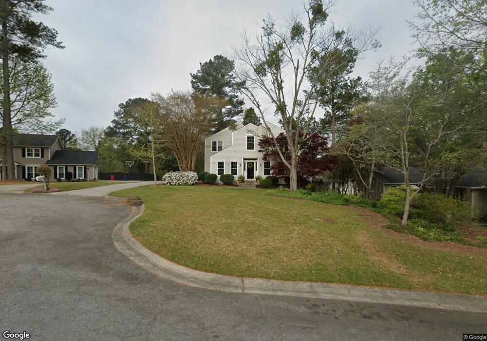
107 Kells Ct Macon, GA 31210
Estimated Value: $237,652 - $303,000
4
Beds
3
Baths
2,054
Sq Ft
$133/Sq Ft
Est. Value
About This Home
This home is located at 107 Kells Ct, Macon, GA 31210 and is currently estimated at $273,163, approximately $132 per square foot. 107 Kells Ct is a home located in Bibb County with nearby schools including Lane Elementary School, Howard Middle School, and Howard High School.
Ownership History
Date
Name
Owned For
Owner Type
Purchase Details
Closed on
Feb 10, 2006
Sold by
Maples Larry E and Maples Lucile F
Bought by
Watson Robert K and Watson Amy I
Current Estimated Value
Home Financials for this Owner
Home Financials are based on the most recent Mortgage that was taken out on this home.
Original Mortgage
$126,760
Outstanding Balance
$70,035
Interest Rate
6.08%
Mortgage Type
New Conventional
Estimated Equity
$203,128
Purchase Details
Closed on
Jul 19, 2001
Bought by
Watson Robert and Watson Amy I
Create a Home Valuation Report for This Property
The Home Valuation Report is an in-depth analysis detailing your home's value as well as a comparison with similar homes in the area
Purchase History
We collect this data history from publicly available records. To have your information removed, we recommend requesting removal directly through your county’s website.
| Date | Buyer | Sale Price | Title Company |
|---|---|---|---|
| Watson Robert K | $158,450 | None Available | |
| Watson Robert | $136,900 | -- |
Source: Public Records
Mortgage History
We collect this data history from publicly available records. To have your information removed, we recommend requesting removal directly through your county’s website.
| Date | Status | Borrower | Loan Amount |
|---|---|---|---|
| Open | Watson Robert K | $126,760 |
Source: Public Records
Tax History
| Year | Tax Paid | Tax Assessment Tax Assessment Total Assessment is a certain percentage of the fair market value that is determined by local assessors to be the total taxable value of land and additions on the property. | Land | Improvement |
|---|---|---|---|---|
| 2025 | $1,835 | $81,677 | $14,000 | $67,677 |
| 2024 | $1,897 | $81,677 | $14,000 | $67,677 |
| 2023 | $1,439 | $81,677 | $14,000 | $67,677 |
| 2022 | $2,447 | $77,692 | $9,331 | $68,361 |
| 2021 | $2,193 | $64,721 | $8,258 | $56,463 |
| 2020 | $2,241 | $64,721 | $8,258 | $56,463 |
| 2019 | $1,980 | $57,583 | $8,258 | $49,325 |
| 2018 | $3,212 | $57,583 | $8,258 | $49,325 |
| 2017 | $1,895 | $57,583 | $8,258 | $49,325 |
| 2016 | $1,750 | $57,582 | $8,258 | $49,325 |
| 2015 | $2,477 | $57,582 | $8,258 | $49,325 |
| 2014 | $2,901 | $57,582 | $8,258 | $49,325 |
Source: Public Records
Map
Nearby Homes
- 527 Commanche Dr
- 532 Sioux Dr
- 528 Commanche Dr
- 231 Alexandria Dr
- 556 Commanche Place
- 206 Huntington Ct
- 602 Commanche Dr
- 208 Huntington Ct
- 636 Lokchapee Ridge
- 4260 Wood Forest Place
- 177 Brookstone Way
- 835 Old Lundy Rd
- 912 Lundy Terrace
- 914 Glenbrook Rd
- 4506 Rivoli Dr
- 4740 Wesleyan Woods Dr
- 125 N Laura Ann Ct
- 843 Green Oak Terrace
- 1115 Darlington Dr
- 4555 Old Club Rd
- 135 Brandon Way
- 129 Brandon Way
- 121 Brandon Way
- 106 Kells Ct
- 102 Kells Ct
- 102 Kells Ct Unit 13
- 111 Kells Ct
- 134 Brandon Way
- 110 Kells Ct
- 115 Brandon Way
- 128 Brandon Way
- 153 Brandon Way
- 122 Brandon Way
- 140 Brandon Way
- 157 Brandon Way
- 148 Brandon Way
- 109 Brandon Way
- 144 Brandon Way
- 116 Brandon Way
- 152 Brandon Way
Your Personal Tour Guide
Ask me questions while you tour the home.