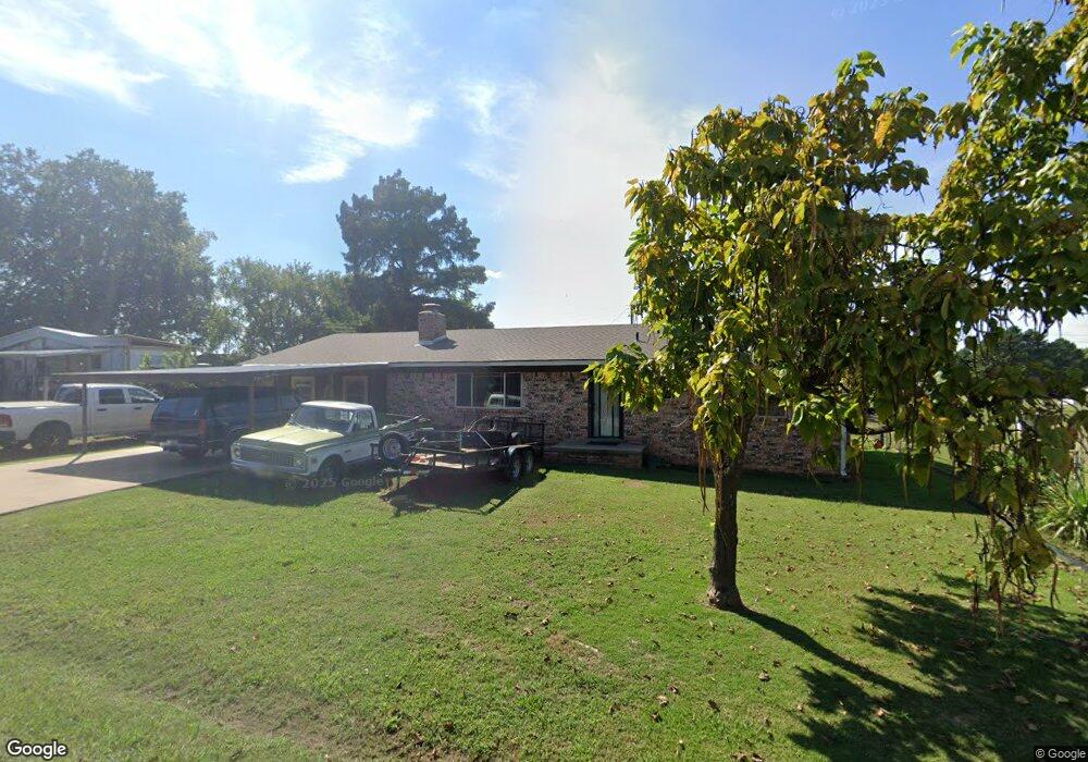
107 Maple Dr Pocola, OK 74902
Estimated Value: $140,000 - $198,000
3
Beds
2
Baths
1,520
Sq Ft
$108/Sq Ft
Est. Value
About This Home
This home is located at 107 Maple Dr, Pocola, OK 74902 and is currently estimated at $164,842, approximately $108 per square foot. 107 Maple Dr is a home located in Le Flore County with nearby schools including Pocola Elementary School, Pocola Middle School, and Pocola High School.
Ownership History
Date
Name
Owned For
Owner Type
Purchase Details
Closed on
May 13, 2010
Sold by
Minks Investement Properties Llc
Bought by
White Brian N and White Kristin D
Current Estimated Value
Home Financials for this Owner
Home Financials are based on the most recent Mortgage that was taken out on this home.
Original Mortgage
$95,918
Outstanding Balance
$63,948
Interest Rate
5.02%
Mortgage Type
New Conventional
Estimated Equity
$100,894
Purchase Details
Closed on
Dec 23, 2009
Sold by
Secretary Of Hud Of Washington Dc
Bought by
Minks Investments Properties Llc
Create a Home Valuation Report for This Property
The Home Valuation Report is an in-depth analysis detailing your home's value as well as a comparison with similar homes in the area
Home Values in the Area
Average Home Value in this Area
Purchase History
| Date | Buyer | Sale Price | Title Company |
|---|---|---|---|
| White Brian N | $87,000 | -- | |
| Minks Investments Properties Llc | -- | -- |
Source: Public Records
Mortgage History
| Date | Status | Borrower | Loan Amount |
|---|---|---|---|
| Open | White Brian N | $95,918 |
Source: Public Records
Tax History
| Year | Tax Paid | Tax Assessment Tax Assessment Total Assessment is a certain percentage of the fair market value that is determined by local assessors to be the total taxable value of land and additions on the property. | Land | Improvement |
|---|---|---|---|---|
| 2025 | $605 | $8,273 | $770 | $7,503 |
| 2023 | $589 | $7,799 | $770 | $7,029 |
| 2022 | $575 | $7,799 | $770 | $7,029 |
| 2021 | $527 | $7,799 | $770 | $7,029 |
| 2020 | $551 | $8,114 | $770 | $7,344 |
| 2019 | $593 | $8,652 | $770 | $7,882 |
| 2018 | $614 | $8,439 | $770 | $7,669 |
| 2017 | $647 | $8,829 | $770 | $8,059 |
| 2016 | $652 | $8,894 | $770 | $8,124 |
| 2015 | $657 | $8,894 | $770 | $8,124 |
| 2014 | $680 | $9,090 | $770 | $8,320 |
Source: Public Records
Map
Nearby Homes
- 103 State Line Rd
- 608 Ridge Point Dr
- 8409 Vickery Ln
- 7816 Texas Rd
- 7021 State Line Rd
- 7501 Cheryl Ln
- 8916 Southridge Dr
- 7512 Highway 271 S
- 6700 S 6th St
- 8205 Clover Dr
- 8400 US Highway 271
- 6808 S 9th St
- 7423 Highway 271 S
- 8601 S 16th St
- 8005 Holly Ave
- 7512 Cypress Ave
- 921 Cedar Ln
- 406 Butler St
- 1326 & 1328 Rabbit Run Rd
- Lot #2 Us Highway 271
Your Personal Tour Guide
Ask me questions while you tour the home.