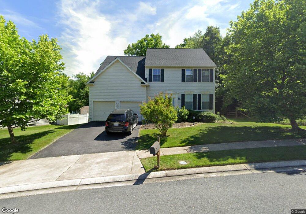
107 Queensberry Rd Rosedale, MD 21237
Estimated Value: $526,000 - $621,000
About This Home
This home is located at 107 Queensberry Rd, Rosedale, MD 21237 and is currently estimated at $572,965, approximately $247 per square foot. 107 Queensberry Rd is a home located in Baltimore County with nearby schools including Parkville Middle & Center of Technology, Overlea High School, and St. Joseph School-Fullerton.
Ownership History
We collect this data history from publicly available records. To have your information removed, we recommend requesting removal directly through your county’s website.
Purchase Details
Home Financials for this Owner
Home Financials are based on the most recent Mortgage that was taken out on this home.Purchase Details
Home Financials for this Owner
Home Financials are based on the most recent Mortgage that was taken out on this home.Purchase Details
Purchase Details
Purchase Details
Home Financials for this Owner
Home Financials are based on the most recent Mortgage that was taken out on this home.Purchase Details
Home Financials for this Owner
Home Financials are based on the most recent Mortgage that was taken out on this home.Purchase Details
Home Values in the Area
Average Home Value in this Area
Purchase History
We collect this data history from publicly available records. To have your information removed, we recommend requesting removal directly through your county’s website.
| Date | Buyer | Sale Price | Title Company |
|---|---|---|---|
| $385,000 | -- | ||
| $385,000 | -- | ||
| $407,550 | -- | ||
| $407,550 | -- | ||
| $450,000 | -- | ||
| $450,000 | -- | ||
| $291,865 | -- |
Mortgage History
We collect this data history from publicly available records. To have your information removed, we recommend requesting removal directly through your county’s website.
| Date | Status | Borrower | Loan Amount |
|---|---|---|---|
| Open | $365,700 | ||
| Previous Owner | $365,700 | ||
| Previous Owner | $90,000 | ||
| Previous Owner | $360,000 | ||
| Previous Owner | $360,000 |
Tax History
We collect this data history from publicly available records. To have your information removed, we recommend requesting removal directly through your county’s website.
| Year | Tax Paid | Tax Assessment Tax Assessment Total Assessment is a certain percentage of the fair market value that is determined by local assessors to be the total taxable value of land and additions on the property. | Land | Improvement |
|---|---|---|---|---|
| 2025 | $6,323 | $439,333 | -- | -- |
| 2024 | $6,323 | $415,667 | $0 | $0 |
| 2023 | $3,001 | $392,000 | $128,100 | $263,900 |
| 2022 | $5,783 | $382,633 | $0 | $0 |
| 2021 | $5,394 | $373,267 | $0 | $0 |
| 2020 | $5,394 | $363,900 | $128,100 | $235,800 |
| 2019 | $5,249 | $361,067 | $0 | $0 |
| 2018 | $4,816 | $358,233 | $0 | $0 |
| 2017 | $4,664 | $355,400 | $0 | $0 |
| 2016 | $4,762 | $331,000 | $0 | $0 |
| 2015 | $4,762 | $306,600 | $0 | $0 |
| 2014 | $4,762 | $282,200 | $0 | $0 |
Map
- 2 Merion Ave
- 8112 Cypress Point Dr
- 22 Merion Ave
- 26 Merion Ave
- 8110 Cypress Point Dr
- 23 Merion Ave
- 8108 Cypress Point Dr
- 1 Comes Ridge Ct
- 29 Merion Ave
- 31 Merion Ave
- 8105 Cypress Point Dr
- 8101 Cypress Point Dr
- 5085 Silver Oak Dr
- 5059 Silver Oak Dr
- 8101 Glen Arbor Dr
- 8144 Glen Arbor Dr
- 57 Willow Path Ct
- 4484 Cole Farm Rd
- 4240 Maple Path Cir
- 23 Laurel Path Ct
- 104 Queensberry Rd
- 106 Queensberry Rd
- 102 Queensberry Rd
- 32 Broadbridge Rd
- 34 Broadbridge Rd
- 34 Broadbridge Rd
- 108 Queensberry Rd
- 100 Queensberry Rd
- 36 Broadbridge Rd
- 110 Queensberry Rd
- 105 Queensberry Rd
- 103 Queensberry Rd
- 112 Queensberry Rd
- 38 Broadbridge Rd
- 101 Queensberry Rd
- 109 Queensberry Rd
- 27 Broadbridge Rd
- 25 Broadbridge Rd
- 29 Broadbridge Rd
- 23 Broadbridge Rd
Ask me questions while you tour the home.