Estimated Value: $56,000 - $212,000
Studio
--
Bath
1,764
Sq Ft
$84/Sq Ft
Est. Value
About This Home
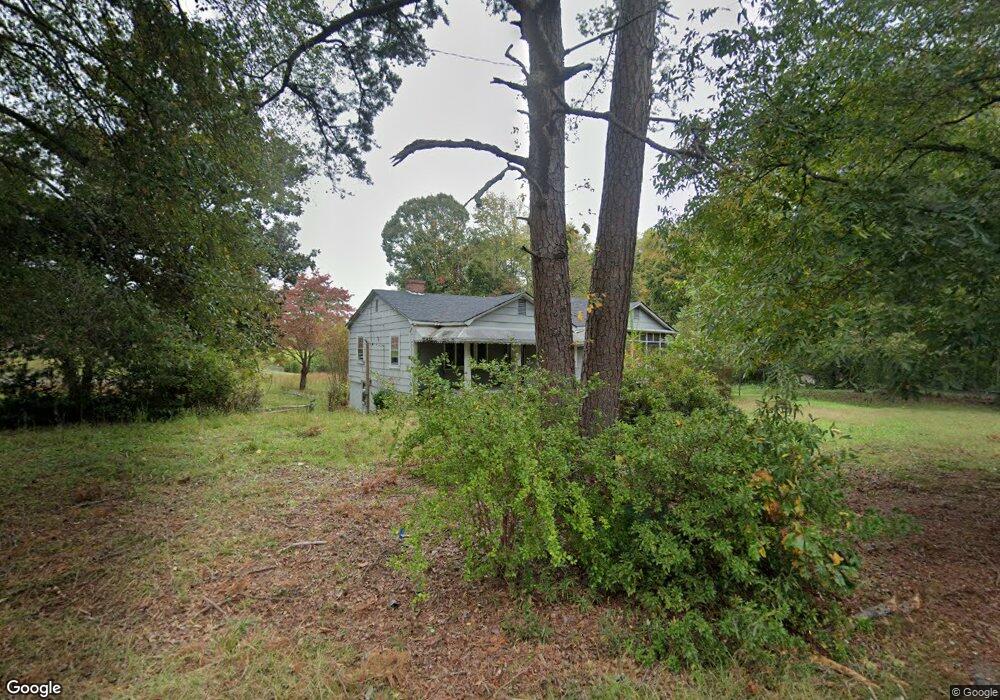
This home is located at 107 Rifle Range Rd, Union, SC 29379 and is currently estimated at $148,014, approximately $83 per square foot. 107 Rifle Range Rd is a home with nearby schools including Union County High School, Unity Christian Academy, and Union Christian Day School.
Ownership History
Date
Name
Owned For
Owner Type
Purchase Details
Closed on
Apr 1, 2025
Sold by
Rodger C Jarrell Real Est
Bought by
Flores Richard A
Current Estimated Value
Home Financials for this Owner
Home Financials are based on the most recent Mortgage that was taken out on this home.
Original Mortgage
$44,900
Outstanding Balance
$44,551
Interest Rate
6.85%
Mortgage Type
Construction
Estimated Equity
$103,463
Purchase Details
Closed on
Mar 10, 2023
Sold by
Garner Brian and Sitwala Lena Inez
Bought by
Rodger C Jarrell Real Estate & Mortgages
Purchase Details
Closed on
Sep 27, 2018
Bought by
Garner Briane and Sitwala Lena I
Purchase Details
Closed on
Nov 2, 2007
Sold by
Garner Alice S
Bought by
Garner Levone
Create a Home Valuation Report for This Property
The Home Valuation Report is an in-depth analysis detailing your home's value as well as a comparison with similar homes in the area
Purchase History
| Date | Buyer | Sale Price | Title Company |
|---|---|---|---|
| Flores Richard A | $49,900 | -- | |
| Rodger C Jarrell Real Estate & Mortgages | $18,000 | -- | |
| Garner Briane | -- | -- | |
| Garner Levone | -- | -- |
Source: Public Records
Mortgage History
| Date | Status | Borrower | Loan Amount |
|---|---|---|---|
| Open | Flores Richard A | $44,900 |
Source: Public Records
Tax History
| Year | Tax Paid | Tax Assessment Tax Assessment Total Assessment is a certain percentage of the fair market value that is determined by local assessors to be the total taxable value of land and additions on the property. | Land | Improvement |
|---|---|---|---|---|
| 2025 | $986 | $59,450 | $6,500 | $52,950 |
| 2024 | $986 | $3,100 | $270 | $2,830 |
| 2023 | $986 | $3,100 | $0 | $0 |
| 2022 | $948 | $3,100 | $270 | $2,830 |
| 2021 | $948 | $3,100 | $270 | $2,830 |
| 2020 | $975 | $3,100 | $270 | $2,830 |
| 2019 | $942 | $3,100 | $270 | $2,830 |
| 2018 | $371 | $3,100 | $270 | $2,830 |
| 2017 | $404 | $2,070 | $180 | $1,890 |
| 2016 | $404 | $2,070 | $180 | $1,890 |
| 2015 | $1,026 | $2,070 | $180 | $1,890 |
| 2014 | $1,026 | $2,390 | $180 | $2,210 |
Source: Public Records
Map
Nearby Homes
- 307 Glendale Rd
- 101 Beechtree Place
- 101 Hidden Hill Rd
- 107 Hidden Hill Rd
- 100 Culbreath Heights
- 108 Eastwood Ave
- 100 Eastwood Ave
- 112 Woodrow St
- 209 Belvue Dr
- 210 Mcbeth St
- 231 State Road S-44-289
- 204 Wardlaw St
- 200 4th St
- 207 Maid Marion Dr
- 703 S Boyce St
- 405 S Pinckney St
- 507 McLure St
- 203 E South St
- 114 Park Dr
- 0 Talley (Lot 2) Dr
- 111 Rifle Range Rd
- 108 Rifle Range Rd
- 201 Sims Dr
- 0 Rifle Range Rd and Sims Dr
- 112 Rifle Range Rd
- 119 Rifle Range Rd
- 205 Sims Dr
- 135 Rifle Range Rd
- 116 Rifle Range Rd
- 207 Sims Dr
- 122 Rifle Range Rd
- 209 Sims Dr
- 211 Sims Dr
- 237 Beltline Rd
- 241 Beltline Rd
- 301 Beltline Rd
- 315 Beltline Rd
- 319 Beltline Rd
- 216 Beltline Rd
- 325 Beltline Rd
Your Personal Tour Guide
Ask me questions while you tour the home.