Estimated Value: $156,075 - $236,000
About This Home
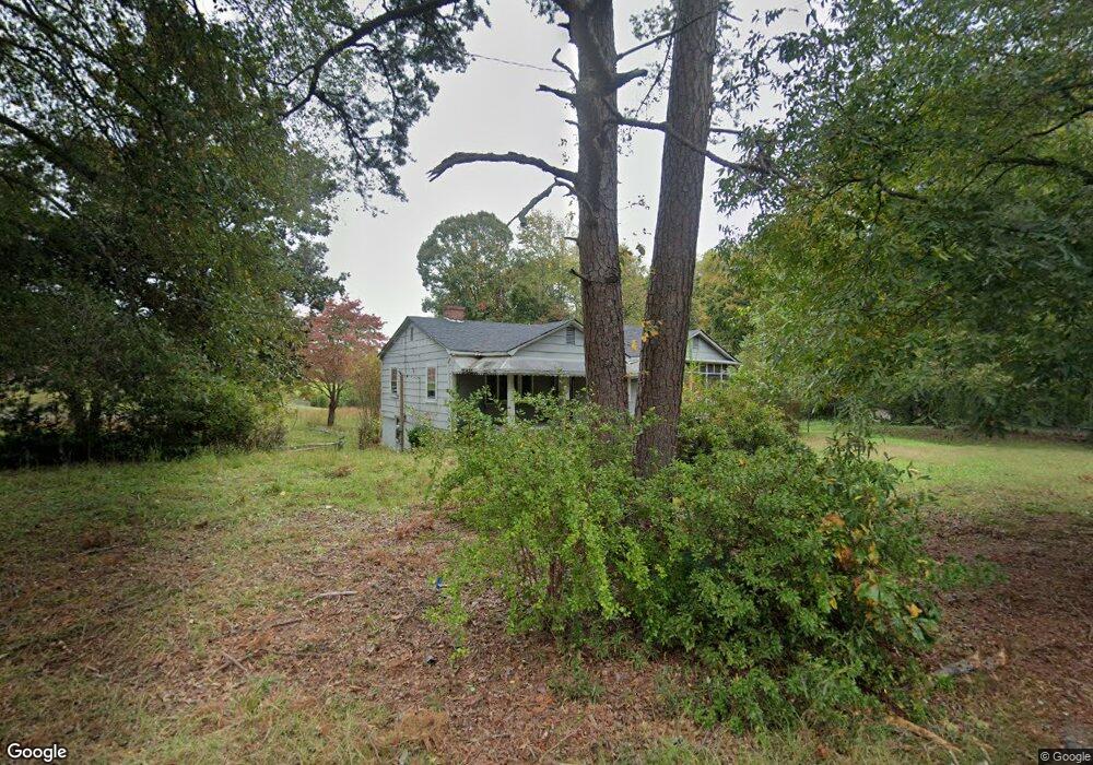
This home is located at 107 Rifle Range Rd, Union, SC 29379 and is currently estimated at $194,019, approximately $109 per square foot. 107 Rifle Range Rd is a home with nearby schools including Union County High School, Unity Christian Academy, and Union Christian Day School.
Ownership History
We collect this data history from publicly available records. To have your information removed, we recommend requesting removal directly through your county’s website.
Purchase Details
Home Financials for this Owner
Home Financials are based on the most recent Mortgage that was taken out on this home.Purchase Details
Purchase Details
Purchase Details
Purchase History
We collect this data history from publicly available records. To have your information removed, we recommend requesting removal directly through your county’s website.
| Date | Buyer | Sale Price | Title Company |
|---|---|---|---|
| $49,900 | -- | ||
| $18,000 | -- | ||
| -- | -- | ||
| -- | -- |
Mortgage History
We collect this data history from publicly available records. To have your information removed, we recommend requesting removal directly through your county’s website.
| Date | Status | Borrower | Loan Amount |
|---|---|---|---|
| Open | $44,900 |
Tax History
We collect this data history from publicly available records. To have your information removed, we recommend requesting removal directly through your county’s website.
| Year | Tax Paid | Tax Assessment Tax Assessment Total Assessment is a certain percentage of the fair market value that is determined by local assessors to be the total taxable value of land and additions on the property. | Land | Improvement |
|---|---|---|---|---|
| 2025 | $1,058 | $3,570 | $310 | $3,260 |
| 2024 | $986 | $3,100 | $270 | $2,830 |
| 2023 | $986 | $3,100 | $0 | $0 |
| 2022 | $948 | $3,100 | $270 | $2,830 |
| 2021 | $948 | $3,100 | $270 | $2,830 |
| 2020 | $975 | $3,100 | $270 | $2,830 |
| 2019 | $942 | $3,100 | $270 | $2,830 |
| 2018 | $371 | $3,100 | $270 | $2,830 |
| 2017 | $404 | $2,070 | $180 | $1,890 |
| 2016 | $404 | $2,070 | $180 | $1,890 |
| 2015 | $1,026 | $2,070 | $180 | $1,890 |
| 2014 | $1,026 | $2,390 | $180 | $2,210 |
Map
- 319 Brookside Dr
- 118 Brookside Dr
- 101 Hidden Hill Rd
- 100 Culbreath Heights
- 108 Eastwood Ave
- 101 Hodges Ln
- 104 E Henrietta St
- 100 Eastwood Ave
- 112 Woodrow St
- 210 Mcbeth St
- 204 Wardlaw St
- 231 State Road S-44-289
- 829 Duncan Bypass
- 128 Bird St
- 310 S Mountain St
- 405 S Pinckney St
- 515 McLure St
- 703 S Boyce St
- 507 McLure St
- 203 E South St
- 111 Rifle Range Rd
- 108 Rifle Range Rd
- 201 Sims Dr
- 0 Rifle Range Rd and Sims Dr
- 112 Rifle Range Rd
- 119 Rifle Range Rd
- 205 Sims Dr
- 135 Rifle Range Rd
- 116 Rifle Range Rd
- 207 Sims Dr
- 122 Rifle Range Rd
- 209 Sims Dr
- 211 Sims Dr
- 0 Sims Dr
- 237 Beltline Rd
- 241 Beltline Rd
- 301 Beltline Rd
- 315 Beltline Rd
- 319 Beltline Rd
- 216 Beltline Rd
Ask me questions while you tour the home.