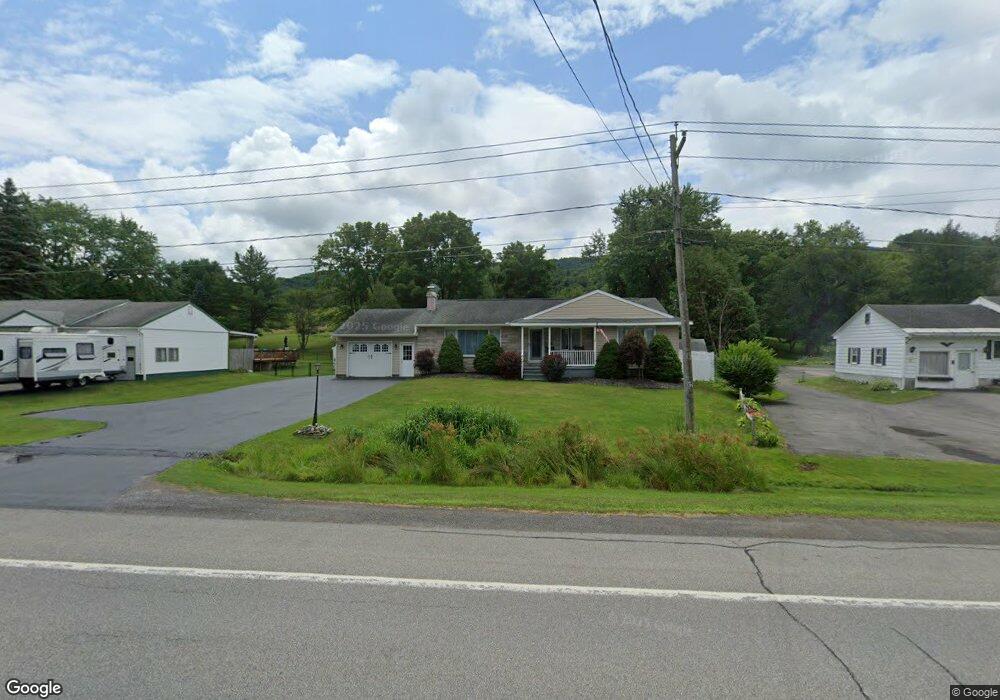
1070 State Route 5s Mohawk, NY 13407
Estimated Value: $188,000 - $256,740
3
Beds
3
Baths
1,517
Sq Ft
$143/Sq Ft
Est. Value
About This Home
This home is located at 1070 State Route 5s, Mohawk, NY 13407 and is currently estimated at $217,685, approximately $143 per square foot. 1070 State Route 5s is a home located in Herkimer County with nearby schools including Harry M. Fisher Elementary School, Barringer Road Elementary School, and Gregory B. Jarvis Middle School.
Ownership History
Date
Name
Owned For
Owner Type
Purchase Details
Closed on
Nov 13, 2007
Sold by
Joy Edward
Bought by
Wilson Gary
Current Estimated Value
Home Financials for this Owner
Home Financials are based on the most recent Mortgage that was taken out on this home.
Original Mortgage
$160,008
Outstanding Balance
$101,708
Interest Rate
6.47%
Mortgage Type
Purchase Money Mortgage
Estimated Equity
$115,977
Purchase Details
Closed on
Jul 6, 2001
Sold by
Federico Paul T Shirley
Bought by
Joy Edward J Toni J
Create a Home Valuation Report for This Property
The Home Valuation Report is an in-depth analysis detailing your home's value as well as a comparison with similar homes in the area
Home Values in the Area
Average Home Value in this Area
Purchase History
| Date | Buyer | Sale Price | Title Company |
|---|---|---|---|
| Wilson Gary | $161,500 | -- | |
| Joy Edward J Toni J | $100,000 | Jeffrey Rheinhardt |
Source: Public Records
Mortgage History
| Date | Status | Borrower | Loan Amount |
|---|---|---|---|
| Open | Wilson Gary | $160,008 |
Source: Public Records
Tax History
| Year | Tax Paid | Tax Assessment Tax Assessment Total Assessment is a certain percentage of the fair market value that is determined by local assessors to be the total taxable value of land and additions on the property. | Land | Improvement |
|---|---|---|---|---|
| 2024 | $3,287 | $85,400 | $14,000 | $71,400 |
| 2023 | $3,362 | $85,400 | $14,000 | $71,400 |
| 2022 | $3,325 | $85,400 | $14,000 | $71,400 |
| 2021 | $3,326 | $85,400 | $14,000 | $71,400 |
| 2020 | $2,662 | $85,400 | $14,000 | $71,400 |
| 2019 | $2,565 | $85,400 | $14,000 | $71,400 |
| 2018 | $2,682 | $85,400 | $14,000 | $71,400 |
| 2017 | $2,643 | $85,400 | $14,000 | $71,400 |
| 2016 | $2,585 | $85,400 | $14,000 | $71,400 |
| 2015 | -- | $85,400 | $14,000 | $71,400 |
| 2014 | -- | $85,400 | $14,000 | $71,400 |
Source: Public Records
Map
Nearby Homes
- 1224 State Route 5s
- 6264 New York 5
- 422 Cheese Factory Rd
- 549 New York 5s
- 120 McKensy Place
- 3921 State Route 167
- 105 Willard St
- Lot 3-1 Oregon Rd
- 159 Pine Grove Rd
- 554 W Main St
- 182 Main Rd
- 160 Main Rd
- 180 Lowes Blvd
- 640 Gun Club Rd
- 387 W Main St
- 114 Piper Rd
- 340 Pleasant Ave
- 123 Piper Rd
- 328 Eureka Ave
- 328 Pleasant Ave
- 1066 State Route 5s
- 1074 State Route 5s
- 1080 State Route 5s
- 1058 State Route 5s
- 1065 State Route 5s
- 1084 State Route 5s
- 1079 State Route 5s
- 1084 New York 5s
- 1057 State Route 5s
- 1050 State Route 5s
- 1083 New York 5s
- 1049 State Route 5s
- 1048 New York 5s
- 1048 State Route 5s
- 1094 State Route 5s
- 1045 State Route 5s
- 1040 State Route 5s
- 1041 State Route 5s
- 1103 State Route 5s
- 1103 New York 5s
Your Personal Tour Guide
Ask me questions while you tour the home.