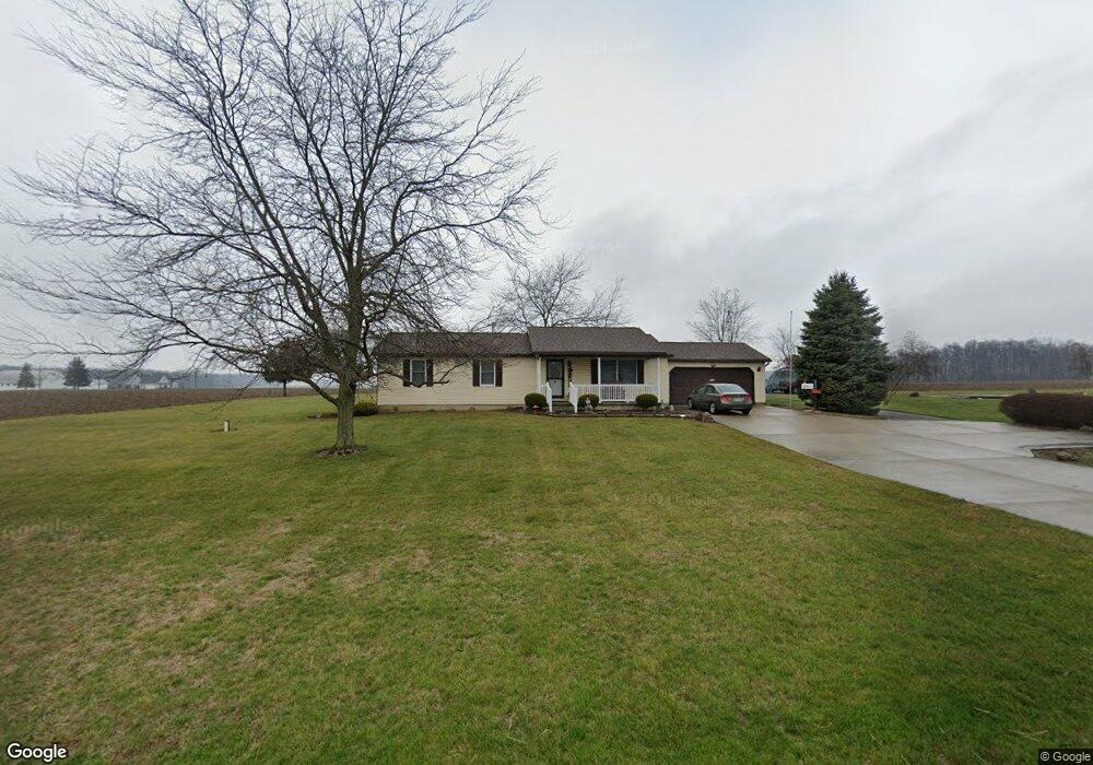
10705 Botkins Rd Botkins, OH 45306
Estimated Value: $293,000 - $314,000
3
Beds
1
Bath
1,400
Sq Ft
$216/Sq Ft
Est. Value
About This Home
This home is located at 10705 Botkins Rd, Botkins, OH 45306 and is currently estimated at $302,425, approximately $216 per square foot. 10705 Botkins Rd is a home with nearby schools including Botkins Elementary School and Botkins High School.
Ownership History
Date
Name
Owned For
Owner Type
Purchase Details
Closed on
Dec 21, 2012
Sold by
Behr Robert J and Behr Judy A
Bought by
Paul Andrew K
Current Estimated Value
Home Financials for this Owner
Home Financials are based on the most recent Mortgage that was taken out on this home.
Original Mortgage
$102,400
Outstanding Balance
$69,314
Interest Rate
3.34%
Mortgage Type
New Conventional
Estimated Equity
$233,111
Purchase Details
Closed on
Sep 25, 1998
Sold by
Dietz Clifford M
Bought by
Dietz Robert C and Dietz Lois M
Home Financials for this Owner
Home Financials are based on the most recent Mortgage that was taken out on this home.
Original Mortgage
$51,000
Interest Rate
6.99%
Mortgage Type
New Conventional
Create a Home Valuation Report for This Property
The Home Valuation Report is an in-depth analysis detailing your home's value as well as a comparison with similar homes in the area
Purchase History
| Date | Buyer | Sale Price | Title Company |
|---|---|---|---|
| Paul Andrew K | $128,000 | Western Ohio Title Agency | |
| Dietz Robert C | $182,000 | -- |
Source: Public Records
Mortgage History
| Date | Status | Borrower | Loan Amount |
|---|---|---|---|
| Open | Paul Andrew K | $102,400 | |
| Previous Owner | Dietz Robert C | $51,000 |
Source: Public Records
Tax History
| Year | Tax Paid | Tax Assessment Tax Assessment Total Assessment is a certain percentage of the fair market value that is determined by local assessors to be the total taxable value of land and additions on the property. | Land | Improvement |
|---|---|---|---|---|
| 2025 | $2,627 | $75,160 | $13,840 | $61,320 |
| 2024 | $2,627 | $75,160 | $13,840 | $61,320 |
| 2023 | $2,664 | $74,200 | $13,840 | $60,360 |
| 2022 | $2,447 | $62,060 | $11,210 | $50,850 |
| 2021 | $2,493 | $62,060 | $11,210 | $50,850 |
| 2020 | $2,493 | $62,060 | $11,210 | $50,850 |
| 2019 | $2,164 | $55,780 | $9,180 | $46,600 |
| 2018 | $2,122 | $55,780 | $9,180 | $46,600 |
| 2017 | $2,130 | $55,780 | $9,180 | $46,600 |
| 2016 | $1,759 | $46,410 | $7,520 | $38,890 |
| 2015 | $1,763 | $46,410 | $7,520 | $38,890 |
| 2014 | $1,763 | $46,410 | $7,520 | $38,890 |
| 2013 | $1,975 | $44,560 | $7,520 | $37,040 |
Source: Public Records
Map
Nearby Homes
- 19211 State Route 219
- 321 S Main St
- 407 E South St
- 121 Hanover Ct
- 122 Hanover Ct
- 101 Saxony Dr
- 103 Saxony Dr
- 101 Cedarbrook Ct
- 15031 Ohio 119
- 13400 Whitefeather Trail
- 102 E Main St
- 205 S 2nd St
- 101 W South St
- 917 Sunrise Dr
- 1100 W Auglaize St
- 602 W Benton St
- 608 W Pearl St
- 206 E Benton St
- 14333 Meranda Rd
- 307 W Auglaize St
- 10803 Botkins Rd
- 18710 Hardin Wapak Rd
- 16832 Hardin Wapak Rd
- 15406 Hardin Wapak Rd
- 11025 Botkins Rd
- 18750 Hardin Wapak Rd
- 14252 Hardin Wapak Rd
- 18499 Staley Rd
- 18475 Hardin Wapak Rd
- 10530 Botkins Rd
- 11254 Botkins Rd
- 18311 Hardin Wapak Rd
- 18111 Staley Rd
- 18211 Hardin Wapak Rd
- 18025 Staley Rd
- 11492 Botkins Rd
- 18080 Hardin Wapak Rd
- 18059 Hardin Wapak Rd
- 10201 Botkins Rd
- 18035 Hardin Wapak Rd
Your Personal Tour Guide
Ask me questions while you tour the home.