Estimated Value: $400,000 - $472,000
About This Home
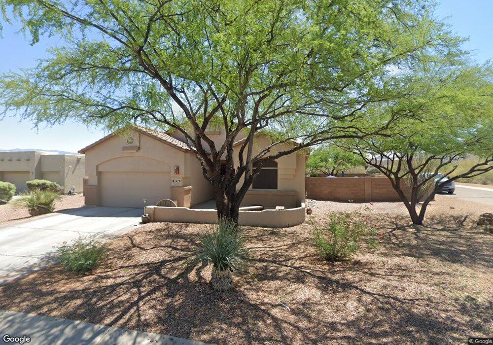
This home is located at 10747 S Wrong Peak Ct, Vail, AZ 85641 and is currently estimated at $432,450, approximately $225 per square foot. 10747 S Wrong Peak Ct is a home located in Pima County with nearby schools including Ocotillo Ridge Elementary School, Vail Academy and High School, and Old Vail Middle School.
Ownership History
We collect this data history from publicly available records. To have your information removed, we recommend requesting removal directly through your county’s website.
Purchase Details
Home Financials for this Owner
Home Financials are based on the most recent Mortgage that was taken out on this home.Home Values in the Area
Average Home Value in this Area
Purchase History
We collect this data history from publicly available records. To have your information removed, we recommend requesting removal directly through your county’s website.
| Date | Buyer | Sale Price | Title Company |
|---|---|---|---|
| $234,584 | -- |
Mortgage History
We collect this data history from publicly available records. To have your information removed, we recommend requesting removal directly through your county’s website.
| Date | Status | Borrower | Loan Amount |
|---|---|---|---|
| Closed | $188,000 | ||
| Closed | $166,000 | ||
| Closed | $41,500 | ||
| Closed | $187,650 |
Tax History
We collect this data history from publicly available records. To have your information removed, we recommend requesting removal directly through your county’s website.
| Year | Tax Paid | Tax Assessment Tax Assessment Total Assessment is a certain percentage of the fair market value that is determined by local assessors to be the total taxable value of land and additions on the property. | Land | Improvement |
|---|---|---|---|---|
| 2026 | $4,215 | $30,460 | -- | -- |
| 2025 | $4,215 | $29,010 | -- | -- |
| 2024 | $3,860 | $27,628 | -- | -- |
| 2023 | $3,860 | $26,313 | $0 | $0 |
| 2022 | $3,657 | $25,060 | $0 | $0 |
| 2021 | $3,754 | $22,730 | $0 | $0 |
| 2020 | $3,615 | $22,730 | $0 | $0 |
| 2019 | $3,579 | $22,637 | $0 | $0 |
| 2018 | $3,359 | $19,635 | $0 | $0 |
| 2017 | $3,272 | $19,635 | $0 | $0 |
| 2016 | $3,036 | $18,700 | $0 | $0 |
| 2015 | $2,925 | $17,809 | $0 | $0 |
Map
- 10835 S Heart Break Ridge Place
- 10836 S Heart Break Ridge Place
- 14260 E Placita Lago Verde
- 10528 S Coyote Melon Loop
- 14237 E Via Cerro Del Molino
- 10612 S Blackhawk Ridge Place
- 14031 E Golden Oaks Rd
- 14041 E Red Pine Place
- 14035 E Red Pine Place
- 14020 E Golden Oaks Rd
- 47 Lots E Colossal Cave Rd Unit 43
- 14217 E Hub Dr
- 13969 E Sage Hills Dr
- 13934 E Sage Hills Dr
- 13859 E Fiery Dawn Dr
- 13834 E Red Hawk Sky Trail
- 10278 S White Surrey Dr
- 10262 S White Surrey Dr
- 14241 E Bolster Dr
- 11640 S Lava Peak Rd
- 10783 S Heart Break Ridge Place
- 10771 S Heart Break Ridge Place
- 10784 S Heart Break Ridge Place
- 10772 S Heart Break Ridge Place
- 10796 S Heart Break Ridge Place
- 10748 S Wrong Peak Ct
- 10749 S Helens Dome Ct
- 10831 S Heart Break Ridge Place
- 14336 E Manhead Lookout Dr
- 10740 S Wrong Peak Ct
- 10833 S Heart Break Ridge Place
- 10741 S Helens Dome Ct
- 10739 S Wrong Peak Ct
- 14322 E Manhead Lookout Dr
- 14438 E Manhead Lookout Dr
- 10750 S Helens Dome Ct
- 10830 S Heart Break Ridge Place
- 14443 E Manhead Lookout Dr
- 10732 S Wrong Peak Ct
- 10724 S Wrong Peak Ct
Ask me questions while you tour the home.