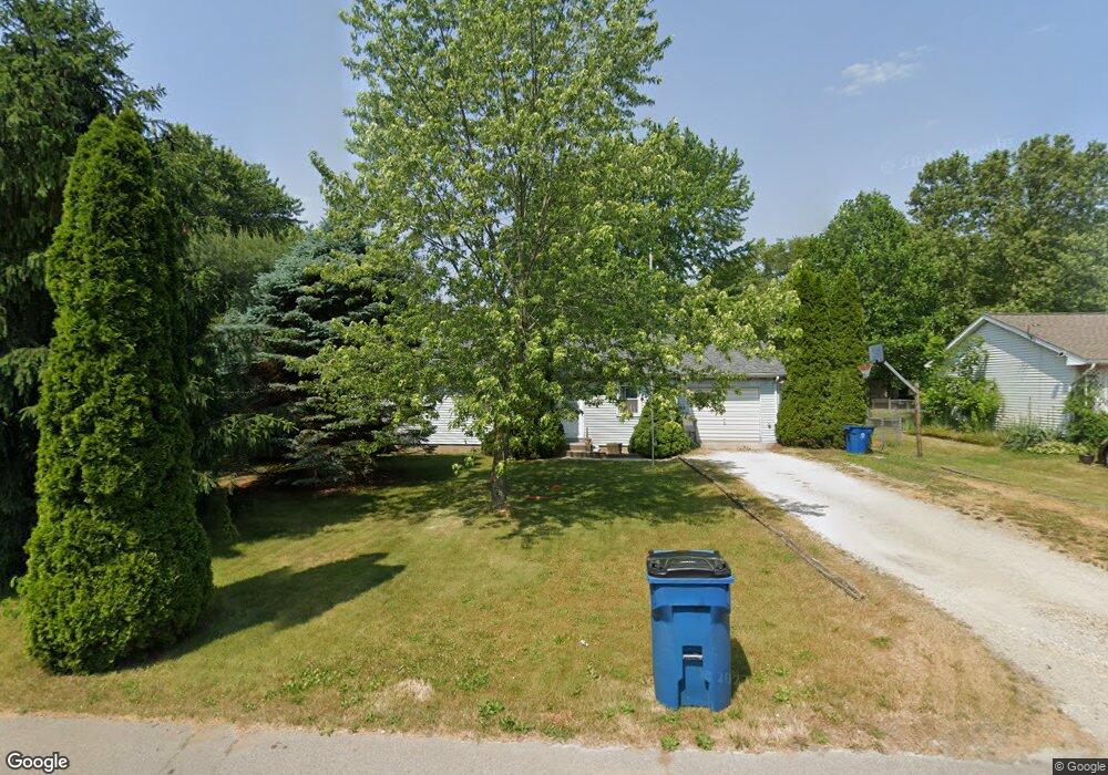
108 Grissom Dr Walkerton, IN 46574
Estimated Value: $176,599 - $223,000
3
Beds
2
Baths
1,092
Sq Ft
$180/Sq Ft
Est. Value
About This Home
This home is located at 108 Grissom Dr, Walkerton, IN 46574 and is currently estimated at $196,400, approximately $179 per square foot. 108 Grissom Dr is a home located in St. Joseph County.
Ownership History
Date
Name
Owned For
Owner Type
Purchase Details
Closed on
Nov 24, 2021
Sold by
Rensberger Lawrence Jay
Bought by
Rensberger Lawrence Jay and Rensberger Dawn R
Current Estimated Value
Home Financials for this Owner
Home Financials are based on the most recent Mortgage that was taken out on this home.
Original Mortgage
$20,000
Outstanding Balance
$13,838
Interest Rate
3.05%
Mortgage Type
Purchase Money Mortgage
Estimated Equity
$182,562
Purchase Details
Closed on
Nov 19, 2021
Sold by
Rensberger Lawrence Jay
Bought by
Rensberger Lawrence Jay and Rensberger Dawn R
Home Financials for this Owner
Home Financials are based on the most recent Mortgage that was taken out on this home.
Original Mortgage
$20,000
Outstanding Balance
$13,838
Interest Rate
3.05%
Mortgage Type
Purchase Money Mortgage
Estimated Equity
$182,562
Purchase Details
Closed on
Nov 12, 2009
Sold by
Rensberger Beth E
Bought by
Rensberger Lawrence Jay
Home Financials for this Owner
Home Financials are based on the most recent Mortgage that was taken out on this home.
Original Mortgage
$63,200
Interest Rate
5.02%
Mortgage Type
New Conventional
Create a Home Valuation Report for This Property
The Home Valuation Report is an in-depth analysis detailing your home's value as well as a comparison with similar homes in the area
Purchase History
| Date | Buyer | Sale Price | Title Company |
|---|---|---|---|
| Rensberger Lawrence Jay | -- | -- | |
| Rensberger Lawrence Jay | -- | None Available | |
| Rensberger Lawrence Jay | -- | Mckesson Title Corp |
Source: Public Records
Mortgage History
| Date | Status | Borrower | Loan Amount |
|---|---|---|---|
| Open | Rensberger Lawrence Jay | $20,000 | |
| Previous Owner | Rensberger Lawrence Jay | $63,200 |
Source: Public Records
Tax History
| Year | Tax Paid | Tax Assessment Tax Assessment Total Assessment is a certain percentage of the fair market value that is determined by local assessors to be the total taxable value of land and additions on the property. | Land | Improvement |
|---|---|---|---|---|
| 2025 | $1,206 | $120,600 | $20,800 | $99,800 |
| 2024 | $1,205 | $119,000 | $20,800 | $98,200 |
| 2023 | $1,189 | $118,900 | $20,800 | $98,100 |
| 2022 | $1,189 | $118,900 | $20,800 | $98,100 |
| 2021 | $1,036 | $102,000 | $12,100 | $89,900 |
| 2020 | $1,062 | $104,600 | $12,100 | $92,500 |
| 2019 | $1,065 | $105,600 | $13,100 | $92,500 |
| 2018 | $1,234 | $106,900 | $13,100 | $93,800 |
| 2017 | $721 | $81,600 | $10,500 | $71,100 |
| 2016 | $686 | $81,600 | $10,500 | $71,100 |
| 2014 | $673 | $82,200 | $10,500 | $71,700 |
Source: Public Records
Map
Nearby Homes
- 909 Illinois St
- 800 Illinois St
- 104 Maine St
- 606 Illinois St
- 602 Illinois St
- 604 Ohio St
- 314 Roosevelt Rd
- 203 Maple St
- 802 Roosevelt Rd
- 900 E St
- 10501 S 875 E
- 8875 N 1150 E
- 31513 Shively Rd
- 8577 N 1175 E
- 8230 Indiana 23
- 8051 N Cardinal Rd
- 8211 N Tippecanoe Dr
- 7976 N Tecumseh Rd
- 7816 N Clover Ln
- 7769 N Tippecanoe Dr
Your Personal Tour Guide
Ask me questions while you tour the home.