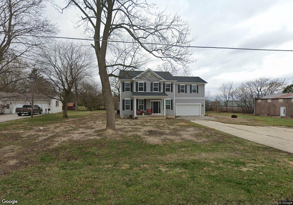
108 Rader Rd Mc Comb, OH 45858
McComb NeighborhoodEstimated Value: $311,000 - $449,477
3
Beds
3
Baths
2,724
Sq Ft
$145/Sq Ft
Est. Value
About This Home
This home is located at 108 Rader Rd, Mc Comb, OH 45858 and is currently estimated at $395,869, approximately $145 per square foot. 108 Rader Rd is a home located in Hancock County with nearby schools including McComb Elementary School, McComb Middle School, and Mccomb Local High School.
Ownership History
Date
Name
Owned For
Owner Type
Purchase Details
Closed on
Jun 30, 2003
Sold by
Gould Brian J and Gould Judy D
Bought by
Sterrett Ii Steven R
Current Estimated Value
Home Financials for this Owner
Home Financials are based on the most recent Mortgage that was taken out on this home.
Original Mortgage
$110,675
Outstanding Balance
$43,893
Interest Rate
4.37%
Mortgage Type
Purchase Money Mortgage
Estimated Equity
$351,976
Purchase Details
Closed on
Jun 1, 1993
Bought by
Gould Brian J and Gould Judy D
Purchase Details
Closed on
May 5, 1992
Bought by
Miller Steven J
Purchase Details
Closed on
Aug 21, 1985
Bought by
Danning Mark D and Danning Phyllis
Create a Home Valuation Report for This Property
The Home Valuation Report is an in-depth analysis detailing your home's value as well as a comparison with similar homes in the area
Home Values in the Area
Average Home Value in this Area
Purchase History
| Date | Buyer | Sale Price | Title Company |
|---|---|---|---|
| Sterrett Ii Steven R | $116,500 | Assured Title | |
| Gould Brian J | $73,500 | -- | |
| Miller Steven J | $69,000 | -- | |
| Danning Mark D | $60,000 | -- |
Source: Public Records
Mortgage History
| Date | Status | Borrower | Loan Amount |
|---|---|---|---|
| Open | Sterrett Ii Steven R | $110,675 |
Source: Public Records
Tax History
| Year | Tax Paid | Tax Assessment Tax Assessment Total Assessment is a certain percentage of the fair market value that is determined by local assessors to be the total taxable value of land and additions on the property. | Land | Improvement |
|---|---|---|---|---|
| 2024 | $3,866 | $113,740 | $11,480 | $102,260 |
| 2023 | $1,697 | $50,160 | $11,480 | $38,680 |
| 2022 | $2,018 | $50,160 | $11,480 | $38,680 |
| 2021 | $1,973 | $44,220 | $10,790 | $33,430 |
| 2020 | $1,725 | $44,220 | $10,790 | $33,430 |
| 2019 | $2,388 | $44,220 | $10,790 | $33,430 |
| 2018 | $2,078 | $38,680 | $9,380 | $29,300 |
| 2017 | $1,044 | $38,680 | $9,380 | $29,300 |
| 2016 | $1,475 | $38,680 | $9,380 | $29,300 |
| 2015 | $1,390 | $35,700 | $7,980 | $27,720 |
| 2014 | $1,440 | $35,700 | $7,980 | $27,720 |
| 2012 | $1,713 | $41,380 | $7,980 | $33,400 |
Source: Public Records
Map
Nearby Homes
- 128 S Liberty St
- 131 E South St
- 203 E Perrin Ave
- 257 S Main St
- 4609 Township Road 235
- 125 Park Dr N
- 7514 Township Road 95
- 4014 County Road 139
- 9894 Smokies Way
- 0 Rock Candy Rd Unit Lot 159
- 0 Rock Candy Rd Unit Lot 170
- 0 Rock Candy Rd Unit Lot 172 206819
- 0 Rock Candy Rd Unit Lot 162
- 0 Rock Candy Rd Unit Lot 171
- 0 Rock Candy Rd Unit Lot 168
- 0 Rock Candy Rd Or Bushwillow Dr Unit Lot 173
- 0 Bearcat Way Or Rock Candy Rd Unit Lot 167
- 0 Bushwillow Dr Or Rock Candy Rd Unit Lot 157
- 3200 Jurnee Dr
- 2970 Otsego Pike
Your Personal Tour Guide
Ask me questions while you tour the home.