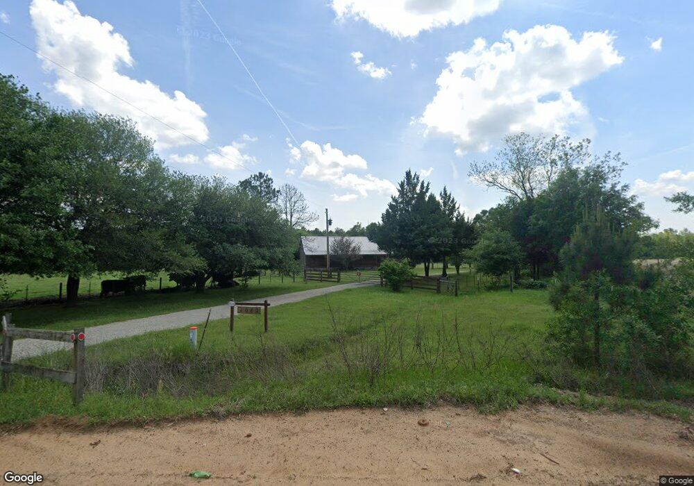
1080 John Pate Rd Ashburn, GA 31714
Estimated Value: $254,000 - $860,833
3
Beds
2
Baths
1,536
Sq Ft
$363/Sq Ft
Est. Value
About This Home
This home is located at 1080 John Pate Rd, Ashburn, GA 31714 and is currently estimated at $557,417, approximately $362 per square foot. 1080 John Pate Rd is a home with nearby schools including Turner County Elementary School, Turner County Middle School, and Turner County High School.
Ownership History
Date
Name
Owned For
Owner Type
Purchase Details
Closed on
Jun 2, 2025
Sold by
Katz Alexander J
Bought by
Sandy Sink Llc
Current Estimated Value
Purchase Details
Closed on
Dec 29, 2017
Sold by
Cannon Curtis B
Bought by
Cannon Curtis B
Purchase Details
Closed on
Dec 30, 2015
Sold by
Cannon Curtis B
Bought by
Calhoun Robert Bradley and Rice Sheila C
Purchase Details
Closed on
Mar 26, 1999
Sold by
Perry W S
Bought by
Cannon Curtis B
Create a Home Valuation Report for This Property
The Home Valuation Report is an in-depth analysis detailing your home's value as well as a comparison with similar homes in the area
Purchase History
| Date | Buyer | Sale Price | Title Company |
|---|---|---|---|
| Sandy Sink Llc | -- | -- | |
| Cannon Curtis B | -- | -- | |
| Calhoun Robert Bradley | -- | -- | |
| Cannon Curtis B | $204,500 | -- |
Source: Public Records
Tax History
| Year | Tax Paid | Tax Assessment Tax Assessment Total Assessment is a certain percentage of the fair market value that is determined by local assessors to be the total taxable value of land and additions on the property. | Land | Improvement |
|---|---|---|---|---|
| 2025 | $3,756 | $251,702 | $158,990 | $92,712 |
| 2024 | $3,805 | $240,584 | $158,990 | $81,594 |
| 2023 | $3,651 | $162,382 | $102,276 | $60,106 |
| 2022 | $3,603 | $162,382 | $102,276 | $60,106 |
| 2021 | $3,557 | $162,382 | $102,276 | $60,106 |
| 2020 | $3,514 | $162,382 | $102,276 | $60,106 |
| 2019 | $3,471 | $162,382 | $102,276 | $60,106 |
| 2018 | $5,194 | $162,382 | $102,276 | $60,106 |
| 2017 | $5,194 | $162,382 | $102,276 | $60,106 |
| 2016 | $1,681 | $113,190 | $102,276 | $10,914 |
| 2015 | -- | $116,693 | $103,100 | $13,594 |
| 2014 | -- | $116,694 | $103,100 | $13,594 |
Source: Public Records
Map
Nearby Homes
- 846 Hawpond Rd
- 2691 Amboy-Rebecca Rd
- 0 Powell Rd
- 0 Mann Rd
- 0 Arms Rd Unit 26542668
- 245 Green Valley Rd
- 0 W Depot St
- 0 Powell Rd Tract 2 Unit 24959
- 0 Powell Rd Tract 2 Unit 10678971
- 0 Julianne Rd Unit 10585704
- 0 Julianne Rd Unit 25546419
- 203 1st St E
- 0 Snowridge Rd
- 174 1st St E
- 107 10th St
- 127 Powell Rd
- 0 Powell Rd Tract 1 Rd
- 0 Lois Rd
- 104 4th St
- 221 1st St W
Your Personal Tour Guide
Ask me questions while you tour the home.