10803 Table Rock Rd Central Point, OR 97502
Estimated Value: $376,247 - $491,000
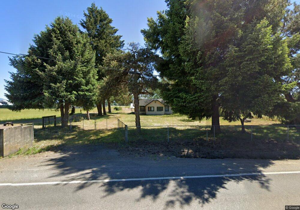
About This Home
This home is located at 10803 Table Rock Rd, Central Point, OR 97502 and is currently estimated at $419,312, approximately $361 per square foot. 10803 Table Rock Rd is a home located in Jackson County with nearby schools including Sams Valley Elementary School, Hanby Middle School, and Crater High School.
Ownership History
We collect this data history from publicly available records. To have your information removed, we recommend requesting removal directly through your county’s website.
Purchase Details
Home Financials for this Owner
Home Financials are based on the most recent Mortgage that was taken out on this home.Purchase Details
Purchase Details
Purchase History
We collect this data history from publicly available records. To have your information removed, we recommend requesting removal directly through your county’s website.
| Date | Buyer | Sale Price | Title Company |
|---|---|---|---|
| $14,250,000 | Ticor Title | ||
| $10,080,000 | Ticor Title | ||
| -- | None Available |
Mortgage History
We collect this data history from publicly available records. To have your information removed, we recommend requesting removal directly through your county’s website.
| Date | Status | Borrower | Loan Amount |
|---|---|---|---|
| Open | $7,250,000 |
Tax History
We collect this data history from publicly available records. To have your information removed, we recommend requesting removal directly through your county’s website.
| Year | Tax Paid | Tax Assessment Tax Assessment Total Assessment is a certain percentage of the fair market value that is determined by local assessors to be the total taxable value of land and additions on the property. | Land | Improvement |
|---|---|---|---|---|
| 2026 | $1,113 | $93,331 | -- | -- |
| 2025 | $1,089 | $90,736 | $17,766 | $72,970 |
| 2024 | $1,089 | $88,215 | $17,365 | $70,850 |
| 2023 | $1,054 | $85,766 | $16,976 | $68,790 |
| 2022 | $1,034 | $85,766 | $16,976 | $68,790 |
| 2021 | $1,006 | $83,391 | $16,601 | $66,790 |
| 2020 | $978 | $81,088 | $16,238 | $64,850 |
| 2019 | $957 | $76,670 | $15,530 | $61,140 |
| 2018 | $929 | $74,555 | $15,195 | $59,360 |
| 2017 | $908 | $74,555 | $15,195 | $59,360 |
| 2016 | $883 | $70,512 | $14,552 | $55,960 |
| 2015 | $852 | $70,512 | $14,552 | $55,960 |
| 2014 | $833 | $66,709 | $13,949 | $52,760 |
Map
- 9566 Old Stage Rd Unit 37
- 7465 Table Rock Terrace
- 10695 Killdee Ave
- 13290 Table Rock Rd
- 8791 Highway 234
- 6850 Downing Rd Unit 11
- 6850 Downing Rd Unit SPC 2
- 6850 Downing Rd Unit SPC 31
- 6850 Downing Rd Unit 25
- 6850 Downing Rd Unit SPC 71
- 6850 Downing Rd Unit 24
- 0 Old Stage Rd Unit 372W06A 2501
- 11322 Modoc Rd
- 11775 Michael Rd
- 0 Oregon 234
- 594 W Gregory Rd
- 380 W Gregory Rd Unit 1
- 380 W Gregory Rd Unit 1
- 6363 Harold Rd
- 8320 Blackwell Rd
- 10916 Table Rock Rd
- 10907 Table Rock Rd
- 10705 Table Rock Rd
- 10911 Table Rock Rd
- 10908 Table Rock Rd
- 10613 Table Rock Rd
- 10857 Table Rock Rd
- 10526 Table Rock Rd
- 10392 Table Rock Rd
- 10351 Table Rock Rd
- 10271 Table Rock Rd
- 11505 Table Rock Rd
- 10149 Table Rock Rd
- 10105 Table Rock Rd
- 10170 Table Rock Rd
- 10083 Table Rock Rd
- 9305 Pumice Ln
- 9363 Pumice Ln
- 9397 Pumice Ln
- 8907 High Banks Rd
Ask me questions while you tour the home.