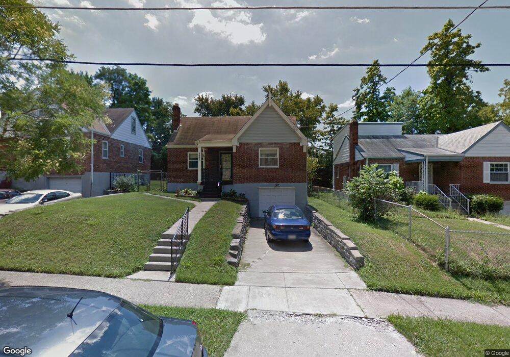
1083 Loiska Ln Cincinnati, OH 45224
College Hill NeighborhoodEstimated Value: $167,621 - $198,000
2
Beds
1
Bath
1,198
Sq Ft
$155/Sq Ft
Est. Value
About This Home
This home is located at 1083 Loiska Ln, Cincinnati, OH 45224 and is currently estimated at $185,905, approximately $155 per square foot. 1083 Loiska Ln is a home located in Hamilton County with nearby schools including Pleasant Hill Elementary School, Robert A. Taft Information Technology High School, and Shroder High School.
Ownership History
Date
Name
Owned For
Owner Type
Purchase Details
Closed on
Aug 10, 2005
Sold by
Wilson Katherine V
Bought by
Holmond Carol A
Current Estimated Value
Home Financials for this Owner
Home Financials are based on the most recent Mortgage that was taken out on this home.
Original Mortgage
$69,000
Interest Rate
5.69%
Mortgage Type
Fannie Mae Freddie Mac
Create a Home Valuation Report for This Property
The Home Valuation Report is an in-depth analysis detailing your home's value as well as a comparison with similar homes in the area
Home Values in the Area
Average Home Value in this Area
Purchase History
| Date | Buyer | Sale Price | Title Company |
|---|---|---|---|
| Holmond Carol A | -- | None Available |
Source: Public Records
Mortgage History
| Date | Status | Borrower | Loan Amount |
|---|---|---|---|
| Closed | Holmond Carol A | $69,000 |
Source: Public Records
Tax History
| Year | Tax Paid | Tax Assessment Tax Assessment Total Assessment is a certain percentage of the fair market value that is determined by local assessors to be the total taxable value of land and additions on the property. | Land | Improvement |
|---|---|---|---|---|
| 2025 | $2,122 | $44,496 | $8,845 | $35,651 |
| 2024 | $2,061 | $44,496 | $8,845 | $35,651 |
| 2023 | $2,159 | $44,496 | $8,845 | $35,651 |
| 2022 | $1,370 | $28,805 | $7,203 | $21,602 |
| 2021 | $1,303 | $28,805 | $7,203 | $21,602 |
| 2020 | $1,357 | $28,805 | $7,203 | $21,602 |
| 2019 | $1,219 | $25,267 | $6,318 | $18,949 |
| 2018 | $1,221 | $25,267 | $6,318 | $18,949 |
| 2017 | $1,152 | $25,267 | $6,318 | $18,949 |
| 2016 | $1,153 | $25,162 | $6,738 | $18,424 |
| 2015 | $1,047 | $25,162 | $6,738 | $18,424 |
| 2014 | $1,056 | $25,162 | $6,738 | $18,424 |
| 2013 | $1,125 | $25,943 | $6,948 | $18,995 |
Source: Public Records
Map
Nearby Homes
- 1197 Toluca Ct
- 6085 Capri Dr
- 6101 Capri Dr
- 6000 Capri Dr
- 5945 Leffingwell Ave
- 6045 Tahiti Dr
- 5940 Kenneth Ave
- 6123 Kingsford Dr
- 6024 Sunridge Dr
- 6629 Charann Ln
- 5974 Sunridge Dr
- 1011 Venetian Terrace
- 6071 Lantana Ave
- 5918 Lantana Ave
- 939 Venetian Terrace
- 1148 Hollywood Ave
- 1190 West Way
- 6728 Sandalwood Ln
- 6538 S Oak Knoll Dr
- 1491 Reid Ave
- 1087 Loiska Ln
- 1079 Loiska Ln
- 1091 Loiska Ln
- 1075 Loiska Ln
- 1082 Addice Way
- 1086 Addice Way
- 1078 Addice Way
- 1090 Addice Way
- 1071 Loiska Ln
- 1074 Addice Way
- 1097 Loiska Ln
- 6114 Argus Rd
- 1084 Loiska Ln
- 1094 Addice Way
- 1080 Loiska Ln
- 1088 Loiska Ln
- 1070 Addice Way
- 1067 Loiska Ln
- 1092 Loiska Ln
- 1098 Addice Way
Your Personal Tour Guide
Ask me questions while you tour the home.