
Seller's Agent in 2025
Larry Federer
Crystal Coast Realty & Home Services
(252) 723-7879
1 in this area
10 Total Sales


Estimated Value: $283,060 - $288,000
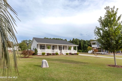
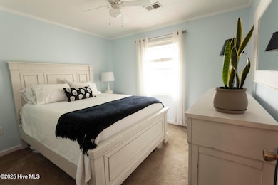
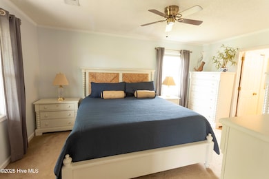
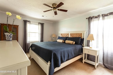
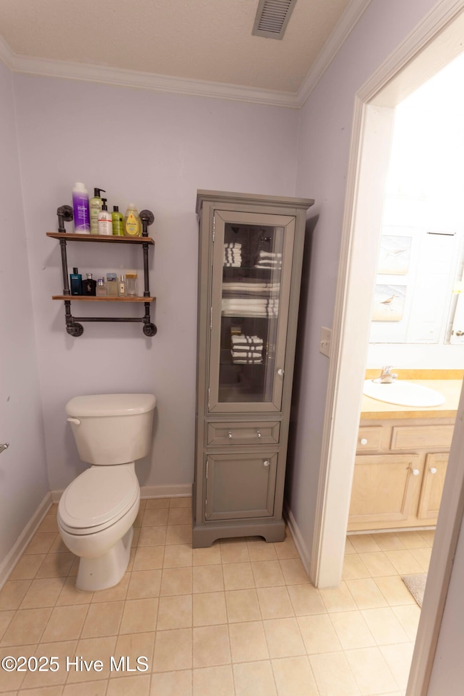
Located in Gloucester on just over a half an acre of land - this three bedroom, two bath home is the perfect retreat. Use as a primary residence or as a second home. Built in 2005, this home has a covered front porch as well as a covered back porch. Pick either to enjoy your morning coffee on. Vaulted ceilings in the living area. Kitchen area has plenty of storage with pantry storage in the laundry room. Outdoor shed for additional storage. Roof is one year old, HVAC is 7 years old. Permanent generator that runs on LP gas. Short drive to public boat ramp and is only a 20 minute boat ride to Cape Lookout National Seashore and lighthouse.
Last Agent to Sell the Property
Crystal Coast Realty & Home Services License #223882 Listed on: 08/23/2025
We collect this data history from publicly available records. To have your information removed, we recommend requesting removal directly through your county’s website.
| Date | Buyer | Sale Price | Title Company |
|---|---|---|---|
| Walker Mollie | $285,000 | None Listed On Document | |
| Rose Charles Glen | -- | None Available | |
| -- | $110,000 | -- | |
| -- | $24,000 | -- |
We collect this data history from publicly available records. To have your information removed, we recommend requesting removal directly through your county’s website.
| Date | Status | Borrower | Loan Amount |
|---|---|---|---|
| Open | Walker Mollie | $279,837 | |
| Closed | Walker Mollie | $14,250 |
| Date | Event | Price | List to Sale | Price per Sq Ft |
|---|---|---|---|---|
| 12/12/2025 12/12/25 | Sold | $285,000 | -1.7% | $209 / Sq Ft |
| 12/12/2025 12/12/25 | Off Market | $290,000 | -- | -- |
| 11/03/2025 11/03/25 | For Sale | $290,000 | 0.0% | $212 / Sq Ft |
| 11/03/2025 11/03/25 | Pending | -- | -- | -- |
| 10/27/2025 10/27/25 | Price Changed | $290,000 | -10.8% | $212 / Sq Ft |
| 10/02/2025 10/02/25 | Price Changed | $325,000 | -7.1% | $238 / Sq Ft |
| 08/23/2025 08/23/25 | For Sale | $350,000 | -- | $256 / Sq Ft |
| Year | Tax Paid | Tax Assessment Tax Assessment Total Assessment is a certain percentage of the fair market value that is determined by local assessors to be the total taxable value of land and additions on the property. | Land | Improvement |
|---|---|---|---|---|
| 2025 | $821 | $209,493 | $42,924 | $166,569 |
| 2024 | $834 | $141,498 | $37,276 | $104,222 |
| 2023 | $908 | $141,498 | $37,276 | $104,222 |
| 2022 | $879 | $141,498 | $37,276 | $104,222 |
| 2021 | $865 | $141,498 | $37,276 | $104,222 |
| 2020 | $873 | $141,498 | $37,276 | $104,222 |
| 2019 | $898 | $152,869 | $41,291 | $111,578 |
| 2017 | $891 | $152,869 | $41,291 | $111,578 |
| 2016 | $887 | $152,869 | $41,291 | $111,578 |
| 2015 | $849 | $152,869 | $41,291 | $111,578 |
| 2014 | $802 | $148,040 | $35,411 | $112,629 |
Seller's Agent in 2025
Larry Federer
Crystal Coast Realty & Home Services
(252) 723-7879
1 in this area
10 Total Sales
J
Seller Co-Listing Agent in 2025
Jesse Sumner
Crystal Coast Realty & Home Services
(910) 385-6797
1 in this area
1 Total Sale
S
Buyer's Agent in 2025
Stacey Bowen
United Country Respess Wilder
(252) 945-3198
1 in this area
49 Total Sales
Source: Hive MLS
MLS Number: 100527095
APN: 7336.04.84.6126000
Disclaimer: Certain information contained herein is derived from information provided by parties other than Homes.com. All information provided is deemed reliable, but is not guaranteed to be accurate and should be independently verified.
![]() The data relating to real estate on this web site comes in part from the Internet Data Exchange program of Hive MLS LLC. All information is deemed reliable but not guaranteed and should be independently verified. All properties are subject to prior sale, change, or withdrawal. Neither listing broker(s) nor Homesnap, Inc. shall be responsible for any typographical errors, misinformation, or misprints, and shall be held totally harmless from any damages arising from reliance upon these data. ©2026 Hive MLS LLC
The data relating to real estate on this web site comes in part from the Internet Data Exchange program of Hive MLS LLC. All information is deemed reliable but not guaranteed and should be independently verified. All properties are subject to prior sale, change, or withdrawal. Neither listing broker(s) nor Homesnap, Inc. shall be responsible for any typographical errors, misinformation, or misprints, and shall be held totally harmless from any damages arising from reliance upon these data. ©2026 Hive MLS LLC
Ask me questions while you tour the home.