Estimated Value: $174,000 - $259,000
3
Beds
2
Baths
1,741
Sq Ft
$120/Sq Ft
Est. Value
About This Home
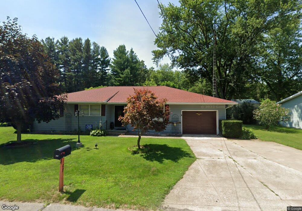
This home is located at 109 N Allen Dr, Knox, IN 46534 and is currently estimated at $208,446, approximately $119 per square foot. 109 N Allen Dr is a home located in Starke County with nearby schools including Knox Community Elementary School, Knox Community Middle School, and Knox Community High School.
Ownership History
Date
Name
Owned For
Owner Type
Purchase Details
Closed on
Dec 22, 2010
Sold by
Not Provided
Bought by
Jame Robert
Current Estimated Value
Home Financials for this Owner
Home Financials are based on the most recent Mortgage that was taken out on this home.
Original Mortgage
$73,000
Outstanding Balance
$48,162
Interest Rate
4.5%
Mortgage Type
New Conventional
Estimated Equity
$160,284
Purchase Details
Closed on
May 1, 2006
Sold by
Geppert Lucja T
Bought by
Gibson Harry P and Gibson Charlotte
Create a Home Valuation Report for This Property
The Home Valuation Report is an in-depth analysis detailing your home's value as well as a comparison with similar homes in the area
Home Values in the Area
Average Home Value in this Area
Purchase History
We collect this data history from publicly available records. To have your information removed, we recommend requesting removal directly through your county’s website.
| Date | Buyer | Sale Price | Title Company |
|---|---|---|---|
| Jame Robert | $79,000 | First Federal Savings Bank | |
| Meadows Robert James | -- | None Available | |
| Gibson Harry P | $75,000 | Starke County Abstract | |
| Gibson Harry P | -- | None Available |
Source: Public Records
Mortgage History
We collect this data history from publicly available records. To have your information removed, we recommend requesting removal directly through your county’s website.
| Date | Status | Borrower | Loan Amount |
|---|---|---|---|
| Open | Meadows Robert James | $73,000 |
Source: Public Records
Tax History
| Year | Tax Paid | Tax Assessment Tax Assessment Total Assessment is a certain percentage of the fair market value that is determined by local assessors to be the total taxable value of land and additions on the property. | Land | Improvement |
|---|---|---|---|---|
| 2025 | $1,174 | $151,500 | $13,300 | $138,200 |
| 2024 | $1,174 | $137,400 | $12,700 | $124,700 |
| 2023 | $1,017 | $126,800 | $11,600 | $115,200 |
| 2022 | $795 | $110,600 | $11,400 | $99,200 |
| 2021 | $572 | $96,000 | $11,400 | $84,600 |
| 2020 | $378 | $84,200 | $11,400 | $72,800 |
| 2019 | $221 | $77,500 | $11,400 | $66,100 |
| 2018 | $172 | $74,500 | $11,400 | $63,100 |
| 2017 | $154 | $73,100 | $11,400 | $61,700 |
| 2016 | $219 | $77,900 | $11,400 | $66,500 |
| 2014 | $188 | $77,600 | $11,400 | $66,200 |
| 2013 | $184 | $77,800 | $11,400 | $66,400 |
Source: Public Records
Map
Nearby Homes
Your Personal Tour Guide
Ask me questions while you tour the home.