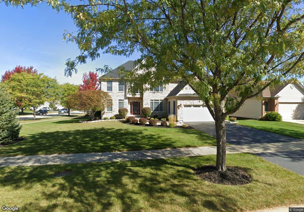
1090 Beed Ave Elburn, IL 60119
Estimated Value: $634,605 - $676,000
About This Home
This home is located at 1090 Beed Ave, Elburn, IL 60119 and is currently estimated at $654,151, approximately $186 per square foot. 1090 Beed Ave is a home located in Kane County with nearby schools including Kaneland Blackberry Creek Elementary School, Harter Middle School, and Kaneland High School.
Ownership History
We collect this data history from publicly available records. To have your information removed, we recommend requesting removal directly through your county’s website.
Purchase Details
Purchase Details
Purchase Details
Home Financials for this Owner
Home Financials are based on the most recent Mortgage that was taken out on this home.Home Values in the Area
Average Home Value in this Area
Purchase History
We collect this data history from publicly available records. To have your information removed, we recommend requesting removal directly through your county’s website.
| Date | Buyer | Sale Price | Title Company |
|---|---|---|---|
| -- | Chicago Title Insurance Co | ||
| -- | None Available | ||
| $460,000 | Chicago Title Insurance Co |
Mortgage History
We collect this data history from publicly available records. To have your information removed, we recommend requesting removal directly through your county’s website.
| Date | Status | Borrower | Loan Amount |
|---|---|---|---|
| Previous Owner | $260,000 |
Tax History
We collect this data history from publicly available records. To have your information removed, we recommend requesting removal directly through your county’s website.
| Year | Tax Paid | Tax Assessment Tax Assessment Total Assessment is a certain percentage of the fair market value that is determined by local assessors to be the total taxable value of land and additions on the property. | Land | Improvement |
|---|---|---|---|---|
| 2024 | $14,541 | $177,401 | $17,164 | $160,237 |
| 2023 | $14,033 | $160,109 | $15,491 | $144,618 |
| 2022 | $12,933 | $141,969 | $14,217 | $127,752 |
| 2021 | $12,467 | $135,881 | $13,607 | $122,274 |
| 2020 | $12,243 | $132,696 | $13,288 | $119,408 |
| 2019 | $12,252 | $130,748 | $13,093 | $117,655 |
| 2018 | $12,114 | $126,947 | $13,093 | $113,854 |
| 2017 | $11,855 | $125,504 | $12,944 | $112,560 |
| 2016 | $12,012 | $123,714 | $12,602 | $111,112 |
| 2015 | -- | $113,121 | $8,711 | $104,410 |
| 2014 | -- | $116,260 | $11,167 | $105,093 |
| 2013 | -- | $113,825 | $11,167 | $102,658 |
Map
- 990 Citizen Ave
- 1140 Independence Ave
- 1200 Independence Ave
- 834 Citizen Ave
- 692 Independence Ave
- 635 Independence Ave
- 1010 Sears Cir
- 1N164 Stargrass Ln
- 886 Simpson Ave
- 16 Derek Dr
- #11 Derek Dr
- Lot #12 Derek Dr
- Lot #5 Derek Dr
- Lot #6 Derek Dr
- Lot #7 Derek Dr
- 0S790 Rowe Rd
- Lot 9 Rowe Rd
- 721 Cherry Cir
- 436 Banbury Ave
- 212 E Kansas St
- 996 Souders Ave
- 920 Souders Ave
- 919 Souders Ave
- 915 Souders Ave
- 908 Souders Ave
- 906 Souders Ave
- 904 Souders Ave
- 1148 Souders Ave
- 1166 Souders Ave
- 1111 Souders Ave Unit 10
- 1017 Souders Ave
- 1322 Blackberry Creek Dr
- 1344 Blackberry Creek Dr
- 1135 Souders Ave
- 1173 Lance Ave
- 1119 Lance Ave
- 1120 Lance Ave
- 1300 Blackberry Creek Dr
- 1147 Souders Ave
- 1366 Blackberry Creek Dr
Ask me questions while you tour the home.