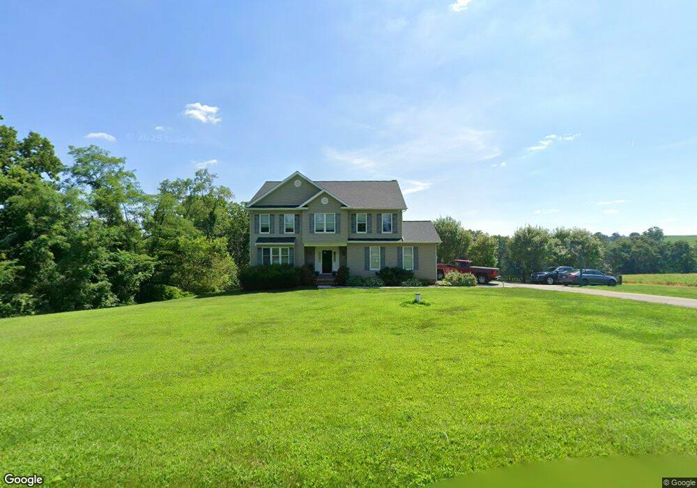
10908 Wheat Rd New Park, PA 17352
Estimated Value: $356,000 - $692,000
4
Beds
4
Baths
3,040
Sq Ft
$178/Sq Ft
Est. Value
About This Home
This home is located at 10908 Wheat Rd, New Park, PA 17352 and is currently estimated at $541,167, approximately $178 per square foot. 10908 Wheat Rd is a home located in York County with nearby schools including South Eastern Intermediate School, South Eastern Middle School, and Kennard-Dale High School.
Ownership History
Date
Name
Owned For
Owner Type
Purchase Details
Closed on
Jun 17, 2008
Sold by
Perzanowski Jason R and Hepburn Kristen B
Bought by
Perzanowski Jason R and Perzanowski Kristen B
Current Estimated Value
Purchase Details
Closed on
Jan 31, 2004
Sold by
Oberlin Scott D and Oberlin Mildred B
Bought by
Perzanowski Jason R and Hepburn Kristen B
Home Financials for this Owner
Home Financials are based on the most recent Mortgage that was taken out on this home.
Original Mortgage
$239,900
Outstanding Balance
$112,434
Interest Rate
5.82%
Mortgage Type
Purchase Money Mortgage
Estimated Equity
$428,733
Create a Home Valuation Report for This Property
The Home Valuation Report is an in-depth analysis detailing your home's value as well as a comparison with similar homes in the area
Purchase History
| Date | Buyer | Sale Price | Title Company |
|---|---|---|---|
| Perzanowski Jason R | -- | None Available | |
| Perzanowski Jason R | $299,900 | -- |
Source: Public Records
Mortgage History
| Date | Status | Borrower | Loan Amount |
|---|---|---|---|
| Open | Perzanowski Jason R | $239,900 | |
| Closed | Perzanowski Jason R | $44,950 |
Source: Public Records
Tax History
| Year | Tax Paid | Tax Assessment Tax Assessment Total Assessment is a certain percentage of the fair market value that is determined by local assessors to be the total taxable value of land and additions on the property. | Land | Improvement |
|---|---|---|---|---|
| 2025 | $9,281 | $307,820 | $55,000 | $252,820 |
| 2024 | $9,235 | $307,820 | $55,000 | $252,820 |
| 2023 | $9,235 | $307,820 | $55,000 | $252,820 |
| 2022 | $9,235 | $307,820 | $55,000 | $252,820 |
| 2021 | $8,893 | $307,820 | $55,000 | $252,820 |
| 2020 | $8,893 | $307,820 | $55,000 | $252,820 |
| 2019 | $8,862 | $307,820 | $55,000 | $252,820 |
| 2018 | $8,862 | $307,820 | $55,000 | $252,820 |
| 2017 | $8,844 | $307,820 | $55,000 | $252,820 |
| 2016 | $0 | $307,820 | $55,000 | $252,820 |
| 2015 | -- | $307,820 | $55,000 | $252,820 |
| 2014 | -- | $307,820 | $55,000 | $252,820 |
Source: Public Records
Map
Nearby Homes
- 0 Lutz Rd Unit PAYK2095052
- 0 Lutz Rd Unit PAYK2095064
- 9185 High Rock Rd
- 14731 Trout School Rd
- 1527 Main St
- 5086 Lakewood Ln
- 18183 Piedmont Rd
- 15138 Little Rd
- 0 Bedrock Rd
- 00 Bedrock Rd
- 18016 Dave Anne Cir
- 17995 Dave Anne Cir
- 55 Brakeman Dr
- 480 Hollow Rd
- 254 Hollow Rd
- 31 N Market St
- 70 Piston Ct
- 17 Charles Ave
- 29 High St
- 9 W Pennsylvania Ave
- 10762 Wheat Rd
- 10662 Wheat Rd
- 10538 Wheat Rd
- 10622 Wheat Rd
- 10584 Wheat Rd
- 10558 Wheat Rd
- 000 Wheat Rd
- 10413 Wheat Rd
- 16905 Gun Club Rd
- 16969 Gun Club Rd
- 10344 Wheat Rd
- 16925 Gun Club Rd
- 16885 Gun Club Rd
- CM-9 Leib Rd
- 16794 Gun Club Rd
- 10953 Blue Ball Rd
- 10555 Blue Ball Rd
- 10234 Wheat Rd
- 10521 Blue Ball Rd
- 17378 Maize Rd
Your Personal Tour Guide
Ask me questions while you tour the home.