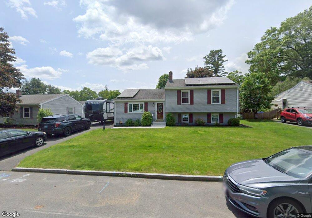
11 Baird Trace Springfield, MA 01118
East Forest Park NeighborhoodEstimated Value: $329,000 - $368,000
3
Beds
2
Baths
1,604
Sq Ft
$216/Sq Ft
Est. Value
About This Home
This home is located at 11 Baird Trace, Springfield, MA 01118 and is currently estimated at $347,187, approximately $216 per square foot. 11 Baird Trace is a home located in Hampden County with nearby schools including Frederick Harris Elementary School, M Marcus Kiley Middle, and Springfield High School of Science and Technology.
Ownership History
Date
Name
Owned For
Owner Type
Purchase Details
Closed on
May 2, 1984
Bought by
Hutchinson Richard R and Hutchinson Christine H
Current Estimated Value
Create a Home Valuation Report for This Property
The Home Valuation Report is an in-depth analysis detailing your home's value as well as a comparison with similar homes in the area
Home Values in the Area
Average Home Value in this Area
Purchase History
| Date | Buyer | Sale Price | Title Company |
|---|---|---|---|
| Hutchinson Richard R | $54,500 | -- |
Source: Public Records
Mortgage History
| Date | Status | Borrower | Loan Amount |
|---|---|---|---|
| Open | Hutchinson Richard R | $154,900 | |
| Closed | Hutchinson Richard R | $124,400 | |
| Closed | Hutchinson Richard R | $92,150 |
Source: Public Records
Tax History
| Year | Tax Paid | Tax Assessment Tax Assessment Total Assessment is a certain percentage of the fair market value that is determined by local assessors to be the total taxable value of land and additions on the property. | Land | Improvement |
|---|---|---|---|---|
| 2025 | $4,828 | $307,900 | $51,400 | $256,500 |
| 2024 | $4,849 | $301,900 | $51,400 | $250,500 |
| 2023 | $4,651 | $272,800 | $49,000 | $223,800 |
| 2022 | $4,558 | $242,200 | $49,000 | $193,200 |
| 2021 | $4,309 | $228,000 | $44,500 | $183,500 |
| 2020 | $3,892 | $199,300 | $44,500 | $154,800 |
| 2019 | $3,784 | $192,300 | $44,500 | $147,800 |
| 2018 | $3,643 | $185,100 | $44,500 | $140,600 |
| 2017 | $3,574 | $181,800 | $44,500 | $137,300 |
| 2016 | $3,226 | $164,100 | $44,500 | $119,600 |
| 2015 | $3,135 | $159,400 | $44,500 | $114,900 |
Source: Public Records
Map
Nearby Homes
- 55 Allen St
- 49 Corcoran Blvd
- 19 Manor Ct Unit 19
- 647 Plumtree Rd
- 125 Manor Ct Unit 125
- 86 Talmadge Dr
- 85 Talmadge Dr
- 24 Wands St
- 509 Plumtree Rd
- 110 W Crystal Brook Dr
- 206 Treetop Ave
- 322 Holcomb Rd
- 41 Hillside Dr
- 47 Hartford Terrace
- 119 Powell Ave
- 46 Hadley St
- 75 Gillette Cir
- 7 Ashbrook St
- 136 Thompkins Ave
- 55 Old Farm Rd
Your Personal Tour Guide
Ask me questions while you tour the home.