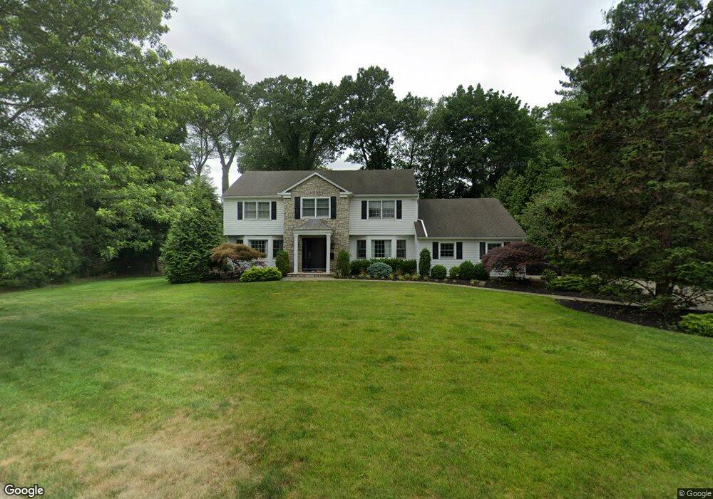
11 Emily Ct Demarest, NJ 07627
Estimated Value: $1,945,000 - $2,435,000
5
Beds
4
Baths
3,468
Sq Ft
$614/Sq Ft
Est. Value
About This Home
This home is located at 11 Emily Ct, Demarest, NJ 07627 and is currently estimated at $2,128,961, approximately $613 per square foot. 11 Emily Ct is a home located in Bergen County with nearby schools including County Road Elementary School, Demarest Middle School, and Luther Lee Emerson Elementary School.
Ownership History
Date
Name
Owned For
Owner Type
Purchase Details
Closed on
May 2, 2017
Sold by
Andriollo Paolo and Andriollo Siew Phing
Bought by
Messer Hal and Messer Alicia
Current Estimated Value
Home Financials for this Owner
Home Financials are based on the most recent Mortgage that was taken out on this home.
Original Mortgage
$1,080,000
Outstanding Balance
$857,637
Interest Rate
3.25%
Mortgage Type
Adjustable Rate Mortgage/ARM
Estimated Equity
$1,271,324
Purchase Details
Closed on
Apr 20, 2006
Sold by
Hennessey Thomas
Bought by
Andriollo Paolo and Andriollo Siew Phing
Home Financials for this Owner
Home Financials are based on the most recent Mortgage that was taken out on this home.
Original Mortgage
$1,000,000
Interest Rate
6.34%
Create a Home Valuation Report for This Property
The Home Valuation Report is an in-depth analysis detailing your home's value as well as a comparison with similar homes in the area
Home Values in the Area
Average Home Value in this Area
Purchase History
We collect this data history from publicly available records. To have your information removed, we recommend requesting removal directly through your county’s website.
| Date | Buyer | Sale Price | Title Company |
|---|---|---|---|
| Messer Hal | $1,350,000 | First American Title | |
| Andriollo Paolo | $1,580,000 | -- |
Source: Public Records
Mortgage History
We collect this data history from publicly available records. To have your information removed, we recommend requesting removal directly through your county’s website.
| Date | Status | Borrower | Loan Amount |
|---|---|---|---|
| Open | Messer Hal | $1,080,000 | |
| Previous Owner | Andriollo Paolo | $1,000,000 |
Source: Public Records
Tax History
| Year | Tax Paid | Tax Assessment Tax Assessment Total Assessment is a certain percentage of the fair market value that is determined by local assessors to be the total taxable value of land and additions on the property. | Land | Improvement |
|---|---|---|---|---|
| 2025 | $34,651 | $1,699,000 | $1,051,000 | $648,000 |
| 2024 | $33,076 | $1,133,500 | $569,500 | $564,000 |
| 2023 | $32,180 | $1,133,500 | $569,500 | $564,000 |
| 2022 | $32,180 | $1,133,500 | $569,500 | $564,000 |
| 2021 | $31,387 | $1,133,500 | $569,500 | $564,000 |
| 2020 | $30,650 | $1,133,500 | $569,500 | $564,000 |
| 2019 | $29,766 | $1,133,500 | $569,500 | $564,000 |
| 2018 | $28,848 | $1,133,500 | $569,500 | $564,000 |
| 2017 | $28,156 | $1,133,500 | $569,500 | $564,000 |
| 2016 | $27,714 | $1,133,500 | $569,500 | $564,000 |
| 2015 | $27,340 | $1,133,500 | $569,500 | $564,000 |
| 2014 | $26,751 | $1,133,500 | $569,500 | $564,000 |
Source: Public Records
Map
Nearby Homes
- 55 Forest Rd
- 16 Poplar Rd
- 22 Maplewood Rd
- 85 Orchard Rd
- 56 Northwood Ave
- 14 O Shaughnessy Ln
- 8 Ranch Ln
- 41 Orchard Rd
- 11 Stone Bridge Ct
- 24 Stone Bridge Ct
- 2 Stone Bridge Ct
- 19 Central Ave
- 22 Northwood Ave
- 7 Central Ave
- 114 Bellaire Dr
- 589 Piermont Rd
- 311 Bellaire Dr
- 414 Bellaire Dr
- 520 Homans Ave
- 232 County Rd
Your Personal Tour Guide
Ask me questions while you tour the home.