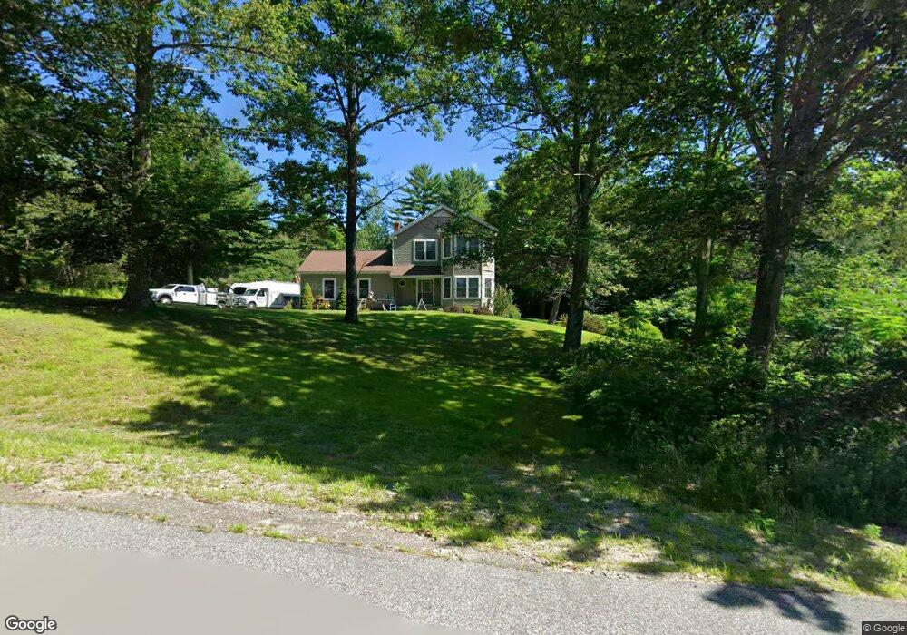
11 Field Ln Turner, ME 04282
Estimated Value: $361,336 - $590,000
4
Beds
3
Baths
3,092
Sq Ft
$153/Sq Ft
Est. Value
About This Home
This home is located at 11 Field Ln, Turner, ME 04282 and is currently estimated at $474,084, approximately $153 per square foot. 11 Field Ln is a home located in Androscoggin County with nearby schools including Tripp Middle School, Leavitt Area High School, and Calvary Christian Academy.
Ownership History
Date
Name
Owned For
Owner Type
Purchase Details
Closed on
Sep 3, 2009
Sold by
Cutter Jamison M and Cutter Sonja R
Bought by
Couturier Angela M and Couturier Jean A
Current Estimated Value
Home Financials for this Owner
Home Financials are based on the most recent Mortgage that was taken out on this home.
Original Mortgage
$212,000
Outstanding Balance
$137,660
Interest Rate
5.21%
Mortgage Type
Purchase Money Mortgage
Estimated Equity
$336,424
Purchase Details
Closed on
Apr 9, 2007
Sold by
Sonagere Kenneth A
Bought by
Cutter Jamison M and Cutter Sonja R
Home Financials for this Owner
Home Financials are based on the most recent Mortgage that was taken out on this home.
Original Mortgage
$222,400
Interest Rate
6.25%
Mortgage Type
Purchase Money Mortgage
Create a Home Valuation Report for This Property
The Home Valuation Report is an in-depth analysis detailing your home's value as well as a comparison with similar homes in the area
Home Values in the Area
Average Home Value in this Area
Purchase History
We collect this data history from publicly available records. To have your information removed, we recommend requesting removal directly through your county’s website.
| Date | Buyer | Sale Price | Title Company |
|---|---|---|---|
| Couturier Angela M | -- | -- | |
| Cutter Jamison M | -- | -- |
Source: Public Records
Mortgage History
We collect this data history from publicly available records. To have your information removed, we recommend requesting removal directly through your county’s website.
| Date | Status | Borrower | Loan Amount |
|---|---|---|---|
| Open | Cutter Jamison M | $212,000 | |
| Previous Owner | Cutter Jamison M | $264,000 | |
| Previous Owner | Cutter Jamison M | $222,400 | |
| Previous Owner | Cutter Jamison M | $41,700 |
Source: Public Records
Tax History
| Year | Tax Paid | Tax Assessment Tax Assessment Total Assessment is a certain percentage of the fair market value that is determined by local assessors to be the total taxable value of land and additions on the property. | Land | Improvement |
|---|---|---|---|---|
| 2025 | $3,849 | $283,000 | $59,300 | $223,700 |
| 2024 | $3,608 | $283,000 | $59,300 | $223,700 |
| 2023 | $3,552 | $283,000 | $59,300 | $223,700 |
| 2022 | $3,226 | $283,000 | $59,300 | $223,700 |
| 2021 | $3,226 | $283,000 | $59,300 | $223,700 |
| 2020 | $3,664 | $204,700 | $51,800 | $152,900 |
| 2019 | $3,685 | $204,700 | $51,800 | $152,900 |
| 2018 | $3,633 | $204,700 | $51,800 | $152,900 |
| 2016 | $3,451 | $204,700 | $51,800 | $152,900 |
| 2015 | $3,255 | $204,700 | $51,800 | $152,900 |
| 2014 | $3,214 | $204,700 | $51,800 | $152,900 |
| 2013 | $3,066 | $204,700 | $51,800 | $152,900 |
Source: Public Records
Map
Nearby Homes
- 0 Auburn Rd Unit 1659141
- 0 Auburn Rd Unit 1648743
- 28-1 Auburn Rd
- Lot 21 Auburn Rd
- 00000 Auburn Rd
- 8-3 Turner St
- 24 Conejo Ln
- 15 Seaward Rd
- 31 Church St
- 42 Willard Dr
- 45 N Shore Rd
- 291 Little Wilson Pond Rd
- 60 N Hill Rd
- 562 Lower St
- 29 N Hill Rd
- 4 Hilltop Ct
- 78 Sunset Blvd
- 013-003-00 Loring Hill Rd
- 5 Fox Run
- 17 Turner St
- 16 Field Ln
- 26 Field Ln
- 322 Mountainside Dr
- 76 Mountainside
- 115 Mountainside Dr
- 91 Mountainside Dr
- 59 Mountainside
- 7 Mountainside Dr
- 10 Mountainside Dr
- 24-11 Mountainside Drive Lot 24-11
- 8 Mountainside Dr
- Lot 9 Mountainside Dr
- 6 Mountainside
- 560 Buckfield Rd
- 1 Mountainside Dr
- 550 Buckfield Rd
- 0 Mountainside Dr Unit 775405
- 0 Mountain Side Dr Unit 1008684
- 0 Mountainside Dr Unit 962508
- 00 Mountainside Dr
Your Personal Tour Guide
Ask me questions while you tour the home.