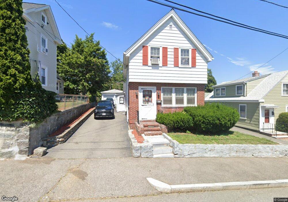
11 Larry Place Quincy, MA 02169
Estimated Value: $542,000 - $631,000
3
Beds
1
Bath
1,293
Sq Ft
$449/Sq Ft
Est. Value
About This Home
This home is located at 11 Larry Place, Quincy, MA 02169 and is currently estimated at $580,242, approximately $448 per square foot. 11 Larry Place is a home located in Norfolk County with nearby schools including South West Middle School, Lincoln-Hancock Community School, and Quincy High School.
Ownership History
Date
Name
Owned For
Owner Type
Purchase Details
Closed on
Dec 27, 2002
Sold by
Berrini Lucy M
Bought by
Palmer Edward C and Palmer Jean Mb
Current Estimated Value
Home Financials for this Owner
Home Financials are based on the most recent Mortgage that was taken out on this home.
Original Mortgage
$265,000
Outstanding Balance
$113,052
Interest Rate
6.02%
Mortgage Type
Purchase Money Mortgage
Estimated Equity
$467,190
Create a Home Valuation Report for This Property
The Home Valuation Report is an in-depth analysis detailing your home's value as well as a comparison with similar homes in the area
Purchase History
| Date | Buyer | Sale Price | Title Company |
|---|---|---|---|
| Palmer Edward C | $280,000 | -- |
Source: Public Records
Mortgage History
| Date | Status | Borrower | Loan Amount |
|---|---|---|---|
| Open | Palmer Edward C | $265,000 |
Source: Public Records
Tax History
| Year | Tax Paid | Tax Assessment Tax Assessment Total Assessment is a certain percentage of the fair market value that is determined by local assessors to be the total taxable value of land and additions on the property. | Land | Improvement |
|---|---|---|---|---|
| 2025 | $6,165 | $534,700 | $272,500 | $262,200 |
| 2024 | $5,769 | $511,900 | $259,500 | $252,400 |
| 2023 | $5,416 | $486,600 | $247,200 | $239,400 |
| 2022 | $5,190 | $433,200 | $197,700 | $235,500 |
| 2021 | $4,943 | $407,200 | $197,700 | $209,500 |
| 2020 | $4,863 | $391,200 | $197,700 | $193,500 |
| 2019 | $4,738 | $377,500 | $191,900 | $185,600 |
| 2018 | $4,596 | $344,500 | $177,700 | $166,800 |
| 2017 | $4,591 | $324,000 | $169,200 | $154,800 |
| 2016 | $4,285 | $298,400 | $153,900 | $144,500 |
| 2015 | $4,052 | $277,500 | $145,100 | $132,400 |
| 2014 | $3,913 | $263,300 | $145,100 | $118,200 |
Source: Public Records
Map
Nearby Homes
- 510 Willard St
- 156 West St
- 211 West St Unit 11B
- 211 West St Unit 12B
- 84 West St Unit 1
- 260 West St Unit 7
- 211 Copeland St
- 9 Westford St
- 40 Cross St Unit 1
- 39 Cross St
- 132 Centre St
- 87 Village Dr
- 230 Willard St Unit 102
- 230 Willard St Unit 207
- 21 Arthur St
- 51 Branch St Unit 3
- 91 Garfield St
- 79 Gilbert St
- 580 Quarry St Unit 13
- 21 Totman St Unit 205
- 7 Larry Place
- 15 Larry Place
- 17 Larry Place
- 17 Larry Place Unit 17
- 17 Larry Place Unit 1
- 475 Willard St
- 1 Larry Place
- 1 Larry Place Unit 204
- 21 Larry Place
- 1397 Fuirnace Brook Pkwy 2
- 1395-1397 Furnace Brook Pkwy Unit 1
- 1395-1397 Furnace Brook Pkwy Unit 7
- 459 Willard St Unit 305
- 459 Willard St Unit 304
- 459 Willard St Unit 302
- 459 Willard St Unit 301
- 459 Willard St Unit 205
- 459 Willard St Unit 204
- 459 Willard St Unit 203
- 459 Willard St Unit 202
Your Personal Tour Guide
Ask me questions while you tour the home.