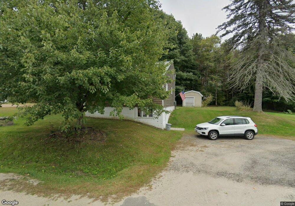
11 Newell Brook Rd Durham, ME 04222
Estimated Value: $319,129 - $524,000
3
Beds
1
Bath
1,456
Sq Ft
$302/Sq Ft
Est. Value
About This Home
This home is located at 11 Newell Brook Rd, Durham, ME 04222 and is currently estimated at $440,282, approximately $302 per square foot. 11 Newell Brook Rd is a home with nearby schools including Durham Community School and Freeport High School.
Ownership History
Date
Name
Owned For
Owner Type
Purchase Details
Closed on
Sep 29, 2009
Sold by
Wakeman John S and Wakeman Ruth E
Bought by
Wakeman Jennifer L and Wakeman Jeffrey K
Current Estimated Value
Home Financials for this Owner
Home Financials are based on the most recent Mortgage that was taken out on this home.
Original Mortgage
$90,000
Outstanding Balance
$23,817
Interest Rate
5.31%
Mortgage Type
Unknown
Estimated Equity
$416,465
Create a Home Valuation Report for This Property
The Home Valuation Report is an in-depth analysis detailing your home's value as well as a comparison with similar homes in the area
Home Values in the Area
Average Home Value in this Area
Purchase History
We collect this data history from publicly available records. To have your information removed, we recommend requesting removal directly through your county’s website.
| Date | Buyer | Sale Price | Title Company |
|---|---|---|---|
| Wakeman Jennifer L | -- | -- |
Source: Public Records
Mortgage History
We collect this data history from publicly available records. To have your information removed, we recommend requesting removal directly through your county’s website.
| Date | Status | Borrower | Loan Amount |
|---|---|---|---|
| Open | Wakeman Jennifer L | $90,000 |
Source: Public Records
Tax History
| Year | Tax Paid | Tax Assessment Tax Assessment Total Assessment is a certain percentage of the fair market value that is determined by local assessors to be the total taxable value of land and additions on the property. | Land | Improvement |
|---|---|---|---|---|
| 2025 | $4,520 | $134,600 | $54,400 | $80,200 |
| 2024 | $2,928 | $134,600 | $54,400 | $80,200 |
| 2023 | $2,874 | $134,600 | $54,400 | $80,200 |
| 2022 | $2,786 | $134,600 | $54,400 | $80,200 |
| 2021 | $2,786 | $134,600 | $54,400 | $80,200 |
| 2020 | $2,381 | $117,600 | $37,400 | $80,200 |
| 2019 | $2,381 | $117,600 | $37,400 | $80,200 |
| 2018 | $2,317 | $117,600 | $37,400 | $80,200 |
| 2016 | $2,211 | $117,600 | $37,400 | $80,200 |
| 2015 | $2,046 | $117,600 | $37,400 | $80,200 |
| 2014 | $1,958 | $117,600 | $37,400 | $80,200 |
| 2013 | $1,758 | $117,600 | $37,400 | $80,200 |
Source: Public Records
Map
Nearby Homes
- 72 Deer Creek Crossing
- Lot 114 Old Brunswick Rd
- 678 Newell Brook Rd
- 4 Arundel Ave
- 26 Stanley Dr
- 11 Sunset Ave
- 363 Lisbon St
- 606 Lisbon St
- lot# Builder Ln
- 10 Blethen St
- 318 Pinkham Brook Rd
- 278 Pinkham Brook Rd
- 41 Winter St
- 663 Lisbon St
- 163 Pinkham Brook Rd
- 10 Middle St
- Map8Lot15E Alder Way
- 272 Lisbon St
- 14 Town & Country Dr
- 3 Douglas St
- 18 Newell Brook Rd
- 22 Newell Brook Rd
- 0 Newell Brook Rd
- 15 Yankee Way
- 25 Newell Brook Rd
- 25 Newell Brook Rd
- 24 Newell Brook Rd
- 1003 Ferry Rd
- 790 Royalsborough Rd
- 0 Newall Brook
- 0 Newell Brook
- 781 Royalsborough Rd
- 1017 Ferry Rd
- 35 Newell Brook Rd
- 1016 Ferry Rd
- 36 Newell Brook Rd
- 38 Newell Brook Rd
- 1020 Ferry Rd
- 808 Royalsborough Rd
- 22 Mill Pond Rd
Your Personal Tour Guide
Ask me questions while you tour the home.