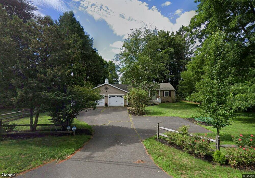
11 Riverside Rd Simsbury, CT 06070
Estimated Value: $479,000 - $525,000
About This Home
This home is located at 11 Riverside Rd, Simsbury, CT 06070 and is currently estimated at $497,893, approximately $253 per square foot. 11 Riverside Rd is a home located in Hartford County with nearby schools including Tariffville School, Henry James Memorial School, and Simsbury High School.
Ownership History
We collect this data history from publicly available records. To have your information removed, we recommend requesting removal directly through your county’s website.
Purchase Details
Purchase Details
Purchase Details
Home Values in the Area
Average Home Value in this Area
Purchase History
We collect this data history from publicly available records. To have your information removed, we recommend requesting removal directly through your county’s website.
| Date | Buyer | Sale Price | Title Company |
|---|---|---|---|
| $337,000 | -- | ||
| $164,000 | -- | ||
| $128,000 | -- |
Mortgage History
We collect this data history from publicly available records. To have your information removed, we recommend requesting removal directly through your county’s website.
| Date | Status | Borrower | Loan Amount |
|---|---|---|---|
| Closed | $179,000 | ||
| Closed | $150,000 | ||
| Closed | $145,000 | ||
| Closed | $100,000 |
Tax History
We collect this data history from publicly available records. To have your information removed, we recommend requesting removal directly through your county’s website.
| Year | Tax Paid | Tax Assessment Tax Assessment Total Assessment is a certain percentage of the fair market value that is determined by local assessors to be the total taxable value of land and additions on the property. | Land | Improvement |
|---|---|---|---|---|
| 2025 | $7,752 | $226,940 | $78,890 | $148,050 |
| 2024 | $7,559 | $226,940 | $78,890 | $148,050 |
| 2023 | $7,221 | $226,940 | $78,890 | $148,050 |
| 2022 | $6,596 | $170,750 | $85,750 | $85,000 |
| 2021 | $6,596 | $170,750 | $85,750 | $85,000 |
| 2020 | $6,333 | $170,750 | $85,750 | $85,000 |
| 2019 | $6,372 | $170,750 | $85,750 | $85,000 |
| 2018 | $6,418 | $170,750 | $85,750 | $85,000 |
| 2017 | $6,295 | $162,400 | $83,550 | $78,850 |
| 2016 | $6,028 | $162,400 | $83,550 | $78,850 |
| 2015 | $6,028 | $162,400 | $83,550 | $78,850 |
| 2014 | $6,032 | $162,400 | $83,550 | $78,850 |
Map
- 4 Hazelmeadow Place
- 7 Middle Ln
- 38 Woodland St
- 1 West St Unit 310
- 37 Old Mill Ct Unit 37
- 15 Sand Hill Rd
- 37 Bantry Rd
- 15 Bantry Rd Unit 15
- 7 Tallwood Ln
- 9 Ashton Cir
- 1 Partridge Ct Unit 1
- 6 Ronan Way
- 6 Prospect Ridge
- 7 Woodleigh Place
- 37 Deer Park Rd
- 24 Hunting Ridge Dr
- 10 Massaco St Unit R
- 7 Fairview St
- 10 Penwood Rd
- 36 Woodside Cir
- 9 Riverside Rd
- 15 Riverside Rd
- 7 Riverside Rd
- 10 Riverside Rd
- 8 Riverside Rd
- 12 Riverside Rd
- 19 Riverside Rd
- 5 Riverside Rd
- 14 Riverside Rd
- 85 E Weatogue St
- 89 E Weatogue St
- 16 Riverside Rd
- 8 Bradley Rd
- 91 E Weatogue St
- 4 Bradley Rd
- 93 E Weatogue St
- 23 Riverside Rd
- 10 Bradley Rd
- 21 Riverside Rd
- 73 E Weatogue St
Ask me questions while you tour the home.