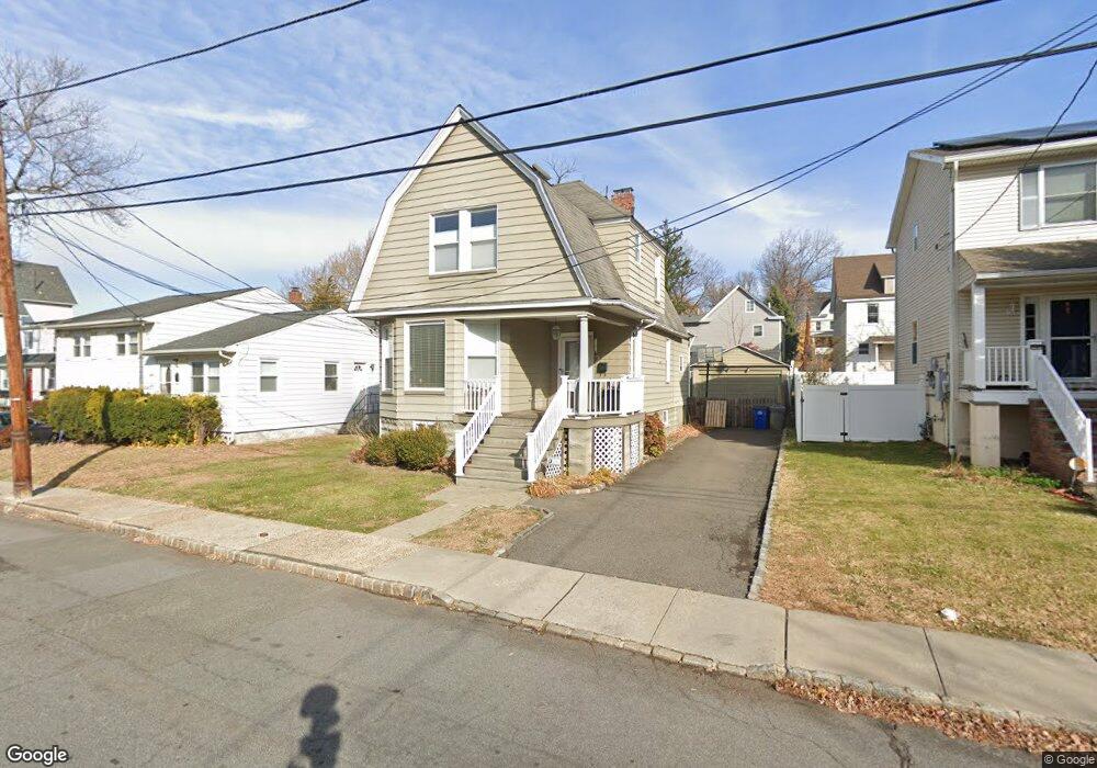
11 William St Summit, NJ 07901
Estimated Value: $722,487 - $1,077,000
Studio
--
Bath
1,416
Sq Ft
$658/Sq Ft
Est. Value
About This Home
This home is located at 11 William St, Summit, NJ 07901 and is currently estimated at $932,122, approximately $658 per square foot. 11 William St is a home located in Union County with nearby schools including L C Johnson Summit Middle School, Summit Sr High School, and Oak Knoll School of the Holy Child.
Ownership History
Date
Name
Owned For
Owner Type
Purchase Details
Closed on
Dec 8, 2009
Sold by
Mccarthy Michael L and Knost Kristan B
Bought by
Cowden Robert and Cowden Jennifer
Current Estimated Value
Home Financials for this Owner
Home Financials are based on the most recent Mortgage that was taken out on this home.
Original Mortgage
$417,000
Outstanding Balance
$273,384
Interest Rate
5%
Mortgage Type
New Conventional
Estimated Equity
$658,738
Purchase Details
Closed on
Apr 14, 1998
Sold by
Johnson Jack
Bought by
Mccarthy Michael L
Home Financials for this Owner
Home Financials are based on the most recent Mortgage that was taken out on this home.
Original Mortgage
$139,200
Interest Rate
7.11%
Create a Home Valuation Report for This Property
The Home Valuation Report is an in-depth analysis detailing your home's value as well as a comparison with similar homes in the area
Home Values in the Area
Average Home Value in this Area
Purchase History
| Date | Buyer | Sale Price | Title Company |
|---|---|---|---|
| Cowden Robert | $469,000 | None Available | |
| Mccarthy Michael L | $174,000 | -- |
Source: Public Records
Mortgage History
| Date | Status | Borrower | Loan Amount |
|---|---|---|---|
| Open | Cowden Robert | $417,000 | |
| Previous Owner | Mccarthy Michael L | $139,200 |
Source: Public Records
Tax History
| Year | Tax Paid | Tax Assessment Tax Assessment Total Assessment is a certain percentage of the fair market value that is determined by local assessors to be the total taxable value of land and additions on the property. | Land | Improvement |
|---|---|---|---|---|
| 2025 | $8,024 | $184,200 | $107,100 | $77,100 |
| 2024 | $7,970 | $184,200 | $107,100 | $77,100 |
| 2023 | $7,970 | $184,200 | $107,100 | $77,100 |
| 2022 | $7,889 | $184,200 | $107,100 | $77,100 |
| 2021 | $7,952 | $184,200 | $107,100 | $77,100 |
| 2020 | $8,031 | $184,200 | $107,100 | $77,100 |
| 2019 | $8,040 | $184,200 | $107,100 | $77,100 |
| 2018 | $7,989 | $184,200 | $107,100 | $77,100 |
| 2017 | $8,040 | $184,200 | $107,100 | $77,100 |
| 2016 | $7,922 | $184,200 | $107,100 | $77,100 |
| 2015 | $7,768 | $184,200 | $107,100 | $77,100 |
| 2014 | $7,567 | $184,200 | $107,100 | $77,100 |
Source: Public Records
Map
Nearby Homes
- 69 Elm St
- 28 Glenside Ave
- 4 Denman Place
- 133 Morris Ave
- 24 Franklin Place
- 1 Irving Place
- 80 Glenside Ave
- 1 Baltusrol Place
- 40 Prospect St
- 64 Tulip St
- 61 Tulip St
- 67 Tulip St
- 133 Summit Ave Unit 16A
- 14 Euclid Ave Unit 102
- 11 Euclid Ave Unit 4D
- 23 Euclid Ave
- 1 Euclid Ave Unit 3B
- 105 Larned Rd
- 49 Norwood Ave
- 28 Morris Ave Unit G4
- 9 William St
- 15 William St
- 17 William St
- 17 William St Unit B
- 17 William St Unit 2
- 224 Morris Ave
- 224 Morris Ave Unit B
- 224 Morris Ave Unit A
- 7 William St
- 226 Morris Ave
- 220 Morris Ave Unit 222
- 8 William St Unit 10
- 10 William St
- 14-16 William St
- 16 William St
- 218 Morris Ave
- 228 Morris Ave
- 12 William St
- 14 William St Unit 16
- 19 William St
Your Personal Tour Guide
Ask me questions while you tour the home.