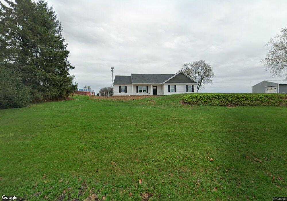
110 E Mount Airy Rd Stevens, PA 17578
Estimated Value: $150,660 - $387,000
3
Beds
1
Bath
1,310
Sq Ft
$217/Sq Ft
Est. Value
About This Home
This home is located at 110 E Mount Airy Rd, Stevens, PA 17578 and is currently estimated at $284,665, approximately $217 per square foot. 110 E Mount Airy Rd is a home located in Lancaster County with nearby schools including Clay Elementary School, Ephrata Intermediate School, and Ephrata Senior High School.
Ownership History
Date
Name
Owned For
Owner Type
Purchase Details
Closed on
May 14, 2010
Sold by
Weaver Vernon E and Weaver Rhoda B
Bought by
Weaver Vernon E and Weaver Rhoda B
Current Estimated Value
Home Financials for this Owner
Home Financials are based on the most recent Mortgage that was taken out on this home.
Original Mortgage
$50,000
Interest Rate
5.23%
Mortgage Type
New Conventional
Create a Home Valuation Report for This Property
The Home Valuation Report is an in-depth analysis detailing your home's value as well as a comparison with similar homes in the area
Home Values in the Area
Average Home Value in this Area
Purchase History
| Date | Buyer | Sale Price | Title Company |
|---|---|---|---|
| Weaver Vernon E | -- | None Available |
Source: Public Records
Mortgage History
| Date | Status | Borrower | Loan Amount |
|---|---|---|---|
| Closed | Weaver Vernon E | $50,000 |
Source: Public Records
Tax History
| Year | Tax Paid | Tax Assessment Tax Assessment Total Assessment is a certain percentage of the fair market value that is determined by local assessors to be the total taxable value of land and additions on the property. | Land | Improvement |
|---|---|---|---|---|
| 2025 | $2,182 | $51,700 | $51,100 | $600 |
| 2024 | $2,182 | $95,300 | $51,100 | $44,200 |
| 2023 | $2,126 | $95,300 | $51,100 | $44,200 |
| 2022 | $2,078 | $95,300 | $51,100 | $44,200 |
| 2021 | $2,033 | $95,300 | $51,100 | $44,200 |
| 2020 | $2,033 | $95,300 | $51,100 | $44,200 |
| 2019 | $2,004 | $95,300 | $51,100 | $44,200 |
| 2018 | $1,615 | $95,300 | $51,100 | $44,200 |
| 2017 | $2,355 | $92,400 | $29,900 | $62,500 |
| 2016 | $2,355 | $92,400 | $29,900 | $62,500 |
| 2015 | $465 | $92,400 | $29,900 | $62,500 |
| 2014 | $1,811 | $92,400 | $29,900 | $62,500 |
Source: Public Records
Map
Nearby Homes
- 100 Lilly Dr
- 46 Mollie Dr
- 2130 W Main St
- 2002 W Main St Unit 74
- 2002 W Main St Unit 63
- 791 Hopeland Rd
- 239 Kimberly Ln
- 101 Ackley Cir
- 154 Sunrise Ln
- 85 Wissler Rd
- 1001 Rebecca Dr
- 144 Sunrise Ln
- 517 Foggy Bottom Rd
- 133 Wyndale Dr
- 131 Sunrise Ln
- 00 Morning Dr
- 120 Morning Dr
- 308 Liberty St
- 1195 Seglock Rd
- 202 Roosevelt Cir
- 120 E Mount Airy Rd
- 130 E Mount Airy Rd
- 125 E Mount Airy Rd
- 150 E Mount Airy Rd
- 70 E Church Rd
- 921 Forest Hill Rd
- 11 W Girl Scout Rd
- 75 E Church Rd
- 180 E Mount Airy Rd
- 60 E Church Rd
- 50 E Church Rd
- 13 W Girl Scout Rd
- 52 E Church Rd
- 190 E Mount Airy Rd
- 931 Forest Hill Rd
- 15 W Girl Scout Rd
- 200 E Mount Airy Rd
- 941 Forest Hill Rd
- 860 Walnut Rd
- 20 W Girl Scout Rd
Your Personal Tour Guide
Ask me questions while you tour the home.