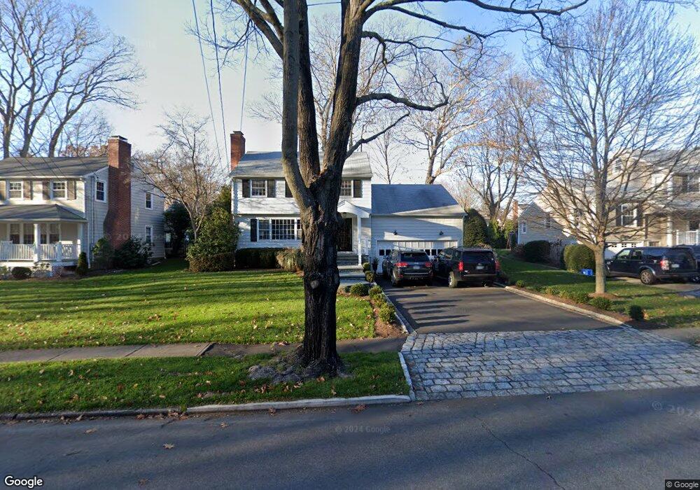
110 Limerick Rd Fairfield, CT 06824
University NeighborhoodEstimated Value: $985,905 - $1,229,000
3
Beds
2
Baths
1,784
Sq Ft
$618/Sq Ft
Est. Value
About This Home
This home is located at 110 Limerick Rd, Fairfield, CT 06824 and is currently estimated at $1,102,726, approximately $618 per square foot. 110 Limerick Rd is a home located in Fairfield County with nearby schools including Riverfield Elementary School, Roger Ludlowe Middle School, and Fairfield Ludlowe High School.
Ownership History
Date
Name
Owned For
Owner Type
Purchase Details
Closed on
Jul 14, 2006
Sold by
Krause Lois K
Bought by
Roberts Michael and Roberts Christine
Current Estimated Value
Home Financials for this Owner
Home Financials are based on the most recent Mortgage that was taken out on this home.
Original Mortgage
$521,250
Outstanding Balance
$310,478
Interest Rate
6.71%
Estimated Equity
$792,248
Create a Home Valuation Report for This Property
The Home Valuation Report is an in-depth analysis detailing your home's value as well as a comparison with similar homes in the area
Home Values in the Area
Average Home Value in this Area
Purchase History
We collect this data history from publicly available records. To have your information removed, we recommend requesting removal directly through your county’s website.
| Date | Buyer | Sale Price | Title Company |
|---|---|---|---|
| Roberts Michael | $695,000 | -- | |
| Roberts Michael | $695,000 | -- |
Source: Public Records
Mortgage History
We collect this data history from publicly available records. To have your information removed, we recommend requesting removal directly through your county’s website.
| Date | Status | Borrower | Loan Amount |
|---|---|---|---|
| Open | Roberts Michael | $521,250 | |
| Closed | Roberts Michael | $112,443 | |
| Closed | Roberts Michael | $521,250 |
Source: Public Records
Tax History
| Year | Tax Paid | Tax Assessment Tax Assessment Total Assessment is a certain percentage of the fair market value that is determined by local assessors to be the total taxable value of land and additions on the property. | Land | Improvement |
|---|---|---|---|---|
| 2025 | $11,171 | $393,470 | $258,930 | $134,540 |
| 2024 | $10,978 | $393,470 | $258,930 | $134,540 |
| 2023 | $10,824 | $393,470 | $258,930 | $134,540 |
| 2022 | $10,718 | $393,470 | $258,930 | $134,540 |
| 2021 | $10,616 | $393,470 | $258,930 | $134,540 |
| 2020 | $6,191 | $395,990 | $256,200 | $139,790 |
| 2019 | $10,609 | $395,990 | $256,200 | $139,790 |
| 2018 | $10,438 | $395,990 | $256,200 | $139,790 |
| 2017 | $6,133 | $395,990 | $256,200 | $139,790 |
| 2016 | $10,069 | $395,640 | $256,200 | $139,440 |
| 2015 | $9,853 | $397,460 | $271,950 | $125,510 |
| 2014 | $9,698 | $397,460 | $271,950 | $125,510 |
Source: Public Records
Map
Nearby Homes
- 1373 Mill Plain Rd
- 12 Sconset Dr
- 179 Lawrence Rd
- 273 Osborne Hill Rd
- 360 Duck Farm Rd
- 22 Knollwood Dr
- 88 Middlebrook Dr
- 1482 Bronson Rd
- 63 Henry St
- 125 Pepperidge Cir
- 631 Reid St
- 289 Old Mill Rd
- 10 Millspaugh Dr
- 1747 Jennings Rd
- 533 N Benson Rd
- 464 Round Hill Rd
- 73 Oxbow Rd
- 52 Robin Ln
- 1185 Stillson Rd
- 570 Unquowa Rd
- 122 Limerick Rd
- 94 Limerick Rd
- 103 Limerick Rd
- 65 Shadowood Rd
- 53 Shadowood Rd
- 83 Shadowood Rd
- 70 Limerick Rd
- 119 Limerick Rd
- 35 Shadowood Rd
- 81 Limerick Rd
- 42 Limerick Rd
- 70 Shadowood Rd
- 58 Shadowood Rd
- 86 Shadowood Rd
- 37 Limerick Rd
- 40 Shadowood Rd
- 67 Limerick Rd
- 55 Limerick Rd
- 20 Shadowood Rd
- 1522 Mill Plain Rd
Your Personal Tour Guide
Ask me questions while you tour the home.