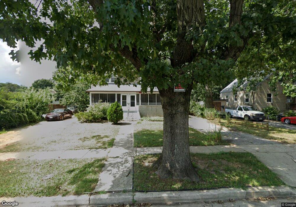
110 Range Rd Glen Burnie, MD 21061
Estimated Value: $248,158 - $318,000
Studio
1
Bath
1,152
Sq Ft
$253/Sq Ft
Est. Value
About This Home
This home is located at 110 Range Rd, Glen Burnie, MD 21061 and is currently estimated at $291,790, approximately $253 per square foot. 110 Range Rd is a home located in Anne Arundel County with nearby schools including Richard Henry Lee Elementary School, Corkran Middle School, and Glen Burnie High School.
Ownership History
Date
Name
Owned For
Owner Type
Purchase Details
Closed on
Nov 15, 2012
Sold by
May Cynthia J
Bought by
Baldwin Connie M
Current Estimated Value
Purchase Details
Closed on
Oct 20, 2012
Sold by
Baldwin Connie M and Baldwin Charles B
Bought by
Baldwin Connie M
Purchase Details
Closed on
Nov 17, 2011
Sold by
Twinfarm Llc
Bought by
May Patrick L and May Cynthia J
Home Financials for this Owner
Home Financials are based on the most recent Mortgage that was taken out on this home.
Original Mortgage
$124,000
Interest Rate
4.1%
Mortgage Type
Purchase Money Mortgage
Purchase Details
Closed on
Jun 13, 2011
Sold by
Boyer Harold G
Bought by
Twinfarm Llc
Purchase Details
Closed on
Jun 1, 2011
Sold by
Boyer Harold G and Boyer Shirley E
Bought by
Twinfarm Llc
Create a Home Valuation Report for This Property
The Home Valuation Report is an in-depth analysis detailing your home's value as well as a comparison with similar homes in the area
Home Values in the Area
Average Home Value in this Area
Purchase History
| Date | Buyer | Sale Price | Title Company |
|---|---|---|---|
| Baldwin Connie M | -- | None Available | |
| Baldwin Connie M | -- | None Available | |
| May Cynthia J | -- | None Available | |
| May Patrick L | $170,000 | None Available | |
| Twinfarm Llc | -- | -- | |
| Twinfarm Llc | -- | None Available | |
| Twinfarm Llc | -- | -- |
Source: Public Records
Mortgage History
| Date | Status | Borrower | Loan Amount |
|---|---|---|---|
| Previous Owner | May Patrick L | $124,000 |
Source: Public Records
Tax History
| Year | Tax Paid | Tax Assessment Tax Assessment Total Assessment is a certain percentage of the fair market value that is determined by local assessors to be the total taxable value of land and additions on the property. | Land | Improvement |
|---|---|---|---|---|
| 2025 | $2,884 | $239,300 | $144,700 | $94,600 |
| 2024 | $2,884 | $222,867 | $0 | $0 |
| 2023 | $2,672 | $206,433 | $0 | $0 |
| 2022 | $2,362 | $190,000 | $114,700 | $75,300 |
| 2020 | $2,238 | $182,067 | $0 | $0 |
| 2019 | $2,198 | $178,100 | $104,700 | $73,400 |
| 2018 | $1,728 | $170,400 | $0 | $0 |
| 2017 | $1,990 | $162,700 | $0 | $0 |
| 2016 | -- | $155,000 | $0 | $0 |
| 2015 | -- | $155,000 | $0 | $0 |
| 2014 | -- | $155,000 | $0 | $0 |
Source: Public Records
Map
Nearby Homes
- 505 Aquahart Rd
- 600 Oakwood Rd
- 1003 Lee Rd
- 307 Oxford Dr
- 303 Oxford Dr
- 502 Wimmer Rd
- 722 Cotter Rd
- 301 8th Ave SE
- 403 Arbor Dr
- 1412 Houghton Rd
- 1200 Whitman Dr
- 1015 Phillip Dr
- 1302 Whitman Dr
- 1011 Londonderry Dr
- 208 Gloucester Dr
- 7530 Baltimore Annapolis Blvd
- 1616 Lorimer Rd
- 1208 Montgomery Dr
- 1702 Manning Rd
- 106 3rd Ave SE
Your Personal Tour Guide
Ask me questions while you tour the home.