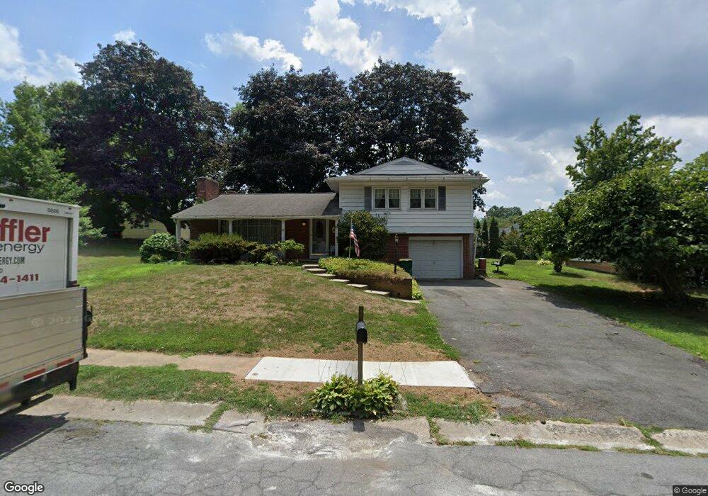
110 Red Maple Rd Lancaster, PA 17602
Conestoga Woods NeighborhoodEstimated Value: $321,823 - $386,000
About This Home
This home is located at 110 Red Maple Rd, Lancaster, PA 17602 and is currently estimated at $351,456, approximately $251 per square foot. 110 Red Maple Rd is a home located in Lancaster County with nearby schools including Burrowes Elementary School, Wickersham Elementary School, and Lincoln Middle School.
Ownership History
We collect this data history from publicly available records. To have your information removed, we recommend requesting removal directly through your county’s website.
Purchase Details
Home Financials for this Owner
Home Financials are based on the most recent Mortgage that was taken out on this home.Purchase Details
Home Values in the Area
Average Home Value in this Area
Purchase History
We collect this data history from publicly available records. To have your information removed, we recommend requesting removal directly through your county’s website.
| Date | Buyer | Sale Price | Title Company |
|---|---|---|---|
| -- | None Available | ||
| -- | None Available |
Mortgage History
We collect this data history from publicly available records. To have your information removed, we recommend requesting removal directly through your county’s website.
| Date | Status | Borrower | Loan Amount |
|---|---|---|---|
| Closed | $144,172 |
Tax History
We collect this data history from publicly available records. To have your information removed, we recommend requesting removal directly through your county’s website.
| Year | Tax Paid | Tax Assessment Tax Assessment Total Assessment is a certain percentage of the fair market value that is determined by local assessors to be the total taxable value of land and additions on the property. | Land | Improvement |
|---|---|---|---|---|
| 2026 | $5,703 | $142,600 | $38,300 | $104,300 |
| 2025 | $5,643 | $142,600 | $38,300 | $104,300 |
| 2024 | $5,643 | $142,600 | $38,300 | $104,300 |
| 2023 | $5,548 | $142,600 | $38,300 | $104,300 |
| 2022 | $5,317 | $142,600 | $38,300 | $104,300 |
| 2021 | $5,203 | $142,600 | $38,300 | $104,300 |
| 2020 | $5,203 | $142,600 | $38,300 | $104,300 |
| 2019 | $5,125 | $142,600 | $38,300 | $104,300 |
| 2018 | $2,604 | $142,600 | $38,300 | $104,300 |
| 2017 | $6,697 | $145,800 | $30,200 | $115,600 |
| 2016 | $6,636 | $145,800 | $30,200 | $115,600 |
| 2015 | $2,589 | $145,800 | $30,200 | $115,600 |
| 2014 | $5,364 | $145,800 | $30,200 | $115,600 |
Map
- 131 Garden City Dr
- 156 Conestoga Blvd
- 315 Conestoga Blvd
- 102 River Bend Park Unit 102
- 38 River Bend Park Unit 38
- 1550 Putnam Dr
- 516 Conestoga Greenway Trail
- 136 Conestoga Woods Rd
- 637 S Franklin St
- 4 Rumford Ct Unit 150
- 625 Stevens Ave
- 16 Rumford Ct
- 1031 S Duke St
- 1315 E King St
- 1036 E King St
- 464 S Ann St
- 1564 Millport Rd
- 523 Rear Juniata St
- 44 Ranck Ave
- 704 S Lime St
- 116 Red Maple Rd
- 206 Landis Dr
- 214 Landis Dr
- 45 Holly Cir
- 122 Red Maple Rd
- 113 Red Maple Rd
- 164 Landis Dr
- 224 Landis Dr
- 121 Red Maple Rd
- 35 Holly Cir
- 128 Red Maple Rd
- 65 Holly Cir
- 156 Landis Dr
- 20 Red Maple Rd
- 155 Garden City Dr
- 230 Landis Dr
- 134 Red Maple Rd
- 151 Landis Dr
- 225 Landis Dr
- 317 Holly Ln
Ask me questions while you tour the home.