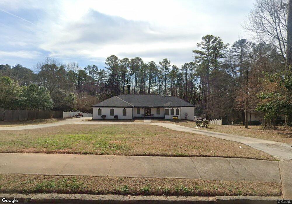
1102 Rowland Rd Stone Mountain, GA 30083
Estimated Value: $346,000 - $399,000
1
Bed
1
Bath
600
Sq Ft
$604/Sq Ft
Est. Value
About This Home
This home is located at 1102 Rowland Rd, Stone Mountain, GA 30083 and is currently estimated at $362,492, approximately $604 per square foot. 1102 Rowland Rd is a home located in DeKalb County with nearby schools including Allgood Elementary School, Freedom Middle School, and Clarkston High School.
Ownership History
Date
Name
Owned For
Owner Type
Purchase Details
Closed on
Dec 14, 2021
Sold by
Eaton A C
Bought by
Eaton A C A and Eaton Gloria J
Current Estimated Value
Purchase Details
Closed on
May 14, 2004
Sold by
Nix Fred
Bought by
Eaton Gloria J
Home Financials for this Owner
Home Financials are based on the most recent Mortgage that was taken out on this home.
Original Mortgage
$32,000
Interest Rate
6.38%
Mortgage Type
New Conventional
Purchase Details
Closed on
Oct 8, 2003
Sold by
Washington Mutual
Bought by
Nix Fred
Create a Home Valuation Report for This Property
The Home Valuation Report is an in-depth analysis detailing your home's value as well as a comparison with similar homes in the area
Home Values in the Area
Average Home Value in this Area
Purchase History
| Date | Buyer | Sale Price | Title Company |
|---|---|---|---|
| Eaton A C A | -- | -- | |
| Eaton A C | $290,000 | -- | |
| Eaton Gloria J | $40,000 | -- | |
| Nix Fred | -- | -- |
Source: Public Records
Mortgage History
| Date | Status | Borrower | Loan Amount |
|---|---|---|---|
| Previous Owner | Eaton Gloria J | $32,000 |
Source: Public Records
Tax History
| Year | Tax Paid | Tax Assessment Tax Assessment Total Assessment is a certain percentage of the fair market value that is determined by local assessors to be the total taxable value of land and additions on the property. | Land | Improvement |
|---|---|---|---|---|
| 2025 | $657 | $128,000 | $13,080 | $114,920 |
| 2024 | $686 | $132,880 | $13,080 | $119,800 |
| 2023 | $686 | $130,760 | $13,080 | $117,680 |
| 2022 | $589 | $117,600 | $13,080 | $104,520 |
| 2021 | $589 | $90,800 | $9,080 | $81,720 |
| 2020 | $593 | $90,800 | $9,080 | $81,720 |
| 2019 | $2,459 | $93,760 | $8,920 | $84,840 |
| 2018 | $1,747 | $62,000 | $8,920 | $53,080 |
| 2017 | $1,764 | $62,000 | $8,920 | $53,080 |
| 2016 | $1,605 | $64,360 | $8,920 | $55,440 |
| 2014 | $653 | $17,280 | $8,920 | $8,360 |
Source: Public Records
Map
Nearby Homes
- 1159 Rowland Rd
- 1051 Rowland Rd
- 863 Brafferton Place
- 4094 Carlisle Place
- 957 Rowland Rd
- 4447 Lake Breeze Dr
- 4048 Carlinswood Way
- 4036 Carlinswood Way
- 4408 Redan Rd
- 905 S Indian Creek Dr
- 4406 Carriage Trail
- 3958 Durham Park Rd
- 804 Rowland Rd
- 798 Durham Trail
- 4011 Redan Rd Unit 10
- 737 Allgood Valley Ct
- 1346 S Indian Creek Dr
- 4326 Autumn Hill Dr
- 4654 Hope Springs Rd
- 1239 Sharonton Dr
- 1112 Rowland Rd
- 1092 Rowland Rd
- 1109 Rowland Rd
- 4200 Durham Cir
- 1099 Rowland Rd
- 4186 Durham Cir
- 1117 Rowland Rd Unit 4
- 4210 Durham Cir
- 4178 Durham Cir
- 4291 Kings Troop Rd
- 1132 Rowland Rd Unit 2
- 1074 Rowland Rd
- 1127 Rowland Rd Unit 4
- 4170 Durham Cir
- 1135 Rowland Rd Unit 4
- 4275 Kings Troop Rd Unit 5
- 882 Wakehurst Place
- 890 Wakehurst Place Unit 5
- 1144 Rowland Rd
- 4162 Durham Cir
Your Personal Tour Guide
Ask me questions while you tour the home.