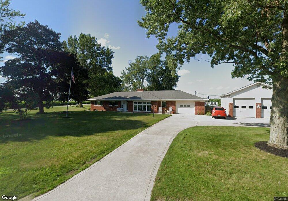
11020 County Road 1950 West Unity, OH 43570
Estimated Value: $228,000 - $250,876
3
Beds
3
Baths
2,162
Sq Ft
$109/Sq Ft
Est. Value
About This Home
This home is located at 11020 County Road 1950, West Unity, OH 43570 and is currently estimated at $236,719, approximately $109 per square foot. 11020 County Road 1950 is a home located in Williams County with nearby schools including Hilltop Elementary School and Hilltop High School.
Ownership History
Date
Name
Owned For
Owner Type
Purchase Details
Closed on
May 14, 2021
Sold by
Depew Chauncey M and Depew Douglas Lloyd
Bought by
Snider Timothy E and Snider Jackie L
Current Estimated Value
Home Financials for this Owner
Home Financials are based on the most recent Mortgage that was taken out on this home.
Original Mortgage
$175,410
Outstanding Balance
$129,280
Interest Rate
3.1%
Mortgage Type
New Conventional
Estimated Equity
$107,439
Purchase Details
Closed on
Oct 20, 1997
Sold by
Depew Chauncey M
Bought by
Depew Chauncey M
Purchase Details
Closed on
Jan 1, 1990
Bought by
Depew Chauncey M
Create a Home Valuation Report for This Property
The Home Valuation Report is an in-depth analysis detailing your home's value as well as a comparison with similar homes in the area
Purchase History
We collect this data history from publicly available records. To have your information removed, we recommend requesting removal directly through your county’s website.
| Date | Buyer | Sale Price | Title Company |
|---|---|---|---|
| Snider Timothy E | $194,900 | None Available | |
| Depew Chauncey M | -- | -- | |
| Depew Chauncey M | -- | -- |
Source: Public Records
Mortgage History
We collect this data history from publicly available records. To have your information removed, we recommend requesting removal directly through your county’s website.
| Date | Status | Borrower | Loan Amount |
|---|---|---|---|
| Open | Snider Timothy E | $175,410 |
Source: Public Records
Tax History
| Year | Tax Paid | Tax Assessment Tax Assessment Total Assessment is a certain percentage of the fair market value that is determined by local assessors to be the total taxable value of land and additions on the property. | Land | Improvement |
|---|---|---|---|---|
| 2025 | $2,602 | $71,750 | $6,790 | $64,960 |
| 2024 | $2,602 | $71,750 | $6,790 | $64,960 |
| 2023 | $2,651 | $56,840 | $6,930 | $49,910 |
| 2022 | $2,505 | $56,840 | $6,930 | $49,910 |
| 2021 | $2,121 | $56,840 | $6,930 | $49,910 |
| 2020 | $1,754 | $47,360 | $5,780 | $41,580 |
| 2019 | $1,725 | $47,360 | $5,780 | $41,580 |
| 2018 | $1,676 | $47,360 | $5,780 | $41,580 |
| 2017 | $1,690 | $46,480 | $6,160 | $40,320 |
| 2016 | $1,607 | $46,480 | $6,160 | $40,320 |
| 2015 | $1,607 | $46,480 | $6,160 | $40,320 |
| 2014 | $1,562 | $42,250 | $5,600 | $36,650 |
| 2013 | $1,540 | $42,250 | $5,600 | $36,650 |
Source: Public Records
Map
Nearby Homes
- 111 Leigh Rd
- 613 W Jackson St
- 611 W Jackson St
- 000 W Jackson
- 502 N Lincoln St
- 108 E Rings St
- 402 N Liberty St
- 9019 19-50 Rd
- 8906 County Road 21
- 16806 US Highway 20a Unit 20 & 24
- 16806 U S 20a
- 22227 Us Highway 20a
- 8437 18 Rd
- 21184 20n Rd Unit Tract 1
- 21184 20n Rd Unit Tract 3
- 20-n Road Unit Tract 2
- 14640 U S 20a
- 102 W Lynn St
- 301 Horton St
- 106 W Lynn St
- 11020 County Road 19-50
- 11044 County Road 1950
- 10988 County Road 1950
- 19652 County Road K
- 11066 County Road 1950
- 11090 County Road 1950
- 11100 County Road 1950
- 11100 County Road 19-50
- 11188 County Road 1950
- 11160 Us Highway 127
- 11261 Us Highway 127
- 11325 Us Highway 127
- 19915 County Road K
- 11367 Us Highway 127
- 11367 US Hwy 127
- 11439 Us Highway 127
- 11487 Us Highway 127
- 0 C R J Unit 4637342
- 0 C R J Unit 4641448
- 000 C R J (41 66 Acres)
Your Personal Tour Guide
Ask me questions while you tour the home.