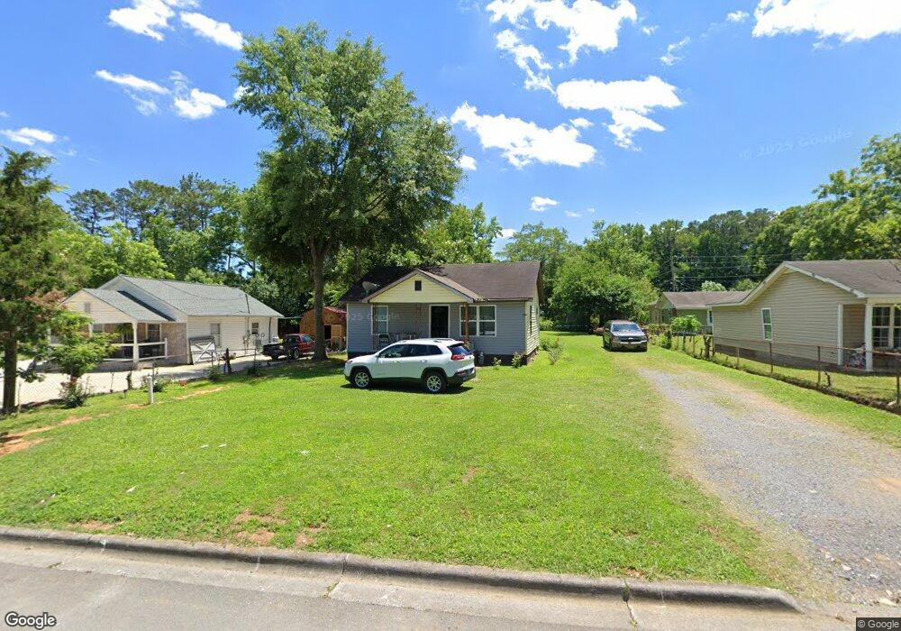
1104 Foster St Dalton, GA 30721
Estimated Value: $142,000 - $172,370
2
Beds
1
Bath
962
Sq Ft
$166/Sq Ft
Est. Value
About This Home
This home is located at 1104 Foster St, Dalton, GA 30721 and is currently estimated at $159,843, approximately $166 per square foot. 1104 Foster St is a home located in Whitfield County with nearby schools including Roan Elementary School, Dalton High School, and Christian Heritage School.
Ownership History
Date
Name
Owned For
Owner Type
Purchase Details
Closed on
Dec 15, 2023
Sold by
Jbce Properties Llc and Magana Silvia
Bought by
Urias Maria C
Current Estimated Value
Home Financials for this Owner
Home Financials are based on the most recent Mortgage that was taken out on this home.
Original Mortgage
$147,250
Outstanding Balance
$144,445
Interest Rate
7.76%
Mortgage Type
New Conventional
Estimated Equity
$15,398
Purchase Details
Closed on
Sep 7, 2023
Sold by
Ross Jewell
Bought by
Jbce Properties Llc and Silviamagana
Purchase Details
Closed on
Apr 3, 2009
Sold by
Federal Home Loan Mortgage Corporation
Bought by
Ross Jewell
Purchase Details
Closed on
Feb 3, 2009
Sold by
Naranjo Sergio
Bought by
Branch Banking Co
Purchase Details
Closed on
Mar 14, 2006
Sold by
Charter Barbara
Bought by
Naranjo Sergio
Purchase Details
Closed on
Dec 1, 1999
Bought by
Charter Barbara
Create a Home Valuation Report for This Property
The Home Valuation Report is an in-depth analysis detailing your home's value as well as a comparison with similar homes in the area
Purchase History
We collect this data history from publicly available records. To have your information removed, we recommend requesting removal directly through your county’s website.
| Date | Buyer | Sale Price | Title Company |
|---|---|---|---|
| Urias Maria C | $155,000 | None Listed On Document | |
| Jbce Properties Llc | $90,000 | None Listed On Document | |
| Ross Jewell | $32,551 | -- | |
| Branch Banking Co | $59,900 | -- | |
| Naranjo Sergio | $85,000 | -- | |
| Charter Barbara | $42,000 | -- |
Source: Public Records
Mortgage History
We collect this data history from publicly available records. To have your information removed, we recommend requesting removal directly through your county’s website.
| Date | Status | Borrower | Loan Amount |
|---|---|---|---|
| Open | Urias Maria C | $147,250 |
Source: Public Records
Tax History
| Year | Tax Paid | Tax Assessment Tax Assessment Total Assessment is a certain percentage of the fair market value that is determined by local assessors to be the total taxable value of land and additions on the property. | Land | Improvement |
|---|---|---|---|---|
| 2025 | $1,752 | $54,108 | $8,400 | $45,708 |
| 2024 | $1,752 | $54,108 | $8,400 | $45,708 |
| 2023 | $1,338 | $36,125 | $12,420 | $23,705 |
| 2022 | $979 | $28,434 | $12,420 | $16,014 |
| 2021 | $981 | $28,434 | $12,420 | $16,014 |
| 2020 | $1,019 | $28,434 | $12,420 | $16,014 |
| 2019 | $1,050 | $28,434 | $12,420 | $16,014 |
| 2018 | $1,066 | $28,434 | $12,420 | $16,014 |
| 2017 | $1,026 | $28,434 | $12,420 | $16,014 |
| 2016 | $880 | $24,225 | $9,660 | $14,565 |
| 2014 | $800 | $24,225 | $9,660 | $14,565 |
| 2013 | -- | $24,224 | $9,660 | $14,564 |
Source: Public Records
Map
Nearby Homes
- 307 N Bogle St
- 301B Fields Ave
- 204 N Bogle St
- 303 Janice St
- 825 Martin Luther King jr Blvd
- 306 Robinwood Dr
- 601 Juniper Ave
- 1114 Underwood St
- 432 4th Ave
- 1300 Ludie St
- 626 Fifth Ave
- 1104 May St
- 230 Henderson St
- 171 Keith St
- 404 Paige St
- 406 Lester Ave
- 514 Sheridan Ave
- 0 Underwood St Unit 129860
- 107 Van Buren Dr
- 429 S Glenwood Ave
- 1102 Foster St
- 1102 Foster St
- 1013 Nelson Dr
- 1106 Foster St
- 1108 Foster St
- 1100 Foster St
- 1103 Foster St
- 1019 Nelson St
- 1017 Nelson St Unit 1
- 1021 Nelson St
- 1023 Foster St
- 1012 Foster St
- 1110 Foster St
- 1031 Foster St
- 1011 Nelson St
- 1107 Foster St
- 1103 Nelson St
- 1019 Foster St
- 1012 Nelson St
- 1010 Foster St
Your Personal Tour Guide
Ask me questions while you tour the home.