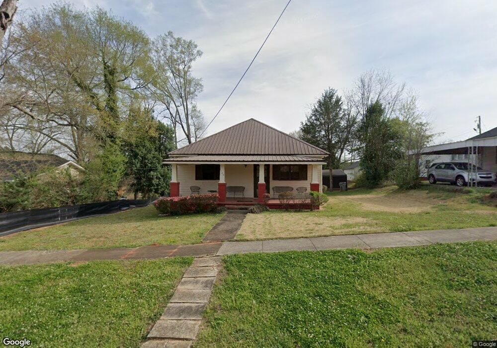
1105 2nd Ave Lagrange, GA 30240
Estimated Value: $94,359 - $161,000
3
Beds
1
Bath
1,328
Sq Ft
$94/Sq Ft
Est. Value
About This Home
This home is located at 1105 2nd Ave, Lagrange, GA 30240 and is currently estimated at $124,340, approximately $93 per square foot. 1105 2nd Ave is a home with nearby schools including Berta Weathersbee Elementary School, Whitesville Road Elementary School, and Rosemont Elementary School.
Ownership History
Date
Name
Owned For
Owner Type
Purchase Details
Closed on
Jul 12, 1980
Sold by
Bonner Phillip B and Bonner Lynn H
Bought by
Mccutchen Willie H
Current Estimated Value
Purchase Details
Closed on
Aug 18, 1979
Sold by
Smallwood Roy T and Smallwood Glenda A
Bought by
Bonner Phillip B and Bonner Lynn H
Purchase Details
Closed on
Jan 1, 1972
Sold by
Culpepper Tonnie L and Culpepper Lucie E
Bought by
Smallwood Roy T and Smallwood Glenda A
Purchase Details
Closed on
Jun 1, 1969
Sold by
William D Newell
Bought by
Culpepper Tonnie L and Culpepper Lucie E
Purchase Details
Closed on
Jan 1, 1952
Sold by
Callaway Comm Fdn
Bought by
William D Newell
Create a Home Valuation Report for This Property
The Home Valuation Report is an in-depth analysis detailing your home's value as well as a comparison with similar homes in the area
Purchase History
| Date | Buyer | Sale Price | Title Company |
|---|---|---|---|
| Mccutchen Willie H | $30,900 | -- | |
| Bonner Phillip B | $26,800 | -- | |
| Smallwood Roy T | -- | -- | |
| Culpepper Tonnie L | -- | -- | |
| William D Newell | -- | -- |
Source: Public Records
Tax History
| Year | Tax Paid | Tax Assessment Tax Assessment Total Assessment is a certain percentage of the fair market value that is determined by local assessors to be the total taxable value of land and additions on the property. | Land | Improvement |
|---|---|---|---|---|
| 2025 | -- | $33,560 | $3,560 | $30,000 |
| 2024 | -- | $29,080 | $3,560 | $25,520 |
| 2023 | $0 | $27,240 | $3,560 | $23,680 |
| 2022 | $701 | $25,120 | $3,560 | $21,560 |
| 2021 | $689 | $22,840 | $3,560 | $19,280 |
| 2020 | $689 | $22,840 | $3,560 | $19,280 |
| 2019 | $635 | $21,040 | $3,560 | $17,480 |
| 2018 | $0 | $21,040 | $3,560 | $17,480 |
| 2017 | $635 | $21,040 | $3,560 | $17,480 |
| 2016 | $0 | $20,134 | $3,552 | $16,582 |
| 2015 | -- | $20,134 | $3,552 | $16,582 |
| 2014 | -- | $21,231 | $3,552 | $17,679 |
| 2013 | -- | $21,945 | $3,552 | $18,393 |
Source: Public Records
Map
Nearby Homes
- 1304 Forrest Ave
- 1405 Forrest Ave
- 1402 Forrest Ave
- 1308 Forrest Ave
- 900 B N Pkwy
- 1015 Stonewall St
- 1017 Stonewall St
- 812 Elm St
- 1205 Park Ave
- 613 S Lee St
- 1308 Park Ave
- 109 Garfield St
- 606 Poplar St
- 606 S Lee St
- 517 Jefferson St
- 1311 Juniper St
- 1300 Murphy Ave
- 1808 Murphy Ave
- 1520 Brownwood Ave
- 202 Parker Ln
Your Personal Tour Guide
Ask me questions while you tour the home.