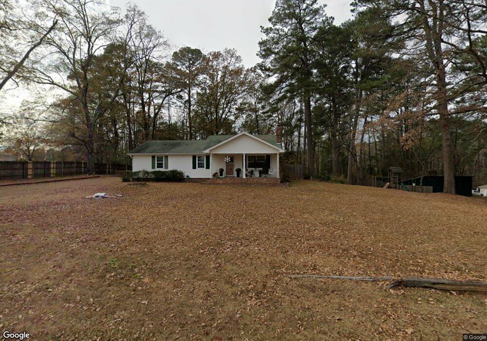
1109 N Red St Sheridan, AR 72150
Estimated Value: $233,000 - $282,000
About This Home
This home is located at 1109 N Red St, Sheridan, AR 72150 and is currently estimated at $261,606, approximately $106 per square foot. 1109 N Red St is a home located in Grant County.
Ownership History
We collect this data history from publicly available records. To have your information removed, we recommend requesting removal directly through your county’s website.
Purchase Details
Home Financials for this Owner
Home Financials are based on the most recent Mortgage that was taken out on this home.Purchase Details
Home Values in the Area
Average Home Value in this Area
Purchase History
We collect this data history from publicly available records. To have your information removed, we recommend requesting removal directly through your county’s website.
| Date | Buyer | Sale Price | Title Company |
|---|---|---|---|
| $170,000 | Professional Land Title Comp | ||
| $139,000 | -- |
Mortgage History
We collect this data history from publicly available records. To have your information removed, we recommend requesting removal directly through your county’s website.
| Date | Status | Borrower | Loan Amount |
|---|---|---|---|
| Open | $140,000 |
Tax History
We collect this data history from publicly available records. To have your information removed, we recommend requesting removal directly through your county’s website.
| Year | Tax Paid | Tax Assessment Tax Assessment Total Assessment is a certain percentage of the fair market value that is determined by local assessors to be the total taxable value of land and additions on the property. | Land | Improvement |
|---|---|---|---|---|
| 2025 | $900 | $44,360 | $3,600 | $40,760 |
| 2024 | $1,364 | $30,300 | $2,210 | $28,090 |
| 2023 | $939 | $30,300 | $2,210 | $28,090 |
| 2022 | $989 | $30,300 | $2,210 | $28,090 |
| 2021 | $989 | $30,300 | $2,210 | $28,090 |
| 2020 | $1,051 | $31,690 | $6,000 | $25,690 |
| 2019 | $1,051 | $31,690 | $6,000 | $25,690 |
| 2018 | $1,076 | $31,690 | $6,000 | $25,690 |
| 2017 | $1,076 | $31,690 | $6,000 | $25,690 |
| 2015 | -- | $31,040 | $6,000 | $25,040 |
| 2014 | -- | $31,040 | $6,000 | $25,040 |
| 2012 | -- | $31,040 | $6,000 | $25,040 |
Map
- 63 Horton Hills Dr
- 9 Horton Ln
- 7 Christen Ln
- 5 Smokey Ridge Ct
- 1000 N Arch St
- 1 Rose Ct
- 912 W Vine St
- 100 W Sunset Dr
- 1400 Skyline Dr
- 205 W 7th St
- 3400 U S Highway 270
- 923 W Center St
- 304 N Arch St
- 1502 W Center St
- 77 N Grant St
- 305 N Oak St
- 1201 N Rock St
- 12 Sayde Ln
- 411 W Center St Unit 270
- 2825 Hwy 35n
- 9 Pinecrest Cir
- 14 Pinecrest Cir
- 0 Red Street (Tract A) Unit 21032782
- 38 Horton Ln
- 0 Red Street (Tract B) Unit 21032786
- 62 Horton Ln
- 1100 N Red St
- 64 Horton Ln
- 706 W 11th St
- 22 Pinecrest Cir
- 1194 N Red St
- 723 Red Sheridan St
- Lot 3 & 4 Horton Ln
- 29 Horton Ln
- 33 Horton Ln
- 35 Horton Ln
- 65 Horton Hills Dr
- 1009 N Red St
- N Red St
- W 11th St
Ask me questions while you tour the home.