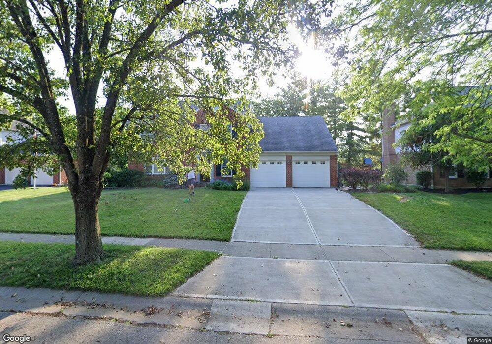
11093 Allenhurst Blvd W Cincinnati, OH 45241
Estimated Value: $393,688 - $537,000
About This Home
This home is located at 11093 Allenhurst Blvd W, Cincinnati, OH 45241 and is currently estimated at $458,422, approximately $217 per square foot. 11093 Allenhurst Blvd W is a home located in Hamilton County with nearby schools including Sharonville Elementary School, Princeton Community Middle School, and Princeton High School.
Ownership History
We collect this data history from publicly available records. To have your information removed, we recommend requesting removal directly through your county’s website.
Purchase Details
Purchase Details
Home Financials for this Owner
Home Financials are based on the most recent Mortgage that was taken out on this home.Purchase Details
Home Financials for this Owner
Home Financials are based on the most recent Mortgage that was taken out on this home.Home Values in the Area
Average Home Value in this Area
Purchase History
We collect this data history from publicly available records. To have your information removed, we recommend requesting removal directly through your county’s website.
| Date | Buyer | Sale Price | Title Company |
|---|---|---|---|
| -- | Attorney | ||
| $237,000 | -- | ||
| $195,500 | -- |
Mortgage History
We collect this data history from publicly available records. To have your information removed, we recommend requesting removal directly through your county’s website.
| Date | Status | Borrower | Loan Amount |
|---|---|---|---|
| Previous Owner | $189,600 | ||
| Previous Owner | $185,700 | ||
| Closed | $27,400 |
Tax History
We collect this data history from publicly available records. To have your information removed, we recommend requesting removal directly through your county’s website.
| Year | Tax Paid | Tax Assessment Tax Assessment Total Assessment is a certain percentage of the fair market value that is determined by local assessors to be the total taxable value of land and additions on the property. | Land | Improvement |
|---|---|---|---|---|
| 2025 | $4,885 | $102,718 | $19,075 | $83,643 |
| 2023 | $4,173 | $102,718 | $19,075 | $83,643 |
| 2022 | $4,331 | $85,680 | $18,886 | $66,794 |
| 2021 | $4,210 | $85,680 | $18,886 | $66,794 |
| 2020 | $4,259 | $85,680 | $18,886 | $66,794 |
| 2019 | $4,248 | $78,603 | $17,325 | $61,278 |
| 2018 | $3,985 | $78,603 | $17,325 | $61,278 |
| 2017 | $3,731 | $78,603 | $17,325 | $61,278 |
| 2016 | $3,795 | $79,293 | $16,853 | $62,440 |
| 2015 | $3,832 | $79,293 | $16,853 | $62,440 |
| 2014 | $3,845 | $79,293 | $16,853 | $62,440 |
| 2013 | $3,510 | $74,106 | $15,750 | $58,356 |
Map
- 4005 Haverstraw Dr
- 4210 Allenhurst Close Ct
- 10938 Timberwood Ct
- 10994 Timberwood Ln
- 10903 Sharondale Rd
- 10865 Lemarie Dr
- 10749 Plainfield Rd
- 3610 Grandview Ave
- 10660 Bridlepath Ln
- 3524 Cornell Rd
- 11662 Sharonwoods Ct
- 3460 Grandview Ave
- 11122 Main St
- 12 Woodsview Ln
- 4074 E Kemper Rd
- 10854 Wyscarver Rd
- 4254 Fox Hollow Dr
- 3319 Mcgrew St
- 3571 Horncastle Dr
- 5310 E Kemper Rd
- 11099 Allenhurst Blvd E
- 11087 Allenhurst Blvd W
- 11099 Allenhurst Blvd W
- 11122 Mulligan St
- 11128 Mulligan St
- 11116 Mulligan St
- 11132 Mulligan St
- 11105 Allenhurst Blvd W
- 11081 Allenhurst Blvd W
- 11092 Allenhurst Blvd W
- 11086 Allenhurst Blvd W
- 11138 Mulligan St
- 11108 Mulligan St
- 11098 Allenhurst Blvd W
- 4078 Malaer Dr
- 11111 Allenhurst Blvd W
- 11144 Mulligan St
- 11119 Mulligan St
- 11104 Allenhurst Blvd W
- 11093 Zaring Ct
Ask me questions while you tour the home.