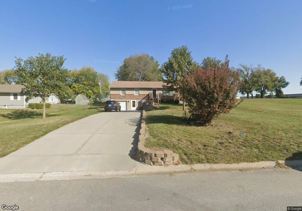
111 Spring St Pleasant Hill, MO 64080
Estimated Value: $257,289 - $285,000
About This Home
This home is located at 111 Spring St, Pleasant Hill, MO 64080 and is currently estimated at $274,072, approximately $229 per square foot. 111 Spring St is a home located in Cass County with nearby schools including Pleasant Hill Primary School, Pleasant Hill Elementary School, and Pleasant Hill Middle School.
Ownership History
We collect this data history from publicly available records. To have your information removed, we recommend requesting removal directly through your county’s website.
Purchase Details
Purchase Details
Home Financials for this Owner
Home Financials are based on the most recent Mortgage that was taken out on this home.Home Values in the Area
Average Home Value in this Area
Purchase History
We collect this data history from publicly available records. To have your information removed, we recommend requesting removal directly through your county’s website.
| Date | Buyer | Sale Price | Title Company |
|---|---|---|---|
| -- | None Listed On Document | ||
| -- | Kansas City Title Inc |
Mortgage History
We collect this data history from publicly available records. To have your information removed, we recommend requesting removal directly through your county’s website.
| Date | Status | Borrower | Loan Amount |
|---|---|---|---|
| Closed | $216,682 | ||
| Closed | $30,000 | ||
| Closed | $225,000 | ||
| Closed | $32,000 | ||
| Closed | $5,000 | ||
| Closed | $77,903 |
Tax History
We collect this data history from publicly available records. To have your information removed, we recommend requesting removal directly through your county’s website.
| Year | Tax Paid | Tax Assessment Tax Assessment Total Assessment is a certain percentage of the fair market value that is determined by local assessors to be the total taxable value of land and additions on the property. | Land | Improvement |
|---|---|---|---|---|
| 2025 | $1,984 | $31,720 | $4,470 | $27,250 |
| 2024 | $1,984 | $27,710 | $4,070 | $23,640 |
| 2023 | $1,984 | $27,710 | $4,070 | $23,640 |
| 2022 | $1,801 | $24,680 | $4,070 | $20,610 |
| 2021 | $1,751 | $24,680 | $4,070 | $20,610 |
| 2020 | $1,655 | $23,880 | $4,070 | $19,810 |
| 2019 | $1,543 | $22,580 | $4,070 | $18,510 |
| 2018 | $1,380 | $19,910 | $3,250 | $16,660 |
| 2017 | $1,324 | $19,910 | $3,250 | $16,660 |
| 2016 | $1,324 | $19,030 | $3,250 | $15,780 |
| 2015 | $1,341 | $19,030 | $3,250 | $15,780 |
| 2014 | $1,346 | $19,030 | $3,250 | $15,780 |
| 2013 | -- | $19,030 | $3,250 | $15,780 |
Map
- 204 Lexington Rd
- 1106 College Hill St
- 1311 Country Club Dr
- 1600 Country Club Dr
- 421 Golfview Dr
- 710 Locust St
- 0 Locust St
- 803 Madison St
- 201 Sitter St
- 405 N Armstrong St
- 1000 Renee Lynde Dr
- 1003 Lincoln St
- 110 S Campbell St
- 122 S Campbell St
- 812 Riffle Dr
- 125 S Campbell St
- 810 Riffle Dr
- 902 Riffle Dr
- 912 Riffle Dr
- 112 S Taylor St
- 109 Spring St
- 107 Spring St
- 105 Spring St
- 1519 Broadway St
- 209 Chris Dr
- 103 Spring St
- 200 Chappell Dr
- 202 Chappell Dr
- 101 Spring St
- 204 Chappell Dr
- 108 S Walker St
- 102 Spring St
- 106 S Walker St
- 201 Palmer Ct Unit 203
- 201 Palmer Ct
- 1402 Eagle Dr
- 206 Chappell Dr
- 201 Chappell Dr
- 1406 Eagle Dr
- 104 S Walker St
Ask me questions while you tour the home.